Divers Exploring A 2,300-Year-Old Pyramid Have Found The Underwater Tomb Of A Powerful Pharaoh

Divers Exploring A 2,300-Year-Old Pyramid Have Found The Underwater Tomb Of A Powerful Pharaoh

Have you ever heard of having to use scuba gear to explore an ancient pyramid? we didn’t either until we came across the story of an archaeologist Pearce Paul Creasman. His story involves the study of an ancient race just as advanced as the Egyptians, who shared the same continent with history and culture just as rich and shrouded in mystery.

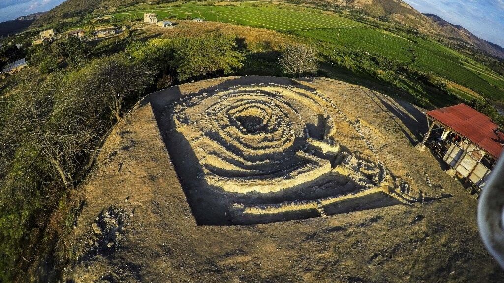
Get ready as the richest go underwater to explore the tomb of a pharaoh that once ruled the “kingdom of kush“. Before we dive right into our pyramid diving story, let’s back it up a bit and learn a little bit about pyramids first. Enormous architectural wonders were built all over the world, centuries before modern technology.

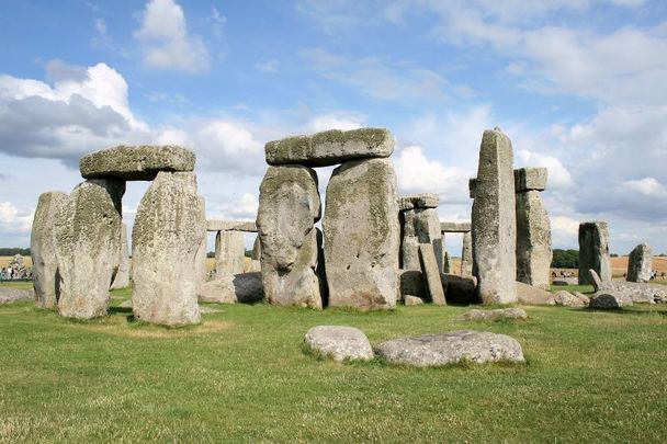
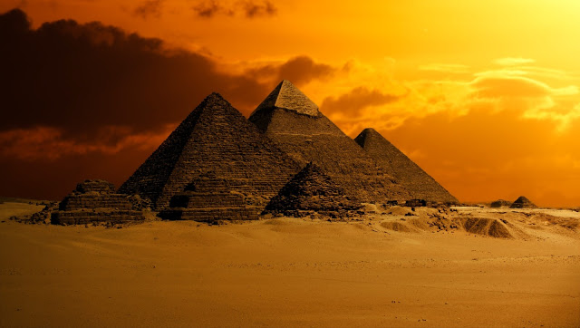
Pyramids were used by ancient peoples as both places of worship and as monuments and tombs of the dead. It’s estimated that there are somewhere in the neighborhood of 2,000 pyramids still standing in the world today, they can be found on every continent on earth except for icy Antarctica. The most famous of course is the Great Pyramids of Giza in Cairo, Egypt. The largest stands at 455 feet. The ancient Egyptians built these amazing structures as tombs and monuments for their pharaohs.

Nuri pyramids.

Over in the Americas, many ancient tribes built step pyramids as temples for worshipping their gods. The famous El Castillo pyramid of Chichen Itza for example was built by the Mayans over eleven hundred years ago in the Yucatan Peninsula of Mexico. It was built as a temple to the serpent God Kukulkan.

In ancient Greece the Pyramid of hellinikon was built some 100 years earlier than the Great Pyramids of Egypt, its purpose remains unknown. In China there stands the great white pyramid of XI’AN, we know very little about it as the Chinese government has banned access to the structure but rumor has it that it could be twice the height of the Great Pyramid at Giza.

On the Australian continent there are two possible yet unconfirmed pyramid sites, the Gympie pyramid and Walsh’s pyramid, and as previously mentioned exactly zero on Antarctica, despite a recent debunked story about one the images turned out to be snow-covered pyramidal-shaped mountaintops.

A shabti found in the submerged chamber of a Kushite pyramid.

The country that holds the title for the most pyramids still intact is surprisingly not Egypt but its neighbor to the south on the African continent Sudan. Sudan is home to some two hundred and forty pyramids built by the ancient Cushite people. Sudan and the cushites also happen to be at the center of our archaeological story.

The kingdom of kush also referred to as Nubia was located in northeast Africa just south of ancient Egypt in modern-day Sudan and it had close ties to ancient Egypt. Its main cities were situated along the Nile River and two of its main tributaries the White Nile and the Blue Nile. If not for the formation of these waterways and their proximity to gold and iron ore deposits it’s likely humans would not have settled in this dry desert region.

The kingdom of kush lasted for over 1,400 years. First established circa 1070 BCE when it gained its independence from Egypt. In 727 BCE kush took control of ancient Egypt, ruling it until the Assyrians arrived in the next century. 

Once the Roman Empire conquered Egypt, the kingdom of kush began to weaken and eventually collapsed sometime in the 4th century CE. The Cushite was very similar to the ancient Egyptians in many ways, sharing a religion, a form of government, and many aspects of culture.

They worshiped Egyptian gods and mummified their dead and entombed them in pyramids. Aside from the Pharaoh and other rulers the highest class in kush were the religious leaders the priests. Much like their Egyptian neighbor’s religion and a strong belief in the afterlife played an important role in the life of the Cushite people.

The pyramids that the Cushite people built to entomb their pharaohs and other important figures looked very similar to the ancient Egyptian structures. They did have a few key differences though for one they differed in size with the average cushite pyramid standing roughly 6 to 30 meters or 20 to 98 feet high while the average Egyptian pyramid was much taller at roughly 138 meters or 453 feet. There was also one other major difference while the Egyptians burial chambers were located inside the pyramidal structure itself the kush burial chambers were located underneath the pyramids buried below the structure.

One such leader buried in this matter was the Pharaoh Nastasen. He ruled the kingdom of kush from 335 to 310 BCE. The little that we do know about this Nubian King is from writings on stone tablets and a more few artifacts. The writings tell us that the highlight of his reign came when the Pharaoh Nastasen defeated an invasion from Upper Egypt and gained many spoils in his victory. 

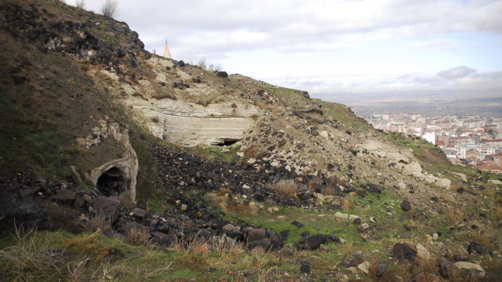
Once Nastasen crossed into the afterlife he became the last cushites, King, to be buried in the royal cemetery and necropolis at nepata. A glorious graveyard spanning more than seven and a half million square feet.

The site of the royal cemetery in the ancient city of nepata is now Karima, Sudan, located about one mile west of the Nile river bank. Seen from the sky one of its most commanding features is an arc of some twenty pyramids built between 650 BCE and 300 BCE. National Geographics Kristin Romy describes this arc of pyramids as a quote “strung together like gems on a delicate necklace”.

There are more than twenty pyramids at the site overall though. At least 60 Nubian kings and queens are buried there among hundreds of other individuals. The most famous resident is Pharaoh taharqa who ruled all of Egypt during the seventh century BCE. The Pharaoh Nastasen’s twenty-three hundred-year-old pyramid tomb the last of its kind stands at roughly thirty feet or 9.1 meters and was erected at one of the lowest points of elevation at the royal necropolis.

This is one of the reasons why Nastasen’s burial chambers are completely underwater. Why exactly? the pyramid’s proximity to the Nile River combined with both natural and man-made climate change has caused the groundwater levels to rise over the centuries. Submerging the tombs that are cut into the bedrock underneath the pyramids. Due to its low elevation nastasen’s tomb is among the most submerged. 

Gold leaf found in the tomb.

Enter archaeologists Pearce Paul Creaseman. Creaseman holds the dual-title of both Egyptologist and underwater archaeologist yes indeed that is a thing, when Creasman first visited the royal cemetery back in 2018 he saw his unique skill set as an opportunity to explore the watery tombs and discover more than what was ever uncovered when the site was first explored nearly a century ago. Back then the water was only knee-deep now the water reached the ceiling of the tomb chambers.

After Creaseman and his team spent the better part of a year digging the staircases leading to nestasen’s tomb out from under sand they put on their scuba gear and headed into the murky waters. Creaseman had to make his way through a series of three chambers. While navigating in water thick with muddy sediment and making vision close to impossible.

When they reached the third and final chamber they discovered a treasure trove of artifacts including gold foil, shabti dolls, funerary figures whom the ancient Nubians believed would accompany the deceased into the afterlife. Also in the chamber the sarcophagus of the pharaoh Nastasen himself. The only problem that ceiling-high muddy water makes excavation and study of these artifacts highly problematic. Creaseman is optimistic though and now packed with experiences and knowing what to expect.

Their aim is to return to the site later in 2020 an attempt to excavate the burial chamber in what they themselves argue is an audacious and logistical challenge. Only then will we know the extent and value of the treasures inside this pyramid and perhaps eventually the dozens of others. Says Christman ” I think we finally have the technology to be able to tell the story of Nuri, to fill in the blanks of what happened here. it’s a remarkable point in history that’s so few know about it. it’s a story that deserves to be told.” So how about you would you take the plunge into those muddy waters to uncover ancient treasures?

https://www.youtube.com/watch?v=0NAyndG5lvc&feature=emb_title

6,500-Year-Old Oven With Heating, Hot Water System Is Similar to Modern Technology

6,500-Year-Old Oven With Heating, Hot Water System Is Similar to Modern Technology

As many modern homeowners know central heating and cooling Charlottesville systems are a vital component of a building. From fireplaces to hot air systems to cooling vents, there have been many conditioning systems built and utilized over the centuries and many have considered the latter two to be more modern inventions. Though this latest archeological finding may make many historians question this idea.

The 6,500-year-old oven was unearthed in an ancient home during an archeological dig at a Neolithic site in Bapska, a village in eastern Croatia, which experts say is one of the most important in Europe.

6,500-year-old oven with heating and hot water system in Croatia
The 6,500-year-old oven unearthed during an archaeological dig at a Neolithic site in Bapska, Croatia.

Experts say the oven provided cooked food, hot water, and central heating for their dwelling, just like a modern-day Aga.

Just imagine if it had slowly started to decline in its efficiency, or even worse, stopped working? You would be missing out on a lot of services that can help to make a house a home, and it’s not like in this day and age where you can look for a home warranty coverage plan (check here for more info) to add extra protection to the appliances in case they should break or need repairing. It’s very likely that you would be left with nothing, which makes it even more extraordinary to see that it has been discovered all these years later.

Marcel Buric – from the Department of Prehistoric Archaeology at Zagreb’s Faculty of Philosophy – said the find was significant because the kiln was covered to protect the rest of the building from fire.

Mr. Buric said: ‘This discovery is important. Because the houses of this period are made of wattle and daubed with a roof made of hay using an open fireplace was dangerous. But a roofed fireplace, like the one in Bapska, besides being safer, also had other advantages.

‘It was permanently heated all day long and as the residents came home after a day in the fields they ate hot food cooked by the oven, washed in warm water, and went to sleep in a room heated by the same kiln. Just like some kitchen ovens today.’

Archaeologists also found a smelted piece of iron ore by the kiln, thought to date back thousands of years before man learned to smelt and work iron.

Mr. Buric said: ‘It’s not possible to say what it was used for but it is a significant find.’

The 6,500-year-old oven had a covered stone frame and worked in a similar way to an AGA.

But elsewhere in the same prehistoric house, scientists found the scene of a more sinister fire.

The cremated remains of a baby aged around 15 months are believed to be the result of a human sacrifice.

Mr. Buric said: ‘We know that such sacrifices were made to ensure the growth of crops by giving life and putting it back into the earth. The more treasured the life, say a baby, the better the result, or so they thought.’

Earlier excavations on the site had revealed a set of deer antlers on the walls of one home, believed to be the world’s first known hunting trophy.

Mr. Buric said: ‘This whole area was a melting point where different cultures from across Europe met and exchanged ideas.’

Elk Teeth Offer Clues to Prehistoric Clothing in Russia

Elk Teeth Offer Clues to Prehistoric Clothing in Russia

According to a statement released by the University of Helsinki, archaeologist Kristiina Mannermaa and her colleagues analyzed more than 4,000 elk incisors recovered from 8,200-year-old graves on an island in northwestern Russia’s Lake Onega.

Many of the graves contain an abundance of objects and red ochre, signifying the wish to ensure the comfort of the buried also after death.

Pendants made of elk incisors were apparently attached to clothing and accessories, such as dresses, coats, cloaks, headdresses, and belts. Although no clothing material has been preserved, the location of the elk teeth sheds light on the possible type of these outfits.

Elk teeth, thousands of them, were used by the YOO people to make their unique elk teeth pendants.

A people of grooved elk tooth pendants

A study headed by archaeologist Kristiina Mannermaa aimed to determine who the people buried in outfits decorated with elk tooth ornaments were, and what the pendants meant to them.

The study analyzed the manufacturing technique of a total of more than 4,000 tooth ornaments or the way in which the teeth had been processed for attachment or suspension.

Elk Teeth Offer Clues to Prehistoric Clothing in Russia
Stone Age People’s Fascination With Elk Teeth Pendants Examined

The results were surprising, as practically all of the teeth had been processed identically by making one or more small grooves at the tip of the root, which made tying the pendants easier.

Only in two instances had a small hole been made in the tooth for threading, both of which were found in the grave of the same woman.

The tooth pendants found in graves located in the Baltic area and Scandinavia from the same period as the Yuzhniy Oleniy Ostrov graves are almost exclusively perforated. Perforation is the surest way of fastening the pendant, but making holes in the narrow tip of a tooth is more laborious than grooving.

The oldest artifact ever found in Eurasia is an elk tooth pendant. It was discovered in the Altai region of Russia in an Denisovan cave.

Archaeological and ethnographic research has shown that humans have been using decorations almost always and everywhere in the world, for several different purposes. To many indigenous peoples in Eurasia, including the Sámi communities, decorations have been and still are an important way of describing a person’s identity and origin.

They are not only aesthetic details but also connected to inter-community communication and the strengthening of intracommunity uniformity.

External elements such as ornaments can also influence the names which neighbouring groups use to refer to a community. In fact, Kristiina Mannermaa calls the people found in the burial site the people of grooved elk tooth pendants.

“Even though there are pendants made of beaver and bear teeth in the graves, the share of elk teeth in them is overwhelming,” Mannermaa says.

The highest number of elk teeth were found in the graves of young adult women and men, the lowest in those of children and elderly people. In other words, elk tooth ornaments were in one way or another linked to age, possibly specifically to the peak reproductive years.

Elk was the most important animal in the ideology and beliefs of the prehistorical hunter-gatherers of the Eurasian forest zone, and their limited availability made elk teeth a valuable material to ancient hunters.

Elks were not brought down very often, and not all members of the community contributed to hunting. It may be that a single individual was given all of the incisors of a caught elk.

Elks have a total of eight incisors, six permanent ones in the lower jaw, and two permanent canines in the shape of incisors. At times, corresponding deciduous teeth were also processed into ornaments.

The largest ornaments required the teeth of at least 8 to 18 elks.

The study was published in the Archaeological and Anthropological Sciences series. In addition to Mannermaa, Riitta Rainio from the University of Helsinki as well as Evgeniy Yurievich Girya, and Dmitriy Gerasimov from Peter the Great’s Museum of Anthropology and Ethnography contributed to the study.

500 Year Old Map Was Discovered That Shatters The “Official” History Of The Planet

500 Year Old Map Was Discovered That Shatters The “Official” History Of The Planet

How many times has the rise and fall of human civilization actually occurred on planet Earth? It has been said that the conventional wisdom that has been passed down for generations (at least that’s where we think the knowledge came from) is not old enough, or there was some disconnect somewhere.

There’s a lot of fake things out there on this topic, but the fact is if you really look close, we can’t account for the existence of many of the world’s mysterious monolithic or archaeological sites.

From the Bosnian Pyramids to the amazing site of Gobekli Tepe in Turkey, to the South African site of Adam’s Calendar, they all irrefutably bring up questions about the origin of humanity itself.

Some sites seem to pre-date human civilization. How can that be explained? Knowing so many other things in life generally are not how they seem, and around every corner in what we were told about the history there is a deception, why wouldn’t there be an official deception located in this field of thought? Who, or what kind of entity could have possibly constructed so many elaborate and practically difficult to understand structures around the planet, millennia ago?

Obviously, our amnesia about the origin of humanity and literally everything about our existence is just a feature of this life. However, it doesn’t have to be such a mystery when it comes to things more concrete than the past-life amnesia people believe we were born with: we can concretely understand the history of humanity a little more.

Many people believe that before about 6,000 years ago in Mesopotamia, the official narrative for how old civilization gets, there must have been other intelligent and/or advanced human civilizations before that time.

Mapmaking itself was once considered much more of a complex task, characteristic of what they call civilized society. Some Babylonian clay tablets that seem to find origin around 1000BC seem to be the first known evidence of map-making.

One piece of the puzzle is thought to be this: the Admiral Piri Reis world map of 1513.

The official first sight of Antarctica reportedly was accomplished by a Russian expedition in 1820. Today it is believed that the continent’s ice caps formed about 34-45 million years ago. With some basic logic that means prior to 1820 Antarctica should not be present on any map, and of course, the continent should contain polar ice caps.

However, Ottoman cartographer and military admiral Piri Reis made a map that seems to contain Antarctica about 500 years ago.

Surviving fragment of the Piri Reis map showing the Central and South American coast. The appended notes say “the map of the western lands drawn by Columbus”

The Piri Reis map has a central focus on the East Coast of South America, Western Africa, and it includes the Northern Antarctic Coast. It seems to illustrate in a surprising amount of detail just what Queen Maud Land in Antarctica looks like. It’s accurate, and in the map, the ice-cold continent was not depicted as a barren wasteland, but rather as a continent full of dense vegetation.

A New Hampshire history professor named Charles Hapgood believed that a much different view of ancient history is depicted by this map, and the findings are unforgettable. Albert Einstein himself wrote a supportive forward to a book written by Charles Hapgood in 1953:

“His idea is original, of great simplicity, and – if it continues to prove itself – of great importance to everything that is related to the history of the Earth’s surface.”

The map is certifiably not a hoax, absolutely authentic by every measure. Here’s where it gets strange: Piri Reis did not say that he or his people specifically discovered Antarctica, but he noted that the information sourced for it was from other, much older maps, logs, and charts.

Hapgood suggests that perhaps the maps had been repeatedly copied and re-translated before the destruction of the Library of Alexandria in Egypt. The destruction of the Library of Alexandria was the book burning of the new world, wiping out an incomprehensible treasure trove of info about the history of humanity, casting the historical knowledge of antiquity into the wind.

So Hapgood for some reason brought this info to the US Air Force of all people, and they performed testing of seismic data in Antarctica. Warning: these are not the people to trust. According to Fingerprints of the Gods:

“…the geographical detail shown in the lower part of the map agrees very remarkably with the results of the seismic profile made across the top of the ice-cap by the Swedish-British Antarctic Expedition of 1949. This indicates the coastline had been mapped before it was covered by the ice-cap. The ice-cap in this region is now about a mile thick. Learn how to enter parallel worlds of consciousness We have no idea how the data on this map can be reconciled with the supposed state of geographical knowledge in 1513. – Harold Z. Ohlmeyer Lt. Colonel, USAF Commander”

Was Antarctica a grassy, green land where life could thrive a mere 500 years ago, or perhaps several thousand years ago?

Inside the Mysterious Underground City, That’s 5,000 Years Old

Inside the Mysterious Underground City, That’s 5,000 Years Old

Underground city partly submerged underwater and estimated to be around 5,000 years old was discovered by municipality crews trying to determine the cause of flooding in several houses in the Avanos district of Turkey’s central Nevşehir province, located at the heart of the historic Cappadocia region.

Inside the Mysterious Underground City, That's 5,000 Years Old
Researchers discovered these ruins from an underground city in Turkey’s Central Anatolian region

Owners of some 15 houses in the Çalış township of Avanos, which is inhabited by 2,200 people, informed the local municipality that their houses were filling up with water and they could not figure out why or where the water was coming from.

Municipality crews started discharging water from the homes while searching for the cause of the flooding, using heavy-duty machines to open the entrances of a tunnel closed for safety decades ago and long forgotten by locals.

A view of the underground city newly discovered in Turkey’s Central Anatolian province of Nevsehir, Turkey

After making more way into the tunnel, crews and locals found an underground city partially covered in clear water, which had caused the flooding, and saw that the houses were situated right on top of the flooded city’s rooms and tunnels.

Initial examinations revealed that the underground city had three floors and comprised of homes, tunnels and places of worship stretching for five kilometres, in addition to a small human figurine believed to be an icon.

The parts of the underground city closer to the surface was being used by locals as an animal shelter until the beginning of the 20th century but later abandoned by them. Alaaddin Sarıtaş, a local from Çalış, told Demirören News Agency that the underground city was actually rediscovered 25 years ago when a child fell inside the tunnel but its entrances were later covered with soil to prevent further accidents.

Local tales referred to the underground city as Gir-Gör, which translates into English as “Enter and See.”

The underground city is located some 80 kilometres away from Cappadocia’s famous underground cities Derinkuyu and Kaymaklı.

The mayor of Çalış Kazım Yılmaz told Anadolu Agency that the underground city covers some 1.2 million square meters. “Those who had been there in the past say it is some 600 meters by 2 kilometres in size,” he said, adding that technical analysis by archaeologists is needed to reveal its origins and exact dimensions.

A view of the underground city newly discovered in Turkey’s Central Anatolian province of Nevsehir, Turkey

It is impossible to clear the rubble and empty the water through municipality means, Yılmaz said, adding that they will apply to the cultural property protection board for the site to be registered as a historical site and ask for the Ministry of Culture’s help to open the underground city to tourism.

The mayor noted that the ground level of the underground city was full of soil that came through the main entrance, and about two meters in length.

Yılmaz added that there were two other sites near the township, which are believed to be large underground cities.

Sarıtaş said that there were foreigners who had arrived in the township with maps trying to find the lost underground city, mentioning a source of “healing water” and “Ceasar’s bath.”

Ahmet Yılmaz, a local, also said that he used to crawl through the tunnels as a child and reach an area containing rooms.

The core of the historic Cappadocia region, currently falling under Ürgüp, Göreme and Avanos districts of Nevşehir and the Güzelyurt district of Aksaray, is located in the middle of a once-active volcanic area in central Anatolia. In addition to its iconic fairy chimneys and other natural rock formations over the course of millions of years, the soft volcanic rocks in the area enabled humans to carve out homes, places of worship, commercial buildings and even cities, thus making the region one of the earliest continuously inhabited sites in the world.

The region, famous for its wineries in its semi-arid climate and on volcanic soil, had lured the greatest states of the time, including the Hittites, Phrygians, Persians, Romans, Byzantines, Seljuks and Ottomans. It was also one of the earliest regions to adopt Christianity and survive from prosecution by building underground cities and settlements.

Despite existing historic settlements and continuous archaeological interest in the region, Cappadocia is believed to contain countless historical sites and artefacts yet to be discovered.

The region is a tourism hotspot with boutique hotels and hot air balloon tours and has seen a significant rise in the number of tourists in recent years, especially from Japan and China.

Did the Celts build “America’s Stonehenge” 4,000 years ago?

Did the Celts build “America’s Stonehenge” 4,000 years ago?

Studying the origins of the aptly named Mystery Hill megaliths, also known as America’s Stonehenge, whets one’s curiosity but does not satisfy—unless one is satisfied by the excitement of confounding mystery alone.

A structure at Mystery Hill, also known as America’s Stonehenge. It may not look quite as impressive as the UK’s Stonehenge, but it also hides many alluring secrets.

The site, in North Salem, N.H., includes stone monoliths and chambers spread across 30 acres.  The stones are said to have complex astronomical alignments. A 4.5-ton stone slab that seems to be the focal point of the site may have served as an altar for sacrifice. It is grooved with a channel for draining, possibly the blood of a victim.

A variety of characteristics have fueled a theory that America’s Stonehenge was built by Europeans as long ago as 2,000 B.C.—thousands of years before the first evidence of Viking settlement in North America. Archaeologists are divided. Some say the evidence is lacking to support this theory and that the site may have been constructed in relatively recent times.

Many similar sites are found on the stretch from Maine to Connecticut, though none as expansive as Mystery Hill. Here’s a look at the site’s characteristics and the views of various experts.

Why it May Have Been the Celts

1. Glyphs seem to suggest an archaic Irish language, though any deciphering of the glyphs has been controversial.

2. It seems from the astronomical alignment that the megaliths mark cross-quarter holidays. These holidays are only celebrated by the Celts, according to astronomer Alan Hill. Some have compared the megaliths to Stonehenge. 

3. “Carbon-14 results coincide with the date of a major immigration by Celts,” according to a book by David Goudsward and Robert Stone titled “America’s Stonehenge: The Mystery Hill Story, from Ice Age to Stone Age.” Stone bought the site in the 1950s and opened it to public viewing and to further research. Goudsward and Stone continue: “The Celtiberians [Celtic-speaking people of the Iberian Peninsula] interacted with Carthaginians, a nationality almost certain to have the skill to cross the Atlantic. However, there is not of the ornamentation on the stones that would be indicative of Celts.”

A structure at the Mystery Hill site.

Why it May Have Been the Natives

1. Archaeologists have found Native American artefacts on-site that are more than 1,000 years old.

2. The use of stone-on-stone tools shows workmanship similar to that employed by Native Americans.

Glyphs of the Celts?

An example of Ogham

Ogham is an Irish script used in the fifth to sixth centuries that consists of crosshatches. Glyphs that may be ogham are said to have been found on the stones.

Karen Wright, who wrote an article for Discovery Magazine in 1998 after visiting Mystery Hill, described what she felt to be dubious deciphering: “Various authors [have made interpretations,] consulting languages from ogham to Russian. The most baroque interpretation, a translation based on Iberic/Punic, was ascribed to three evenly spaced parallel grooves in a rust-coloured cast: ‘In Baal, on behalf of the Canaanites this is dedicated,’ read the translation.

“This, I decided, was the archaeological equivalent of the scene from Lassie in which the dog barks once and Jimmy is given to understand that the leg of a six-year-old girl named Sally has been trapped under a fallen tree 30 yards north of the falls on Coldwater Creek near the old mine shaft and oh, by the way, she’s diabetic too, so bring some insulin.”

A structure at the Mystery Hill site.

Carbon Dating

In 1969, archaeologist James Whittall unearthed stone tools at the site, along with charcoal flakes that could be carbon dated. The dating showed the tools’ user was working around 1,000 B.C., according to Goudsward and Stone.

Whittall recovered charcoal from several other locations on-site and carbon dating ranged from 2,000 B.C. to 400 B.C. 

Dating Using Astronomical Alignments

Astrological alignments concur. Astronomer Dr. Louis Winkler, the principal site scientist, found the positions of some stones align with where the stars and other celestial objects would have been about 2,000 years ago. He has also done radiocarbon and laser theodolite dating to support a Bronze Age origin (2,000 B.C.–1,500 B.C.).

Anthropologist Bob Goodby of the New Hampshire Archaeological Society (NHAS) said the alignments are “coincidental.”

“With so much stone around, it wouldn’t be that difficult to find some alignments that correspond to celestial things,” Goodby told Boston University publication the Bridge. This isn’t the only “coincidence” cited by critics of the ancient-European-origin theory, nor the only one cited as a little too “coincidental” by supporters of the theory.

For example, critic Richard Boisvert, New Hampshire’s deputy state archaeologist, admitted the structures resemble ancient European megalithic structures, but that it’s a coincidence. He told Discovery that it’s a case of the same form-fitting the same function.

Professor of astronomy at New Hampshire Technical Institute Alan Hill does not see the astronomical alignments as coincidence. He told New York Times that the megaliths mark cross-quarter days, the halfway points between the solstices and equinoxes. Celts are the only ones to celebrate cross-quarter holidays, he said. Hill dismissed the theory that the structures are cellars built in the past few centuries, partly because the doors are not wide enough to admit wheelbarrows. A local lawyer and mystery novelist, David Brody, told the Times there are too many similarly puzzling stones and structures in the region to write it all off as coincidence.

stonehenge usa
A structure at the Mystery Hill site.

Stone-on-Stone Tools Suggest Primitive Builders

The builders apparently used stone tools, not metal tools. Boisvert’s boss, New Hampshire state archaeologist Gary Hume, told Discovery the stone-on-stone workmanship is similar to that of Native Americans. He was hesitant to say the megaliths could be 4,000 years old, but he seemed to leave the possibility open. He said he wasn’t going to question “the two reputable surveyors who had vouched for the alignments,” wrote Wright.

The Natives and the Celts are not the only groups archaeologists have pinned as the potential builders. Some say it may have been the Phoenicians, the people of an ancient kingdom on the Mediterranean. The standing stones align with the location of the polestar Thuban during Phoenician times, according to Wright.

Jonathan Pattee, a shoemaker and his family lived on the site throughout much of the 19th century, and many say he and his family built the structures. Dennis Stone, Robert Stone’s son who is also currently owner and operator of the site, told Discovery that some of the structures were probably built by Pattee, but certainly not all. Others have also said the intricacies of construction and alignment were not likely carried out by the Pattee family, and the family would have used metal tools, not stone tools.

Goodby and other critics of the ancient-origin theory say archaeologists would have found signs of people living on or near the site, such as burial grounds. He said the sacrificial stone was probably actually a place for inhabitants in more recent history to make soap. Whatever the theories, as  Goudsward and Stone write: “There has been so much damage in the last four millennia that no matter who you believe built the site, there is just enough physical evidence to warrant further investigation along that line. This has produced a spectrum of theories as wide and expansive as the skies that may or may not be charted by the ancient monoliths.”

Archaeologists find 5,500-year-old plaza in Peru

Archaeologists find 5,500-year-old plaza in Peru

A recent discovery in Peru uncovered an ancient and very old settlement that dates back more than five thousand years to a period long before Europeans settled in the Americas.

Archaeologists say the site, uncovered amid a complex of ruins known as Sechin Bajo, is a major discovery that could help reshape their understanding of the continent’s pre-Columbian history.

Carbon dating by a German and Peruvian excavation team indicates that the circular plaza is at least 5,500 years old, dating to about 3,500 BC, said Cesar Perez, an archaeologist at Peru’s National Institute of Culture who supervised the dig.

Left: A circular plaza unearthed at the ruins of Sechin Bajo, 230 miles north of Lima, may have been a site for gatherings and ceremonies, archaeologists say. El Comercio; Credits: gogeometry.com

That would make it older than the Great Pyramid of Giza.

Sechin Bajo, 230 miles north of the capital, Lima, thus eclipses the ancient Peruvian citadel of Caral, some 5,000 years old, as the New World’s oldest known settlement.

“This has tremendous importance, both in Peru and internationally,” Perez said by cellphone from the area. “We think it’s the oldest urban site found in the Americas.”

Word of the discovery was first published Sunday in the Peruvian daily El Comercio.

“The findings in Sechin Bajo, especially in the buried circular plaza, have demonstrated that there is construction from 5,500 years ago,” Peter R. Fuchs, a German archaeologist who worked at the site, told the newspaper. “Whoever built Sechin Bajo had a good knowledge of architecture and construction.”

Much of the hidden plaza was uncovered this year, and a great deal of excavation remains to be done, Perez said. Relatively little is known about the people who lived there.

The plaza, 33 to 39 feet across, may have been a site for gatherings, perhaps a kind of ceremonial centre. It was built of rocks and adobe bricks.

Successive cultures lived in the area and built over the site.

5,500-year-old ceremonial center and circular pyramid in Peru
A view of the ruins of Sechin Bajo, that was built 5,500 years ago, after it was discovered in Casma. Carbon dating shows it is one of the oldest structures ever found in the Americas. A team of Peruvian and German archaeologists uncovered the plaza, which was hidden beneath another piece of architecture at the ruins known as Sechin Bajo, in Casma, 229 miles north of Lima, the capital.

Earlier finds in the Sechin Bajo area, in the Casma Valley of Peru’s Ancash region, had been dated at more than 3,000 years old. But the circular plaza pushes the area’s settlement date back considerably.

Peru is perhaps best known to outsiders as the cradle of the Inca empire, which stretched from modern-day Chile to Ecuador. But the Incas were relative latecomers in Peru’s long history of human settlement, rising to prominence in the 15th century before being conquered by the Spanish in the early 16th century.

Before the Inca, Peru was home to various civilizations that left a rich legacy of ruins, pottery, tombs and artefacts. Teams of archaeologists are at work throughout the country, including the bustling capital.

Scientists say settlements were beginning to grow in Peru about the time of urbanization in such cradles of civilization as Mesopotamia, Egypt and India.

A 9,000-year-old caribou hunting structure beneath Lake Huron

A 9,000-year-old caribou hunting structure beneath Lake Huron

Underwater archaeologists have discovered evidence of prehistoric caribou hunts that provide unprecedented insight into the social and seasonal organization of early peoples in the Great Lakes region.

An article detailing the discovery of a 9,000-year-old caribou hunting drive lane under Lake Huron appears in today’s issue of the Proceedings of the National Academy of Sciences.

“This site and its associated artefacts, along with environmental and simulation studies, suggest that Late Paleoindian/Early Archaic caribou hunters employed distinctly different seasonal approaches,” said John O’Shea, the Emerson F. Greenman Professor of Anthropological Archaeology at the University of Michigan and lead author of the article.

The Drop 45 Drive Lane. (A) A plan showing the major topographic and cultural features associated with the drive lane. Black dots represent the location of placed stones. The hunting blinds incorporated within the main drive lane feature are labelled. The raised cobble surface to the north and west of the drive lane varies from 1 to 2 m higher than the bedrock on which the drive lane stones are located. This plan was produced as an overlay of the acoustic image. (B) An acoustic image of the drive lane produced via a mosaic of scanning sonar images. The scanning unit is the black circular area near the centre of the image, and the red circles surrounding have radii that increase by 15 m. A trace of the second scanning sonar location is visible in the southeast of the image. Light coloured objects are stones that produce a strong acoustic signature, whereas dark areas are acoustic shadows.
Stone tool debris from the Drop 45 Drive Lane. (A) Composite photograph showing the 11 chert flakes recovered from the Drop 45 Drive Lane. (B) The location of archaeological tests on the Drop 45 Drive Lane superimposed on the acoustic image (Fig. 2B). Small white circles represent test locations that did not generate identifiable archaeological debris. Large white circles with black centres represent locations that produced lithic debris. Black centres with adjacent numerals indicate locations that generated multiple lithic remains. North is to the top of the image, and the red circular rings surrounding the scanning sonar placement are incremented in units of 15 m.

Diver and remote operated vehicle collecting samples at Drop 45 Drive Lane in Lake Huron.“In autumn, small groups carried out the caribou hunts, and in spring, larger groups of hunters cooperated.”

According to O’Shea, who is also Curator of U-M’s Great Lakes Division of the Museum of Anthropological Archaeology, the site was discovered on the Alpena-Amberley Ridge, under 121 feet of water, about 35 miles southeast of Alpena, Mich., on what was once a dry land corridor connecting northeast Michigan to southern Ontario.

The main feature, called Drop 45 Drive Lane, is the most complex hunting structure found to date beneath the Great Lakes. Constructed on level limestone bedrock, the stone lane is comprised of two parallel lines of stones leading toward a cul-de-sac formed by the natural cobble pavement.

Three circular hunting blinds are built into the stone lines, with additional stone alignments that may have served as blinds and obstructions for corralling caribou.

Although autumn was the preferred hunting season for caribou, the orientation of Drop 45 shows that it would only have been effective if the animals were moving in a northwesterly direction, which they would have done during the spring migration from modern-day Ontario.

“It is noteworthy that V-shaped hunting blinds located upslope from Drop 45 are oriented to intercept animals moving to the southeast in the autumn,” O’Shea said.

“This concentration of differing types of hunting structures associated with alternative seasons of migration is consistent with caribou herd movement simulation data indicating that the area was a convergence point along different migration routes, where the landform tended to compress the animals in both the spring and autumn.”

The structures in and around Drop 45, and the chipped stone debris for repairing stone tools, provide unambiguous evidence for intentional human construction and use of the feature, O’Shea said. And they also provide important insight into the social and economic organization of the ancient hunters using this area.

Diver and remote operated vehicle collecting samples at Drop 45 Drive Lane in Lake Huron.

“The larger size and multiple parts of the complex drive lanes would have necessitated a larger cooperating group of individuals involved in the hunt,” he said.

“The smaller V-shaped hunting blinds could be operated by very small family groups relying on the natural shape of the landform to channel caribou towards them.”

Co-authors of the article are Ashley Lemke and Elizabeth Sonnenburg of U-M, Robert Reynolds of Wayne State University and Brian Abbot of Nautilus Marine Group International.

All In One Magazine