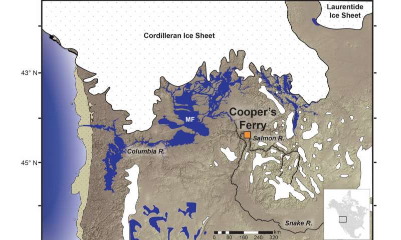
(A) map showing the location of the Cooper’s Ferry site in the context of Pacific Northwest environments at 16,000 years ago; (B) aerial image (from Google Earth) showing the Cooper’s Ferry excavations; (C) site map showing the locations of excavation Area A and Area B.