Category Archives: ASIA

Roman soldier’s 1,900-year-old payslip uncovered in Masada

Roman soldier’s 1,900-year-old payslip uncovered in Masada

Roman soldier’s 1,900-year-old payslip uncovered in Masada

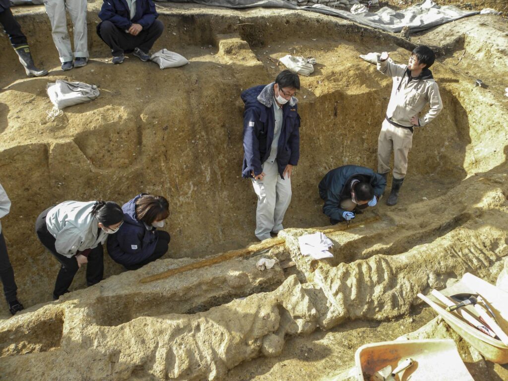
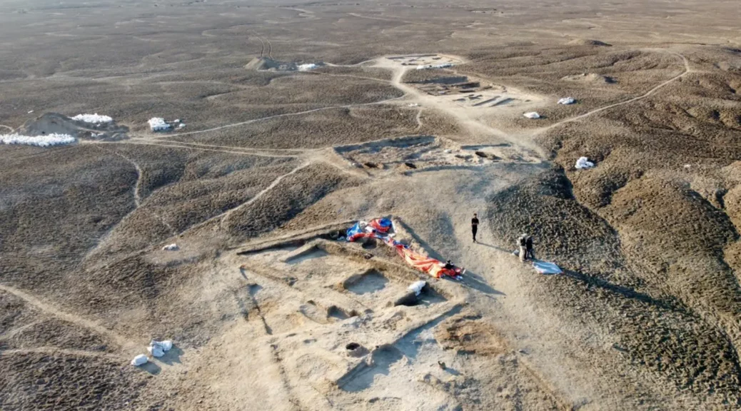
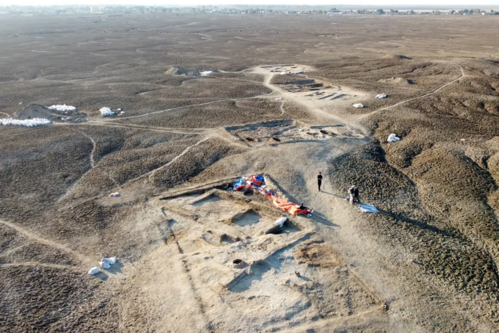
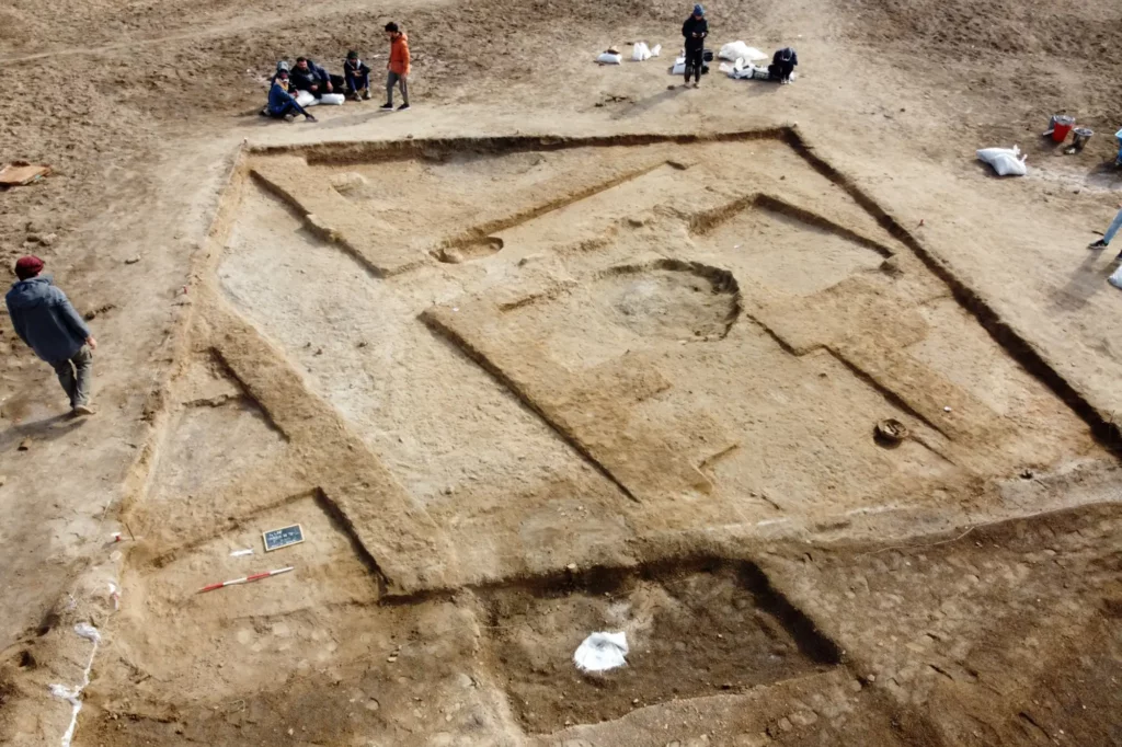
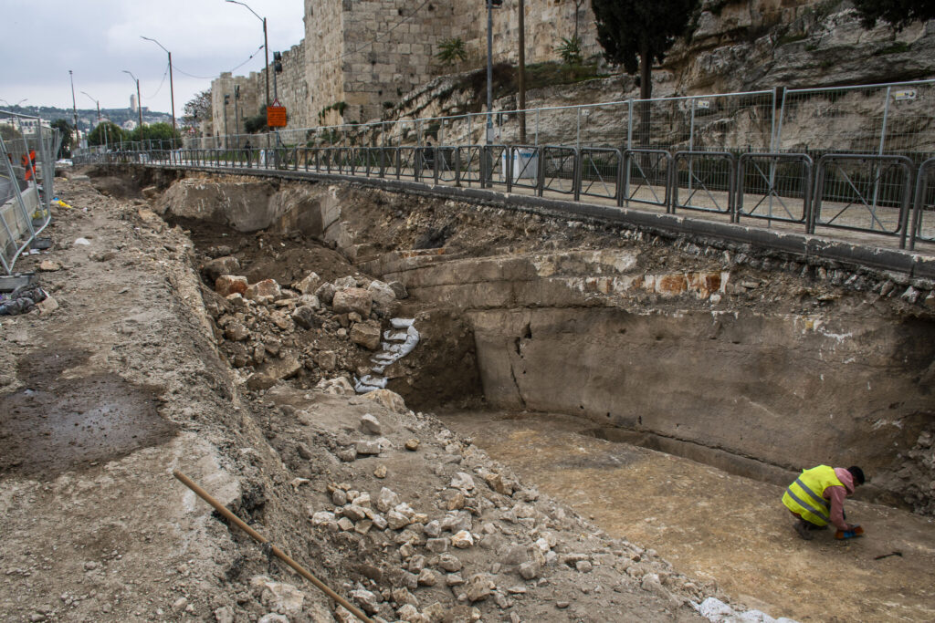
During excavations at Masada, archaeologists from the Israel Antiquities (IAA) uncovered a papyrus payslip dated to 72 BC belonging to a Roman soldier.

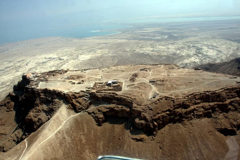
Masada is a rugged crag in the Judean Desert overlooking the Dead Sea.  Herod, the first-century BCE Judean king best known for constructing Jerusalem’s Temple Mount complex, built a fortress and palace on the mountain.

Jewish rebels entrenched themselves at Masada a century later, from 66 to 74 CE, during the Jewish Revolt against Rome. A Roman army besieged the last holdouts nearly four years after the fall of Jerusalem.

The only historical account of the conflict is Josephus Flavius, who claims that the Jewish rebels all committed mass suicide before Roman troops stormed the battlements. However, archaeologists dispute that account’s historical accuracy.

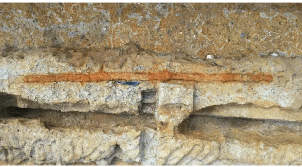
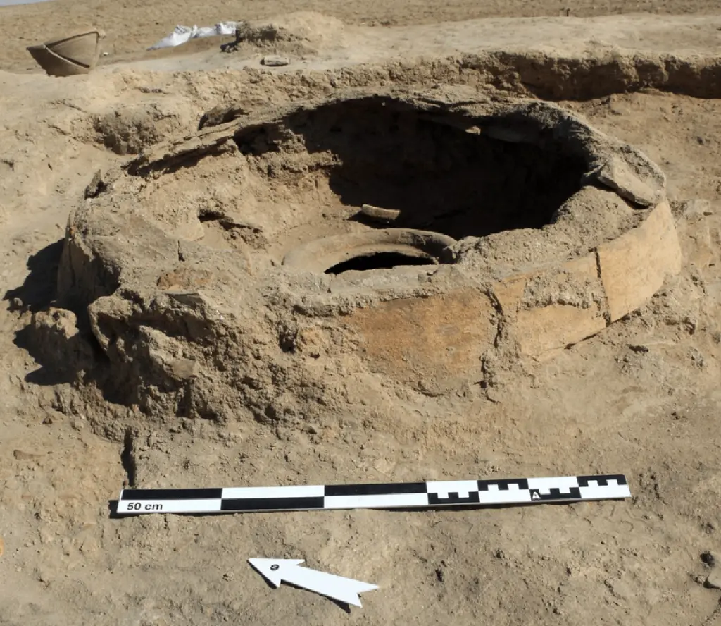
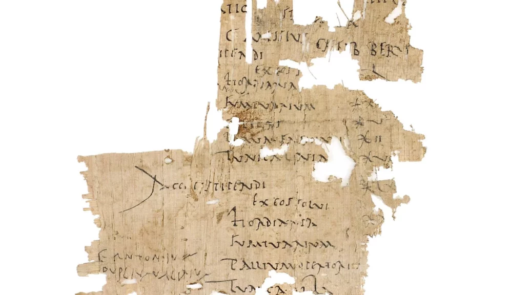
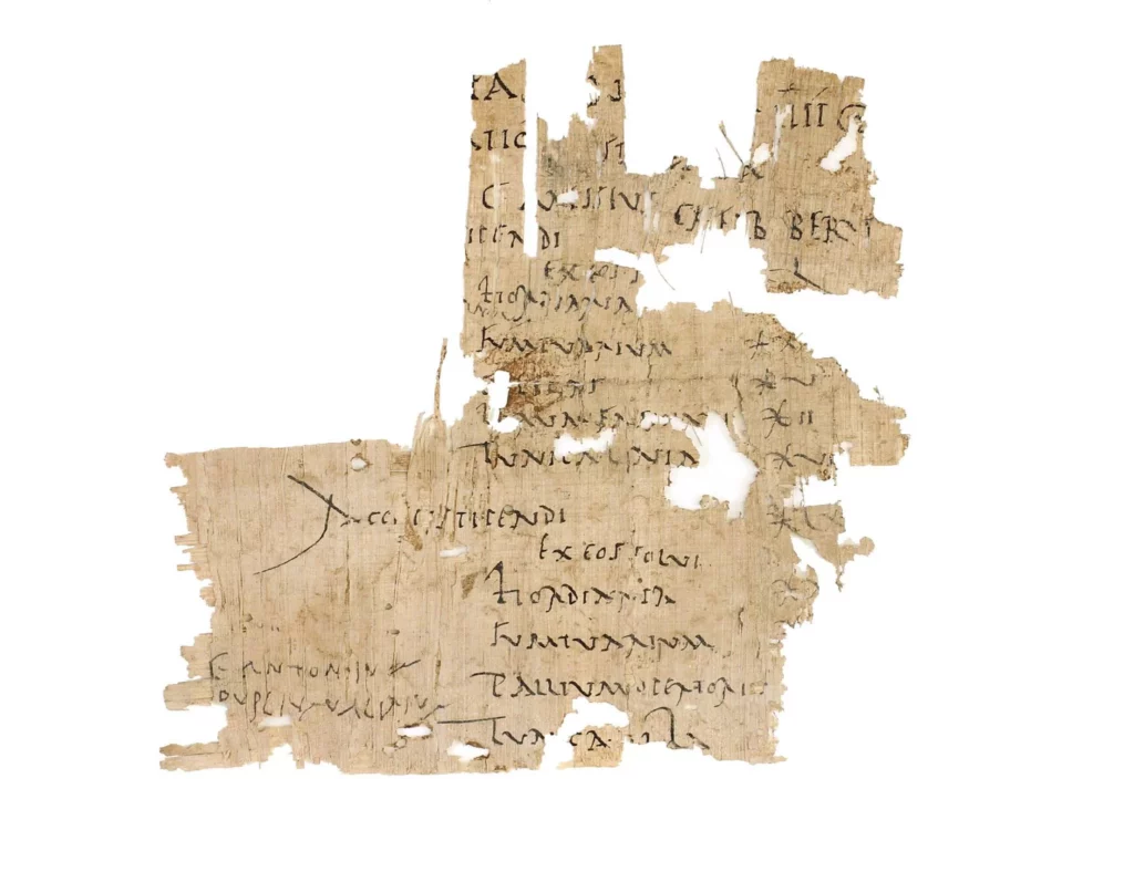
The IAA discovered a detailed military paycheck (one of only three legionary paychecks discovered throughout the Roman Empire) issued to a Roman legionary soldier during the First Jewish-Roman War in AD 72.

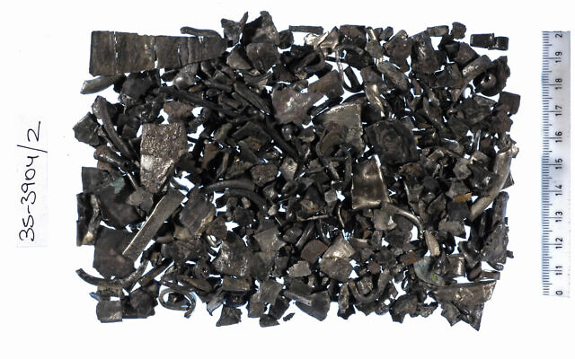
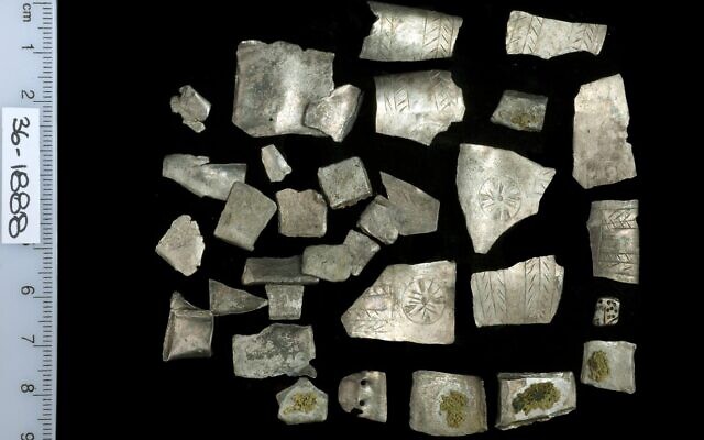
The paycheck is one of 14 Latin scrolls found at Masada by archaeologists – 13 of which was written on papyrus, and one on parchment paper.

An aerial view of Masada Mountain in the desert near the Dead Sea.

Although the papyrus was damaged over time and therefore very fragmentary, it contains valuable information about the management of the Roman army and the status of the soldiers.

The document provides a detailed summary of a Roman soldier’s salary over two pay periods (out of three he would receive annually), including the various deductions that he was charged. The army supplied the soldiers with basic equipment, but, as today, some soldiers chose to add and upgrade their equipment.

“This soldier’s paycheck included deductions for boots and a linen tunic, and even for barley fodder for his horse,” says Dr. Oren Ableman, senior curator-researcher at the Israel Antiquities Authority Dead Sea Scrolls Unit.

“Surprisingly, the details indicate that the deductions almost exceeded the soldier’s salary. Whilst this document provides only a glimpse into a single soldier’s expenses in a specific year, it is clear that in the light of the nature and risks of the job, the soldiers did not stay in the army only for the salary.

According to Dr. Ableman, “The soldiers may have been allowed to loot on military campaigns. Other possible suggestions arise from reviewing the different historical texts preserved in the Israel Antiquities Authority Dead Sea Scrolls Laboratory.

For example, a document discovered in the Cave of Letters in Nahal Hever from the time of the Bar Kokhba Revolt (132–135 CE) sheds some light on some side hustles Roman soldiers used to earn extra cash.

This document is a loan deed signed between a Roman soldier and a Jewish resident, the soldier charging the resident with interest higher than was legal.

This document reinforces the understanding that the Roman soldiers’ salaries may have been augmented by additional sources of income, making service in the Roman army far more lucrative.”

Saudi Arabia unveils reconstructed face of a 2000-year-old Nabataean woman

Saudi Arabia unveils reconstructed face of a 2000-year-old Nabataean woman

Saudi Arabia unveils reconstructed face of a 2000-year-old Nabataean woman

Saudi Arabia is unveiling a reconstruction of the face of an ancient Nabataean woman after several years of work by historians and archaeologists.

The reconstruction, which is the first of its kind, is modeled on the remains of Hinat, a Nabataean woman who was discovered in 2015 in a 2,000-year-old tomb in Hegra, an archaeological site located in the ancient oasis city AlUla, northwestern Saudi Arabia.

Funded by the Royal Commission for AlUla, the reconstruction of Hinat began in the United Kingdom in 2019.

A multidisciplinary team of experts rebuilt bone fragments found in the tomb to reconstruct an image of her appearance using anthropological and archaeological data. A sculptor then used a 3D printer to bring her face to life.

The Nabataeans were an ancient Arab civilization that inhabited northern Arabia and the Levant over 2,000 years ago. The ancient Jordanian city of Petra was the capital of their kingdom, which became a vibrant and commercial international trading hub for spices, medicine and fabric, facilitated by the Nabataeans.

A reconstructed face of an ancient woman known as “Hinat,” a member of the Nabataean civilisation that dates back over 2,000 years, is displayed at the Hegra Welcome Centre.

Starting Monday, history buffs will have the opportunity to meet Hinat on display at the Hegra welcome center in AlUla.

Once a thriving hub for international trade and home to the Nabataeans, Hegra, a UNESCO World Heritage site, was opened in 2020 as a tourist site.

The Nabataean civilization didn’t leave significant historical texts, and information about it comes from inscriptions on tombs and on rocks throughout the Middle East, or from archaeological discoveries.

“The Nabataeans are a bit of a mystery: We know a lot, but at the same time we know very little because they didn’t leave any literary texts or records,” Lebanese-French archeologist Laila Nehme, the director of the project, told National Geographic. “Excavating this tomb was a wonderful opportunity to learn more about their idea of the afterlife.”

According to Nehme, the Nabataeans’ alphabet evolved into modern-day Arabic.

“This tomb has a very nice inscription carved on its facade, which says it belonged to a woman called Hinat,” added Nehme.

But not everyone believes this historical breakthrough is necessarily an accurate representation of the ancient Nabataeans.

Laurence Hapiot, an archaeologist at the King Abdullah University of Science and Technology in Saudi Arabia, tweeted that “there is still some non-scientific interpretation in face reconstruction.”

The AlUla Royal Commission didn’t respond to CNN’s request for comment.

SOURCE: https://edition.cnn.com/

Anomalies Detected in Walls Surrounding Ancient Capital in China

Anomalies Detected in Walls Surrounding Ancient Capital in China

Anomalies Detected in Walls Surrounding Ancient Capital in China
Muon scans are helping to find flaws and archeological surprises inside an ancient fortress wall in the Chinese city of Xi’an, which has grown and modernized since the wall was built nearly 650 years ago.

For nearly 650 years, the fortress walls in the Chinese city of Xi’an have served as a formidable barrier around the central city.

At 12 meters high and up to 18 meters thick, they are impervious to almost everything — except subatomic particles called muons.

Now, thanks to their penetrating abilities, muons may be key to ensuring that the walls that once protected the treasures of the first Ming Dynasty — and are now a national architectural treasure in their own right — stand for centuries more.

A refined detection method has provided the highest-resolution muon scans yet produced of any archaeological structure, researchers report in the Jan. 7 Journal of Applied Physics.

The scans revealed interior density fluctuations as small as a meter across inside one section of the Xi’an ramparts.

The fluctuations could be signs of dangerous flaws or “hidden structures archaeologically interesting for discovery and investigation,” says nuclear physicist Zhiyi Liu of Lanzhou University in China.

In this image, muons have revealed density anomalies in a section of the Xi’an fortress walls. All colors in this plot indicate places where densities are lower than average for the structure, with the bluer portions showing where density is lowest.

Muons are like electrons, only heavier. They rain down all over the planet, produced when charged particles called cosmic rays hit the atmosphere.

Although muons can travel deep into earth and stone, they are scattered or absorbed depending on the material they encounter. Counting the ones that pass through makes them useful for studying volcano interiors, scanning pyramids for hidden chambers and even searching for contraband stashed in containers impervious to X-rays (SN: 4/22/22).

Though muons stream down continuously, their numbers are small enough that the researchers had to deploy six detectors for a week at a time to collect enough data for 3-D scans of the rampart.

It’s now up to conservationists to determine how to address any density fluctuations that might indicate dangerous flaws, or historical surprises, inside the Xi’an walls.

2.3-meter sword found in 4th-century tomb in Japan

2.3-meter sword found in 4th-century tomb in Japan

The largest bronze mirror and the largest “dako” iron sword in Japan were discovered at the Tomio Maruyama burial mound in Nara.

Experts say the twin discoveries from the Tomio Maruyama Tumulus last November can be classified as national treasures, with the shield-shaped mirror being the first of its kind.

The Nara Municipal Buried Cultural Properties Research Center, which excavates and researches Tomiomaruyama kofun, and the Nara Prefectural Archaeological Institute of Kashihara, which assists in the excavation, announced the discoveries on Jan. 25.

The 2.3-meter sword with a meandering blade is also the largest iron sword made in that period in East Asia.

The patterned surface of the mirror carries the designs of two more common “daryu” mirrors, distinctive with its designs based on imaginative creatures, which have been found mainly in western Japan.

A team from Nara Prefecture examine the dakō iron sword found in the Tomio Maruyama burial mound.

The shield-shaped mirror is 64 cm in length, 31 cm in width at most, and weighs 5.7 kilograms. Typically, bronze mirrors that are found at archaeological sites are rounded, but this one is shield-shaped.

The sword is the oldest of the dako swords, distinguished by their wavy, snake-like shapes, which give rise to their name. As burial goods, more than 80 other dako swords have been discovered throughout Japan.

The latest sword has markings of a sheath and handle, and together, its length measures 2.6 meters, more than dominating the last longest dako sword discovered at around 85 cm.

“(These discoveries) indicate that the technology of the Kofun period (300-710 AD) are beyond what had been imagined, and they are masterpieces in metalwork from that period,” said Kosaku Okabayashi, the deputy director for Nara Prefecture’s Archaeological Institute of Kashihara.

A shield-shaped mirror discovered at the Tomio Maruyama burial mound in Nara

Mirror and shields are considered to be tools to protect the dead from evil spirits. The sword is thought to have been enlarged to increase its power, and the possibility of its use as a battle tool is low, researchers said.

The 109-m-diameter Tomio Maruyama burial mound, the largest in Japan and dating to the late 4th century, is believed to have belonged to a significant person who supported the Yamato rulers at the time.

The burial chamber where the discoveries were made is thought to have belonged to someone close to that person, according to Naohiro Toyoshima, an archaeology professor at Nara University. He also said that the ritualistic sword and the shield-shaped mirror may indicate that the individual was involved in military and ritualistic matters.

China’s Mysterious “Heavenly Pit”: The World’s Deepest Sinkhole

China’s Mysterious “Heavenly Pit”: The World’s Deepest Sinkhole

First discovered by specialists in 1994, the world’s deepest sinkhole can be found in Fengjie County, Chongqing Municipality, China. Xiaozhai Tiankeng, or the Xiaozhai Heavenly Pit, measures roughly 537 meters (1,762 feet) in diameter and sinks between 511 and 662 meters (1,667-2,172 feet) into the Earth.

China's Mysterious "Heavenly Pit": The World's Deepest Sinkhole
The hole is so vast you can skydive straight into it.

With near vertical walls, the volume of this momentous geological feature is a whopping 119.349 million cubic meters (around 4.2 billion cubic feet). During heavy rains, a waterfall can sometimes be seen cascading down the hole’s steep walls.

The structure is double nested, meaning it’s comprised of two distinct “bowls” dissecting it into two layers, with each bowl measuring over 300 meters (984 feet) deep.

The Difeng cave, which the sinkhole sits atop, was formed by a powerful underground river. This river can now be seen in the depths of the pit where it carries clear water through the inner cave systems.

The river runs for approximately 8.5 kilometers (5.3 miles) from the underground Tianjing fissure gorge before reaching daylight at the vertical cliff of the Migong River where the underground water system forms a 46-meter (151-foot) high waterfall.

There are 1,285 species of registered plant in the depths of the Xiaozhai sinkhole, creating its own thriving, unique, and rare ecosystem. Ginkgo biloba, a rare species of tree, can be found living in the pit, as well as rare animal species like the clouded leopard, of which there are estimated to be fewer than 10,000 in the wild. 

Found in a large karst area, the sinkhole is comprised of Triassic limestone found in thick pure blocks. It is believed to have formed gradually throughout the last 128,000 years, making it relatively young in age when compared to other sinkholes in the area.

In fact, China is home to a number of sinkholes, referred to generally as “tiankeng”. The word tiankeng means “heavenly pit” or “sky hole” in Chinese, and refers to a very specific group of geological structures.

To be a tiankeng, the sinkhole must be at least 100 meters (328 feet) deep and wide, with a river flowing through the bottom. All tiankeng are comprised of carbonate rock, with the exception of two Venezuelan structures that consist of sandstone. They’re formed through a karst process when their composition is carbonate rock, and a suffusion process when made of sandstone.

The conditions required to form a tiankeng are very specific, making their formation rare.

The rock must be above sea level, and be thick with no layers of impurities. Heavy rain is also required to form these structures, which in turn helps form their underground rivers.

Although the term refers to any sinkhole within these criteria, of the 75 identified, 50 of the largest are found in China, hence the Chinese term becoming the commonplace name for such structures.

5,000-year-old ‘tavern’ discovered on an archeological dig

5,000-year-old ‘tavern’ discovered on an archeological dig

5,000-year-old ‘tavern’ discovered on archeological dig
A team of researchers studying the archeological site of Lagash in southern Iraq uncovered a public eating space that dates back to 2700 B.C.

Archeologists unearthed a 5,000-year-old “tavern” in one of southwest Asia’s earliest cities.

A team of researchers studying the archeological site of Lagash in southern Iraq uncovered the public eating space, which dates back to 2700 B.C., according to the University of Pennsylvania.

The area was replete with benches, a type of clay refrigerator referred to as a “zeer,” an oven, and storage containers, many of which still contained food.

The area was replete with benches, a type of clay refrigerator referred to as a “zeer,” an oven, and storage containers.

The area was replete with benches, a type of clay refrigerator referred to as a “zeer,” an oven, and storage containers.Lagash Archaeological Project

The tavern was discovered during an excavation in Lagash which sought items illustrating what life was like in the urban neighborhood.

“The site was of major political, economic, and religious importance,” Holly Pittman, a professor in Penn’s History of Art department, told the university. “However, we also think that Lagash was a significant population center that had ready access to fertile land and people dedicated to intensive craft production.”

“The site was of major political, economic, and religious importance,” UPenn professor Holly Pittman said.

Pittman likened the ancient metropolis to the city of Trenton, N.J., once known for being the East Coast’s center of manufacturing.

“In that way the city might have been something like Trenton,” she explained, “as in ‘Trenton makes, the world takes,’ a capital city but also an important industrial one.”

3,600-year-old hoards may contain the earliest silver currency in Israel and Gaza

3,600-year-old hoards may contain the earliest silver currency in Israel and Gaza

3,600-year-old hoards may contain the earliest silver currency in Israel and Gaza
A collection of hacksilber from Tel el-Ajjul in Gaza.

A team of Israeli archaeologists has discovered the earliest evidence of silver being used as currency in the Levant, dating back more than 3,600 years, which is 500 years prior to previous estimates.

“This is the earliest evidence of hoarded silver,” the University of Haifa’s Dr. Tzilla Eshel told The Times of Israel.

Uncovered in excavations around Israel and the Gaza Strip, the proto-coinage’s silver dates to the Middle Bronze Age and originated in either ancient Anatolia or in the area of ancient Greece, researchers from the University of Haifa and Hebrew University said on Sunday.

“This means that we are witnessing the first evidence that there was continuous and long-term trade of metals between the Levant and Anatolia, already 1,700 years before the common era,” said Eshel. “We know for sure that in the Iron Age this kind of trade existed, but our findings move the beginning of this type of trade in metals to 500 years earlier,” she said.

The discovery, published in the Journal of Archaeological Science, shows that ancient cities in the region had a much more developed long-distance trade relationship and local economy than previously believed.

The silver hoards were found in Israel’s Megiddo, Gezer and Shiloh, as well as Tel el-‘Ajjul in the Gaza Strip. Their different origins were discovered through isotope analysis. The current study also examined previously discovered samples from the Israel Antiquities Authority, the Rockefeller Museum, and the New Orleans Baptist Theological Seminary.

Pieces of hacksilber discovered at Tel Gezer, before cleaning.

“The use of silver [as currency] indicates a society that used scales, and indicates a society that used writing to write down the transactions,” explained Eshel. “It also means you need to have silver flowing into the area constantly, so the volume of trade has to be larger, and you can see something bigger is happening in economic terms.”

People in the Levant didn’t begin using minted coins until almost 1,000 years after these pieces of broken silver were used as currency, said the researchers. For major purchases, these crudely cut pieces of silver acted as currency through the weight of the precious metal.

“Before there were coins there were a kind of proto-coins. In fact, people, before they would make coins, they first used the idea of taking silver, breaking it up into pieces and weighing them on a scale or balance,” then-head of the Israel Antiquities Authority coin department Donald Ariel told The Times of Israel in a video interview in 2020. “They are lumps of broken jewelry,” said Ariel.

The silver hoards are what is called hacksilber, a German term that means silver that has been cut to specific weights. The team of researchers determined that the fact that there were multiple hoards of these hacksilber discovered throughout the Holy Land — sometimes inside pottery or wrapped in fabric — pointed to the fact that they were widely used.

In fact, the biblical currency of the “shekel” was originally a weight measurement. According to the Babylonians, 1 shekel was approximately 16.83 grams.

“This is the way Abraham paid for the Cave of the Patriarchs — he weighed 400 shekels. There were no coins at the time. He weighed pieces of silver,” said Ariel.

Follow the silver brick road

There were no known silver mines in the Levant, so researchers set out to determine where the pieces of silver originated. Using isotopic testing that examines the chemical composition of lead in the silver, the researchers were able to match it to silver mined from an area in Anatolia, or modern-day Turkey. In the excavated hoards, the silver was also accompanied by other objects from Anatolia, such as the head of an ax and a pendant, confirming Anatolia as the likely origin of the silver.

Eshel calls isotopic testing “an amazing and very powerful tool,” which allowed researchers to pinpoint the geographic area where the silver was likely mined based on its unique chemical composition. She noted that the test isn’t always conclusive and there are some academic debates about its implementation. In some cases researchers can pinpoint the exact spot where a silver object was mined, though the current findings confirmed a more general geographic region.

A location where pieces of silver were discovered at Tel Gezer

“Before, archaeologists tracked trade routes using ceramics, but not every trade route has ceramic evidence,” Eshel said. “This is the first time we are doing it for silver in the Bronze Age.”

Silver first reached the Levant in the 4th millennium BCE, used for figurines and jewelry. Only in the Bronze Age, in the 3rd millennium BCE, were pieces of silver used as currency, Eshel said.

“We know that the silver was the main means of value and exchange in Mesopotamia for a long time, even before the Levant,” explained Eshel. “Everything was valued by silver shekel.”

Because silver was so precious, it was only used for large purchases, such as land. Day-to-day currency more likely used grain, pegged to the shekel weight, such as 2 shekels for a bag of grain, noted Eshel. Eshel said she read that a half gram of silver was equal to a day and a half of work.

A silver hoard of pieces used for currency prior to coin minting

Eshel said that hacked silver is often overlooked by archaeologists because it’s fairly ugly. Oftentimes, such as at Tel el-Ajjul in Gaza near the Egyptian border, hacksilber is found with more beautiful or flashier objects that hold more attention. But Eshel said that the irregular lumps of silver can reveal just as much, if not more, about daily life in the ancient Levant.

“This raw material doesn’t have a nice shape and doesn’t look so great in photos,” she said. “But I think it’s beautiful.”

Mysterious handprint found in 1,000-year-old Jerusalem defensive moat

Mysterious handprint found in 1,000-year-old Jerusalem defensive moat

Mysterious handprint found in 1,000-year-old Jerusalem defensive moat
The mystery handprint was discovered on an ancient moat wall in the Old City of Jerusalem.

A mysterious hand imprint was discovered carved into a 1,000-year-old dry moat that surrounded Jerusalem’s Old City during excavations of defensive fortifications, the Israel Antiquities Authority said in a statement Wednesday.

The archaeological work, carried out as part of an infrastructure project along Sultan Suleiman Street, which runs adjacent to the city walls, revealed a deep rock-hewn moat likely dating from the 10th century, or possibly even earlier, the IAA said.

At one point along the moat’s wall was a handprint carved into the stone, leaving archaeologists baffled as to its purpose.

“Does it symbolize something? Does it point to a specific nearby element? Or is it just a local prank? Time may tell,” researchers said in the statement.

The moat, at least 10 meters wide (approximately 33 feet) and two to seven meters deep (6-23 feet), encircled the whole of Jerusalem at the time, explained Zubair Adawi, Israel Antiquities Authority excavation director.

“People are not aware that this busy street is built directly over a huge moat, an enormous rock-hewn channel,” he said. “Its function was to prevent the enemy besieging Jerusalem from approaching the walls and breaking into the city.”

Zubair Adawi, Israel Antiquities Authority excavation director, points to a carved hand imprint discovered in an ancient moat wall around the Old City of Jerusalem.

Unlike moats surrounding many European castles, the Jerusalem moat was left dry, but its depth and breadth would still have slowed down an approaching army.

So strong were the defenses that it took the Crusader army that arrived in June 1099 some five weeks to cross the moat as Jewish and Muslim defenders fought back, said Amit Re’em, Jerusalem regional director at the IAA.

The stone walls of the Old City that are visible today were built in the sixteenth century by Turkish Ottoman Sultan Suleiman I the Magnificent.

However, earlier fortifications around the ancient city were much stronger.

“In the eras of knights’ battles, swords, arrows, and charging cavalry, the fortifications of Jerusalem were formidable and complex, comprising walls and elements to hold off large armies storming the city,” Re’em said. “Armies trying to capture the city in the Middle Ages had to cross the deep moat and behind it two additional thick fortification walls, while the defenders of the city on the walls rained fire and sulfur down on them.”

Burning sulfur, which produces noxious fumes, was used to deter invaders.

The moat also had secret tunnels enabling defenders to rush out and attack the approaching army before slipping back behind the fortifications. Such tunnels have been uncovered in previous excavations.

Excavations along Sultan Suleiman Street in Jerusalem.

“Many dreamed about and fought for Jerusalem, and the city fortifications are a silent testimony,” said IAA director Eli Escuzido.

“The archaeological finds enable us to visualize the dramatic events and the upheavals that the city underwent,” he said.

Escuzido said the IAA will try to make the discoveries available for public viewing.