Category Archives: NORTH AMERICA

The Mysterious Prehistoric Underwater Structure Beneath Lake Michigan

The Mysterious Prehistoric Underwater Structure Beneath Lake Michigan

A prehistoric structure reminiscent of England’s iconic Stonehenge has been uncovered in Grand Traverse Bay, an arm of Lake Michigan on the western shore of Michigan’s Lower Peninsula.

The findings were found by Dr. Mark Holley, a distinguished professor of underwater archaeology at Northwestern Michigan University.

The picturesque waters of Grand Traverse Bay have long-held maritime history, with dozens of known shipwrecks attesting to the area’s bustling 19th and 20th-century maritime trade routes. Under its serene surface, secrets of a different kind have emerged, capturing the attention of archaeologists and historians.

Archaeologists uncovered sunken boats and cars and even a Civil War-era pier at a depth of around 40 feet into Lake Michigan’s Grand Traverse Bay, using sonar techniques to search for shipwrecks.

When archaeologists were searching for shipwrecks under Lake Michigan, they discovered a rock with a prehistoric carving of a mastodon, as well as a collection of stones arranged in a Stonehenge-like manner.
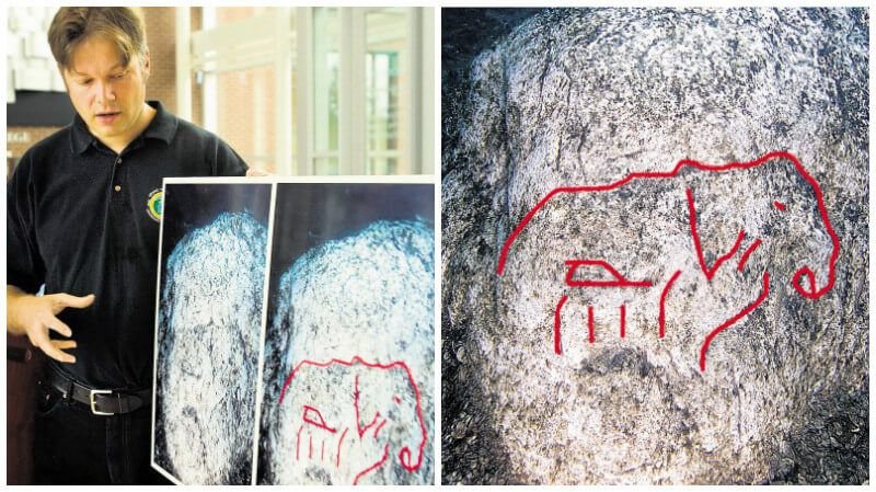
Dr. Holley displays the rock that some people believe has a carving of a mastodon. It has not yet been verified by any scientist that this is a rock carving of the long-extinct animal.

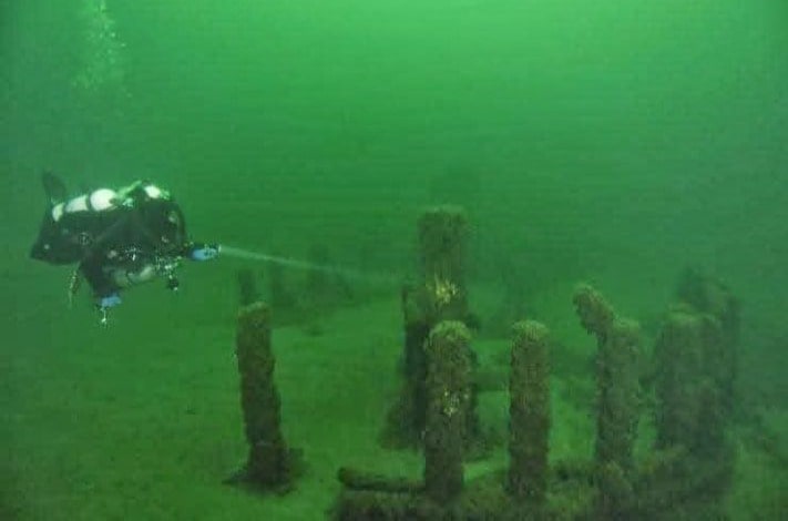
About forty feet beneath Lake Michigan’s glowing waters, Dr. Holley discovered stones arranged in a long line, over one mile in length.

The stones have been dated to approximately 9,000 years ago. That was 4,000 years before Stonehenge was built and approximately two thousand years after the Ice Age ended. It occurred when the lake bed was dry and before Grand Traverse Bay existed.”

“This site seems to gain a life in the media about every six months or so. Sadly, much of the information out there is incorrect. For example, there is not a henge associated with the site and the individual stones are relatively small when compared to what most people think of as European standing stones.

It should be clearly understood that this is not a megalith site like Stonehenge. This label has been placed on the site by individuals in the press who may have been attempting to generate sensation about the story and have not visited the site. The site in Grand Traverse Bay is best described as a long line of stones which is over a mile in length,” Dr. Holley said.

It is, however, not the only strange prehistoric submerged site in this region. While exploring Lake Huron, one of North America’s five Great Lakes, underwater archaeologists discovered traces of an ancient lost civilization that is twice as old as Stonehenge and Egypt’s Great Pyramids.
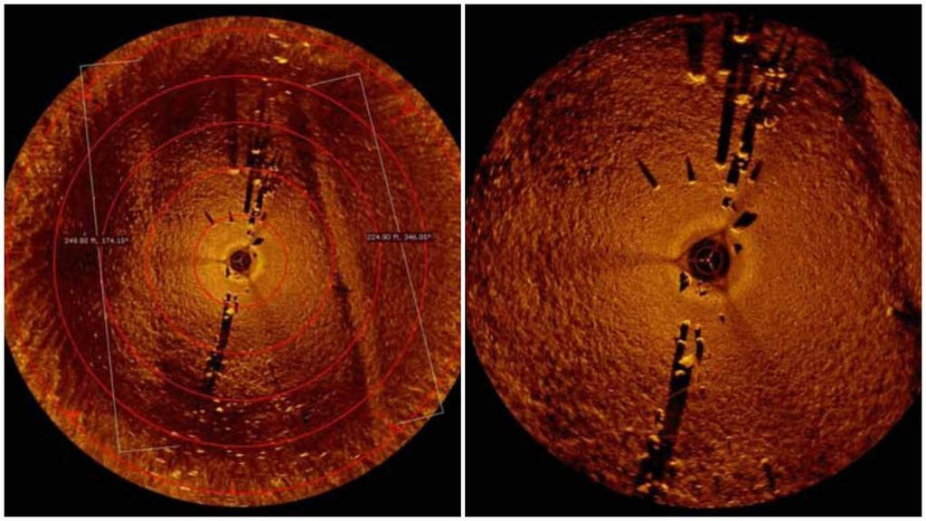
Sonar Image of the stones. Stones Beneath the Waters of Lake Michigan.

Dr. John O’Shea from the University of Michigan has been working on a broadly similar structure over in Lake Huron. He through a leap of innovative thinking, concluded that the structure was perfect for caribou hunting corridors.

According to reports, underwater archaeologists have discovered what appears to be a dry land corridor that once connected northeast Michigan and southern Ontario. Scientists say the main feature, known as Drop 45 Drive Lane, is the most complex hunting structure discovered beneath the Great Lakes to date.

The 9,000-year-old limestone structure consists of two parallel lines of stones that lead to a cul-de-sac lined with natural cobblestones. If the findings are correct, the hunting complex would be twice as old as Stonehenge.

It is highly possible that the site in Grand Traverse Bay may have served a similar function to the one found in Lake Huron.

The exact location of the “Stonehenge-like” structure in Lake Michigan is still a mystery. In order to show the Grand Traverse Band of Ottawa and Chippewa tribes respect for their ancestral heritage and to prevent the site from being inadvertently destroyed, Dr. Holley was kind enough to notify them of his discovery.
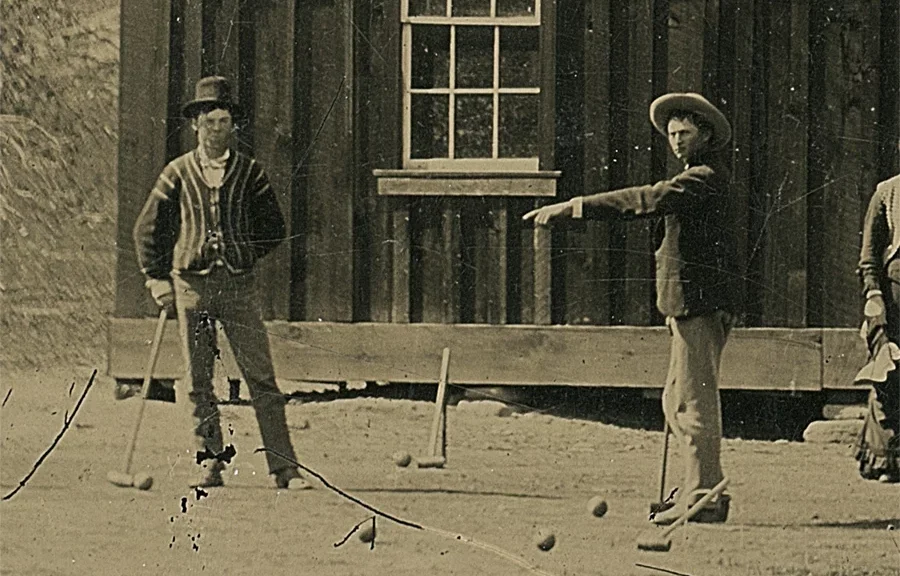
A Fresno junk store in California sold a photo of Billy the Kid for less than $2 — it’s worth $5 million

A Fresno junk store in California sold a photo of Billy the Kid for less than $2 — it’s worth $5 million

A Fresno junk store in California sold a photo of Billy the Kid for less than $2 — it’s worth $5 million

A photograph of the American cowboy, Billy the Kid, is being put up for sale and is expected to fetch more than $5 million. The photograph is one of only two believed to still be in existence and was bought by the seller at a junk shop in California 9 years ago.

Randy Guijarro was hunting for treasures at a Fresno, CA, junk shop in 2010—but he hardly expected to find a real treasure.

Guijarro came across an old photograph inside a cardboard box. It seemed to be from the 19th century, so he figured it was a cool collector’s item. He paid $2 for the image and went on his way.

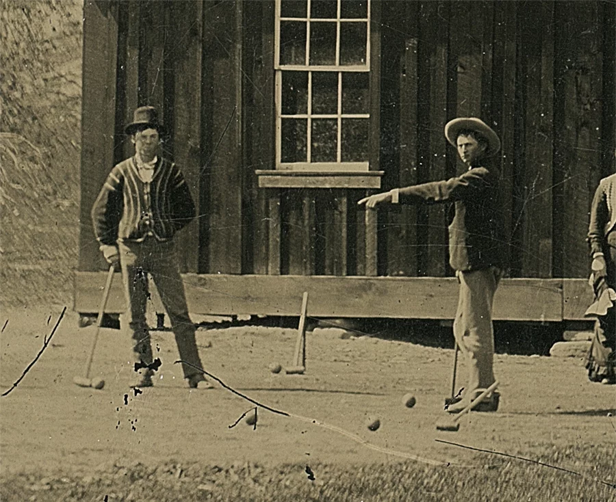
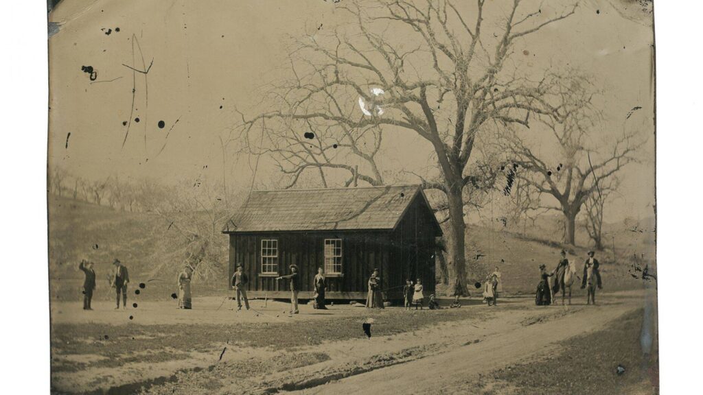
But after a long authentication process, Kagin’s, a San Francisco-based Americana company, has verified that the image is one of the only two photographs ever taken of Henry McCarty, better known as the infamous Western outlaw Billy the Kid. The best part? The photograph actually depicts him playing croquet.

A rare coin dealer in California has concluded that a grainy image of legendary gunman Billy the Kid playing croquet is the real thing and could be worth as much as $5 million.

What?! The infamous shoot-out cowboy gangster playing the super-genteel lawn sport? Say it isn’t so!

The photograph was apparently taken in the summer of 1878 after a wedding—just the time period when croquet was one of America’s most popular pastimes.

The photo, which was confirmed to have been taken in Chaves County, NM, shows a group of 15 or so figures, purportedly Billy the Kid and the Regulators (his gang), among others.

The photo is estimated to have been taken a mere month after the notorious Lincoln County War.

McCarty’s life was brief, but he left an indelible mark on American history. Billy the Kid was a known thief and murderer, who was killed in a gunfight at 21 years old.

He went relatively unknown for most of that time until New Mexico governor Lew Wallace put a price on his head, and he violently escaped prison.

Billy the Kid meets his end at the hands of Sheriff Pat Garrett in Fort Sumner, New Mexico. This violent scene is the finale of G Waldo Browne’s ‘Dandy Rock, the Man from Texas’.

When the photo was first brought to Kagin’s, experts were understandably skeptical. David McCarthy, who worked on authenticating the photo, said, “An original Billy the Kid photo is the holy grail of Western Americana.”

He described the painstaking, year-long process behind authentication:

We had to be certain that we could answer and verify where, when, how and why this photograph was taken.

Simple resemblance is not enough in a case like this – a team of experts had to be assembled to address each and every detail in the photo to ensure that nothing was out of place.

The only other known confirmed tintype photograph of Billy the Kid was taken in 1880 and was sold for a whopping $2.3 million in 2011.

Collectors estimate that this new, shockingly rare photograph could sell for as little as $2 million and as much as $5 million. Not a bad haul for a junk shop find!

Hunting tools Dating Back 1900 Years Found inside a Cave in Querétaro, Mexico

Hunting tools Dating Back 1900 Years were found inside a Cave in Querétaro, Mexico

Archaeologists from the National Institute of Anthropology and History (INAH) found hunting weapons dating back approximately 1,900 years in a cave in the central state of Querétaro.

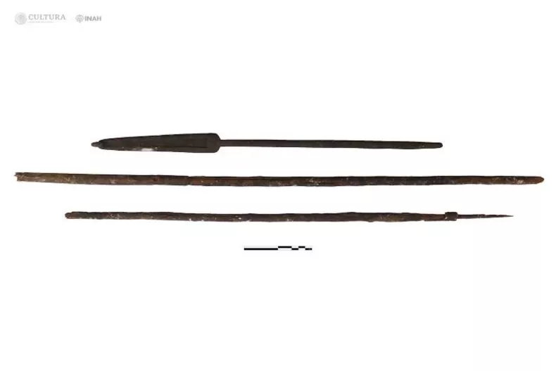
The Federal Ministry of Culture, in collaboration with the National Institute of Anthropology and History (INAH), recovered one of the few sets of pre-Hispanic hunting tools discovered in Mexico to date in a small gallery of the Cave of Treasure in Cadereyta de Montes, Querétaro. It consists of an atlatl (spear) and two wooden darts from the first century of our era.

According to a press announcement by INAH, the discovery was reported by members of the Association of Cavers of Querétaro.

The cave is situated 200 meters above the ravine floor, and once at its entrance, researchers ventured 200 meters through a narrow passage to reach the gallery.

Within this underground branch, with an average height of 80 centimeters, specialists observed an atlatl (51.5 centimeters long), two fragmented darts (66 and 79 centimeters), and a pair of culturally modified wooden sticks (135 and 172 centimeters), likely used as digging sticks and multifunctional tools.

The atlatl is a spear-throwing lever that significantly increases the range and velocity of thrown projectiles, making it possible to target prey at a greater distance than with bare-handed throwing.

The dryness of the environment in the Treasure Cave allowed for the preservation of the hunting instruments, the age of which was determined using radiocarbon dating techniques. This gave a possible age range of A.D. 7-132.

During the exploration, the INAH team did not find other pre-Hispanic archaeological elements in the cave to provide an interpretation of why they were present in that remote location.

However, the results of a sample analysis will be announced by the team on the 27th of January 2024.

The INAH archaeologists said the mystery of the latest discoveries will persist until new investigations are carried out in the areas surrounding the cave. This may enable experts to determine how and why these instruments were left there.

In a Californian gold mine, 40 million year old tools were found

In a Californian gold mine, 40 million-year-old tools were found

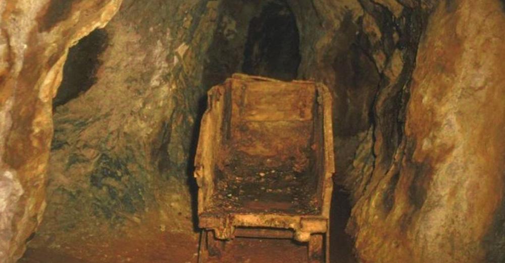
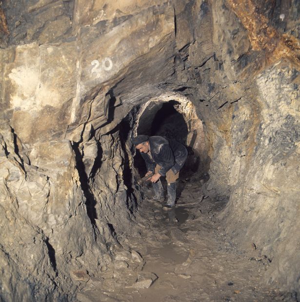
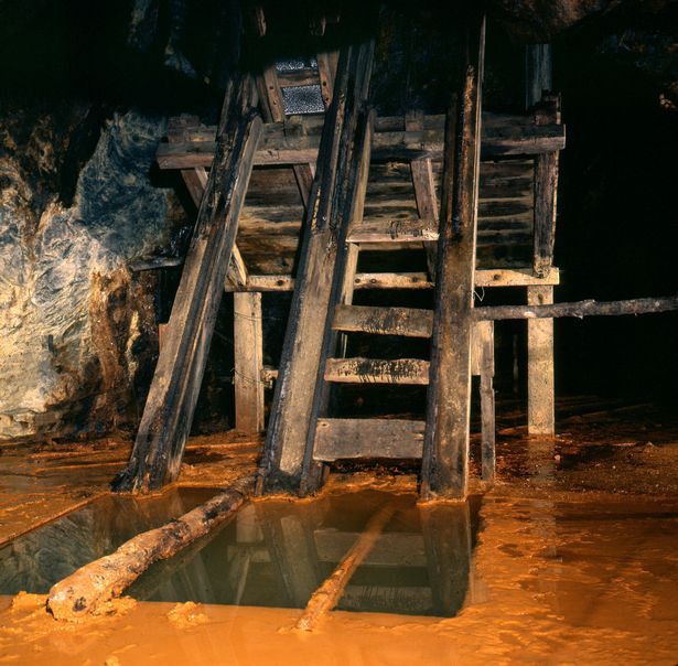
At Table Mountain and other locations in the gold mining region around the middle of the nineteenth century, miners discovered hundreds of stone artifacts and human bones buried deep inside their tunnels.

Experts claim that these bones and artifacts were found embedded in layers from the Eocene epoch (38-55 million years).

The Auriferous Gravels of the Sierra Nevada of California, written by Dr. J. D. Whitney, the leading government geologist in California, was published in 1880 by Harvard University’s Peabody Museum of Comparative Zoology.

In a Californian gold mine, 40 million-year-old tools were found

However, because the information went against accepted Darwinist theories on human origins, it was excluded from scholarly discussions. In 1849, gold was found in the gravels of old riverbeds on the slopes of the Sierra Nevada Mountains, drawing large numbers of rowdy adventurers to settlements including Brandy City, Last Chance, Lost Camp, You Bet, and Poker Flat.

Initially, solitary miners searched for flakes and nuggets among the gravels that had made their way into the present-day streambeds. Auriferous (gold-bearing) gravels were quickly washed from hillsides by high-pressure water jets while other gold-mining businesses bored holes into mountainside deposits and followed the gravel deposits wherever they led.

The miners found hundreds of stone items as well as human fossils. The scientific community received the most crucial information from Dr. J. D. Whitney.

Artifacts from hydraulic mining and surface deposits were of questionable age, while deep mine shaft and tunnel artifacts could be more accurately dated. According to J. D. Whitney, the geological evidence revealed that the auriferous gravels were at least Pliocene in age.

However, according to modern geologists, some of the gravel layers are Eocene in origin. In Tuolumne County’s Table Mountain, several holes were dug, traveling through thick strata of latite, a basaltic volcanic substance, before arriving to the gravels containing gold.

In other instances, the tunnels stretched hundreds of feet horizontally beneath the latite top. The age of findings from the gravels directly above the bedrock might be between 33.2 and 55 million years old, and those from other gravels could be between 9 and 55 million years old.

According to William B. Holmes, a physical anthropologist at the Smithsonian Institution, “If Professor Whitney had fully appreciated the story of human evolution as it is understood today, he would have hesitated to announce the conclusions formulated, notwithstanding the imposing array of testimony with which he was confronted.” Or, to put it another way, the theory had to be rejected if the evidence did not support it, which is exactly what happened.

The Phoebe Hearst Museum of Anthropology at the University of California, Berkeley, still has some of the items Whitney mentioned on exhibit.

Darwinism and other isms had an effect on how archaeological evidence was handled in Hueyatlaco, Mexico. Archaeologists working under the direction of Cynthia Irwin-Williams found stone tools there in the 1970s that were associated to bones from butchered animals.

A group of geologists, including Virginia Steen-McIntyre, dated the location.

The age of the site was established using four different techniques: stratigraphic analysis, zircon fission track dating on volcanic layers above the artifact layers, tephra hydration dating of volcanic crystals found in volcanic layers above the artifact layers, and uranium-series dates on butchered animal bones.

The reason the archaeologists were hesitant to put an age on the site was because they thought that (1) no humans were around 250,000 years ago anyplace on the earth, and (2) no humans visited North America until at most 15,000 or 20,000 years ago.

At Table Mountain and other locations in the gold mining region around the middle of the nineteenth century, miners discovered hundreds of stone artifacts and human bones buried deep inside their tunnels.

Experts claim that these bones and artifacts were found embedded in layers from the Eocene epoch (38-55 million years). The leading government geologist in California, Dr. J. D. Whitney, disclosed this information.

Funerary urn depicting Maya corn god uncovered during Maya Train work

Funerary urn depicting Maya corn god uncovered during Maya Train work

Funerary urn depicting Maya corn god uncovered during Maya Train work

Archaeologists from the National Institute of Anthropology and History (INAH) conducting salvage work along Section 7 of the Maya Train discovered a funerary urn with a carved image of a corn god.

According to a press announcement by INAH,  the general director of INAH, Diego Prieto Hernández, said that, in terms of its typology, this urn has been identified as a Paaktzatz-style vessel.

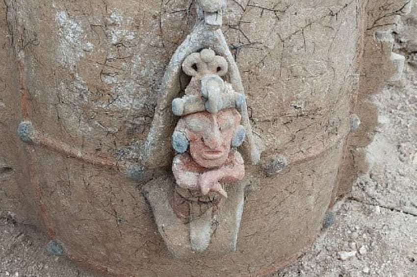
The funerary urn “presents a very interesting image of the corn god emerging from the leaves of a cob,” Hernández said.

According to Prieto Hernández, the urn was found near a similar vessel, which may indicate that the vessels were part of an ancient offering. Due to its typology, the clay pot has been identified as a Paaktzatz-style urn, containing human remains.

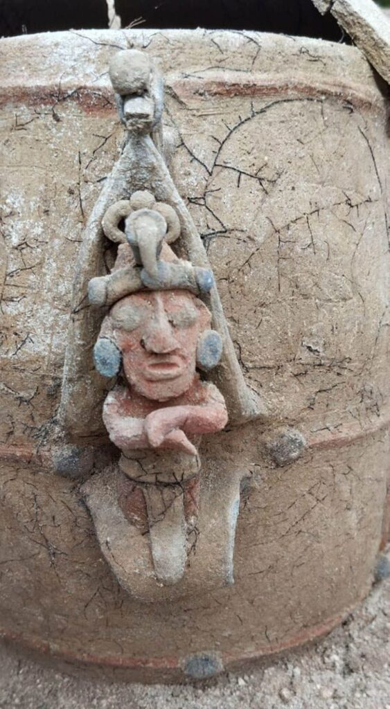
An anthropomorphic pastillage figure depicting the Maya corn god is seen on the funerary urn, according to a press release, and an owl is depicted on the lid, which is also present on the other vessel.

A funerary urn depicting the Maya corn god.

On the front of the vessel is a small anthropomorphic figure made of pastillage (a decorative technique using pieces of ceramic paste), alluding to the deity’s representation as an ear of corn in the growth stage.

In addition to the depiction of the corn god, the urn has ornamentation resembling the Mayan symbol “ik,” which represents wind and divine breath.

The ornamentation of the second vessel consists of applications on the sides, which simulate the thorns of a ceiba tree, a sacred tree among the Mayans of the past and present.

Archaeologists stated that similar images of the Maya deity have been found in figurines from the island of Jaina, in Campeche.

During the Classic Period of Maya iconography, the owl was considered an omen and a symbol of war. Paaktzatz vessels from the Río Bec region of Campeche, crafted between 680 and 770 A.D., provide evidence of this.

Archaeologists, archaeological work done through Jan. 8 on sections 5, 6 and 7 of the Maya Train has uncovered and protected 40,000 archaeological sites, some 1,000 artifacts, over 200,000 ceramic fragments, and 148 human burials.

Archaeologists discover a hidden Maya burial chamber in the walled enclosure of Tulum

Archaeologists discover a hidden Maya burial chamber in the walled enclosure of Tulum

Archaeologists discover a hidden Maya burial chamber in the walled enclosure of Tulum

Archaeologists from the National Institute of Anthropology and History (INAH) have discovered a hidden Maya burial chamber concealed within a cave at the archaeological complex in Tulum, Quintana Roo.

The discovery, sealed off by a massive rock deep inside Mexico’s walled city of Tulum, offers a rare glimpse into the funerary practices of this pre-Hispanic civilization.

By removing a large rock blocking the entrance to a hidden cave within the walled area of the Maya city, archaeologists uncovered the skeletal remains of several individuals.

The discovery was made during routine clearing work for a new visitor path, which is nestled between two prominent temples. A meticulously glued sea snail hinted at Maya craftsmanship, while a split human skeleton hinted at a deeper secret.

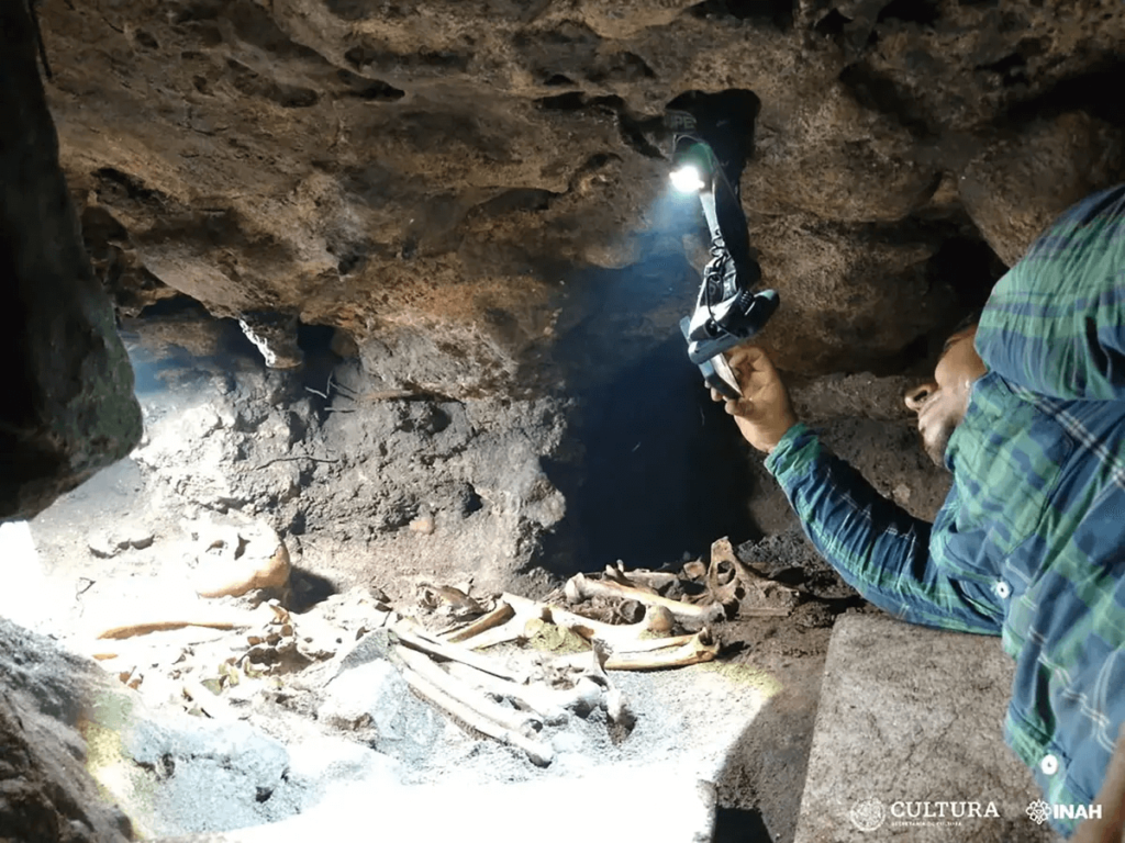
Upon removing the rock that sealed the entrance to the cavity, it was observed that it was literally splitting the skeletal remains of an individual, leaving the lower part of their body outside and the upper part inside. This would indicate that the person might have become trapped while attempting to access the cavity.

The project’s coordinator José Antonio Reyes Solís said in a statement that upon removing the boulder blocking the cave’s entrance, researchers saw that it had been splitting the ossified remains of an individual, leaving the lower part of the body on the outside and the upper part inside.

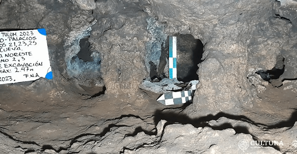
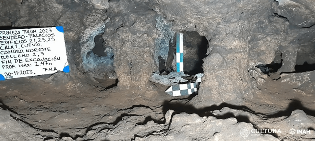
An archaeologist inside the newly discovered burial site at Tulum.

Inside the cramped cave, barely taller than half a meter, lay eight adult burials remarkably preserved by the cool, dry environment.

All materials are being studied further at INAH’s Quintana Roo Center by the head of the Department of Physical Anthropology, Allan Ortega Muñoz.

As the exploration of the cave progressed, The coordinator of the archaeological research project, José Antonio Reyes Solís said, it was identified that the topography shows at least two small chambers, located in the southern and northern parts, no more than 3 meters long by 2 meters wide, and an average height of 50 centimeters.

Likewise, a large number of skeletal remains of animals associated with the burials were recorded. According to the specialists in fauna identification, who collaborate on the project, Jerónimo Avilés and Cristian Sánchez, they correspond, in a preliminary manner, to various mammals (domestic dogs, mice, opossum, blood-sucking bats, white-tailed deer, tepezcuintle, armadillo nine banded, tapir, peccary); birds of the order Galliforme, Passeriforme, Pelecaniforme, Piciforme and Charadriiforme; reptiles (loggerhead sea turtle, land turtle and iguana); fish (tiger shark, barracuda, grouper, drum fish, puffer fish, eagle ray); crustaceans (crab and cirripedians), mollusks (snail) and amphibians (frog). Some bones have cut marks and others have been worked as artifacts, like punches, needles, or fan handles, characteristic of the area.

A single ceramic “molcajete” (grinding bowl) further pinpointed the burials to the late Postclassic period (1200-1550 AD).

In three of the burials, a small mortar of the type decorated with incisions was discovered, and it has been intervened by a restorer for preservation.

Archaeologists’ testimony describes the conditions inside the cave as particularly difficult, owing to the small entryways, low ceilings, lack of natural light, and general heat and humidity.  In addition to photos, a three-dimensional scan of the area will be made so that researchers and the general public can see the materials and remains in their original context.

North America’s First People May Have Arrived By Sea Ice Highway 24,000 Years Ago

North America’s First People May Have Arrived By Sea Ice Highway 24,000 Years Ago

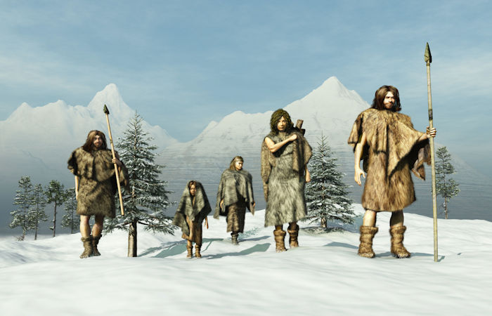
One of the hottest debates in archaeology is about how and when humans first arrived in North America. Archaeologists have traditionally argued that people walked through an ice-free corridor that briefly opened between ice sheets an estimated 13,000 years ago.

North America’s First People May Have Arrived By Sea Ice Highway 24,000 Years Ago

But a growing number of archaeological and genetic finds—including human footprints in New Mexico dated to around 23,000 years old—suggests that people made their way onto the continent much earlier. These early Americans likely traveled along the Pacific coastline from Beringia, the land bridge between Asia and North America that emerged during the last glacial maximum when ice sheets bound up large amounts of water causing sea levels to fall.

Now, in research to be presented Friday, 15 December at the American Geophysical Union Annual Meeting (AGU23) in San Franciso, paleoclimate reconstructions of the Pacific Northwest hint that sea ice may have been one way for people to move farther south.

The idea that early Americans may have traveled along the Pacific Coast isn’t new. People were likely south of the massive ice sheets that once covered much of the continent at least 16,000 years ago.

Given that the ice-free corridor wouldn’t be open for thousands of years before these early arrivals, scientists instead proposed that people may have moved along a “kelp highway.” This theory holds that early Americans slowly traveled down into North America in boats, following the bountiful goods found in coastal waters.

Archaeologists have found evidence of coastal settlements in western Canada dating from as early as 14,000 years ago. But in 2020, researchers noted that freshwater from melting glaciers at the time may have created a strong current that would make it difficult for people to travel along the coast.

Ice highway over dangerous water

To get a fuller picture of ocean conditions during these crucial windows of human migration, Summer Praetorius of the US Geological Survey and her colleagues looked at climate proxies in ocean sediment from the coast. Most of the data came from tiny, fossilized plankton. The abundance and chemistry of these organisms help reconstruct ocean temperatures, salinity, and sea ice cover.

Praetorious’ presentation is part of a session on the climate history and geology of Beringia and the North Pacific during the Pleistocene, the current ice age, at AGU23.

The week-long conference has brought 24,000 experts from across the spectrum of Earth and space sciences to San Francisco this year and connected 3,000 online attendees.

Praetorious’ team used climate models and found that ocean currents were more than twice the strength they are today during the height of the last glacial maximum around 20,000 years ago due to glacial winds and lower sea levels. While not impossible to paddle against, these conditions would have made traveling by boat very difficult, Praetorius said.

However, the records also showed that much of the area was home to winter sea ice until around 15,000 years ago. As a cold-adapted people, “rather than having to paddle against this horrible glacial current, maybe they were using the sea ice as a platform,” Praetorius said.

Arctic people today travel along sea ice on dog sleds and snowmobiles. Early Americans may also have used the ‘sea ice highway’ to get around and hunt marine mammals, slowly making their way into North America in the process, Praetorius said. The climate data suggest conditions along the coastal route may have been conducive to migration between 24,500 and 22,000 years ago and 16,400–14,800 years ago, possibly aided by the presence of winter sea ice.

While proving that people were using sea ice to travel will be tricky, given most of the archaeological sites are underwater, the theory provides a new framework for understanding how humans may have arrived in North America without a land bridge or easy ocean travel.

And the sea ice highway isn’t mutually exclusive with other human migrations further down the line, says Praetorius. The team’s models show the Alaskan current had calmed down by 14,000 years ago, making it easier for people to travel by boat along the coast.

“Nothing is off the table,” she said. “We will always be surprised by ancient human ingenuity.”

Humans Got To America 7,000 Years Earlier Than Thought – New Research Confirms

Humans Got To America 7,000 Years Earlier Than Thought – New Research Confirms

When and how humans first settled in the Americas is a subject of considerable controversy. In the 20th century, archaeologists believed that humans reached the North American interior no earlier than around 14,000 years ago.

But our new research found something different. Our latest study supports the view that people were in America about 23,000 years ago.

Humans Got To America 7,000 Years Earlier Than Thought – New Research Confirms
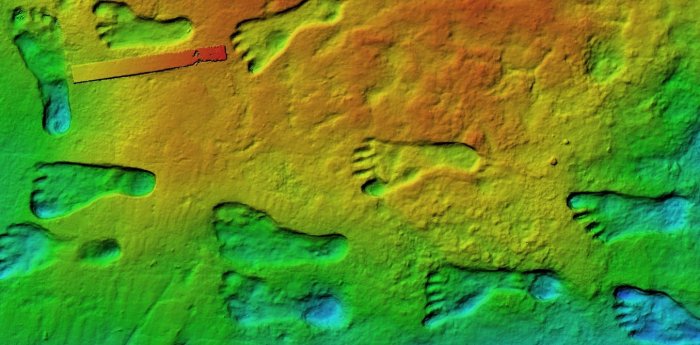
The footprints come from a group of people of different ages.

The 20th-century experts thought the appearance of humans had coincided with the formation of an ice-free corridor between two immense ice sheets straddling what’s now Canada and the northern US. According to this idea, the corridor, caused by melting at the end of the last Ice Age, allowed humans to trek from Alaska into the heart of North America.

Gradually, this orthodoxy crumbled. In recent decades, dates for the earliest evidence of people have crept back from 14,000 years ago to 16,000 years ago. This is still consistent with humans only reaching the Americas as the last Ice Age was ending.

In September 2021, we published a paper in Science that dated fossil footprints uncovered in New Mexico to around 23,000 years ago—the height of the last Ice Age. They were made by a group of people passing by an ancient lake near what’s now White Sands. The discovery added 7,000 years to the record of humans on the continent, rewriting American prehistory.

If humans were in America at the height of the last Ice Age, either the ice posed few barriers to their passage, or humans had been there for much longer. Perhaps they had reached the continent during an earlier period of melting.

Our conclusions were criticized, however, we have now published evidence confirming the early dates.

Dating the pollen

For many people, the word pollen conjures up a summer of allergies, sneezing, and misery. But fossilized pollen can be a powerful scientific tool.

In our 2021 study, we carried out radiocarbon dating on common ditch grass seeds found in sediment layers above and below where the footprints were found. Radiocarbon dating is based on how a particular form—called an isotope—of carbon (carbon-14) undergoes radioactive decay in organisms that have died within the last 50,000 years.

Some researchers claimed that the radiocarbon dates in our 2021 research were too old because they were subject to something called the “hard water” effect. Water contains carbonate salts and therefore carbon. Hard water is groundwater that has been isolated from the atmosphere for some period of time, meaning that some of its carbon-14 has already undergone radioactive decay.

Common ditch grass is an aquatic plant and the critics said seeds from this plant could have consumed old water, scrambling the dates in a way that made them seem older than they were.

It’s quite right that they raised this issue. This is the way that science should proceed, with claim and counter-claim.

How did we test our claim?

Radiocarbon dating is robust and well-understood. You can date any type of organic matter in this way as long as you have enough of it. So two members of our team, Kathleen Springer and Jeff Pigati of the United States Geological Survey set out to date the pollen grains. However, pollen grains are really small, typically about 0.005 millimeters in diameter, so you need lots of them.

This posed a formidable challenge: you need thousands of them to get enough carbon to date something. In fact, you need 70,000 grains or more.

Medical science provided a remarkable solution to our conundrum. We used a technique called flow cytometry, which is more commonly used for counting and sampling individual human cells, to count and isolate fossil pollen for radiocarbon dating.

Flow cytometry uses the fluorescent properties of cells, stimulated by a laser. These cells move through a stream of liquid. Fluorescence causes a gate to open, allowing individual cells in the flow of liquid to be diverted, sampled, and concentrated.

We have pollen grains in all sediment layers between the footprints at White Sands, which allows us to date them. The key advantage of having so much pollen is that you can pick plants like pine trees that are not affected by old water. Our samples were processed to concentrate the pollen within them using flow cytometry.

After a year or more of labor-intensive and expensive laboratory work, we were rewarded with dates based on pine pollen that validated the original chronology of the footprints. They also showed that old water effects were absent at this site.

The pollen also allowed us to reconstruct vegetation that was growing when people made the footprints. We got exactly the kinds of plants we would expect to have been there during the Ice Age in New Mexico.

We also used a different dating technique called optically stimulated luminescence (OSL) as an independent check. OSL relies on the accumulation of energy within buried grains of quartz over time. This energy comes from the background radiation that’s all around us.

Colorized scanning electron microscope image of pollen grains from a variety of common plants.

The more energy we find, the older we can assume the quartz grains are. This energy is released when the quartz is exposed to light, so what you are dating is the last time the quartz grains saw sunlight.

To sample the buried quartz, you drive metal tubes into the sediment and remove them carefully to avoid exposing them to light. Taking quartz grains from the center of the tube, you expose them to light in the lab and measure the light emitted by grains. This reveals their age. The dates from OSL supported those we got using other techniques.

The humble pollen grain and some marvelous medical technology helped us confirm the dates the footprints were made, and when people reached the Americas.