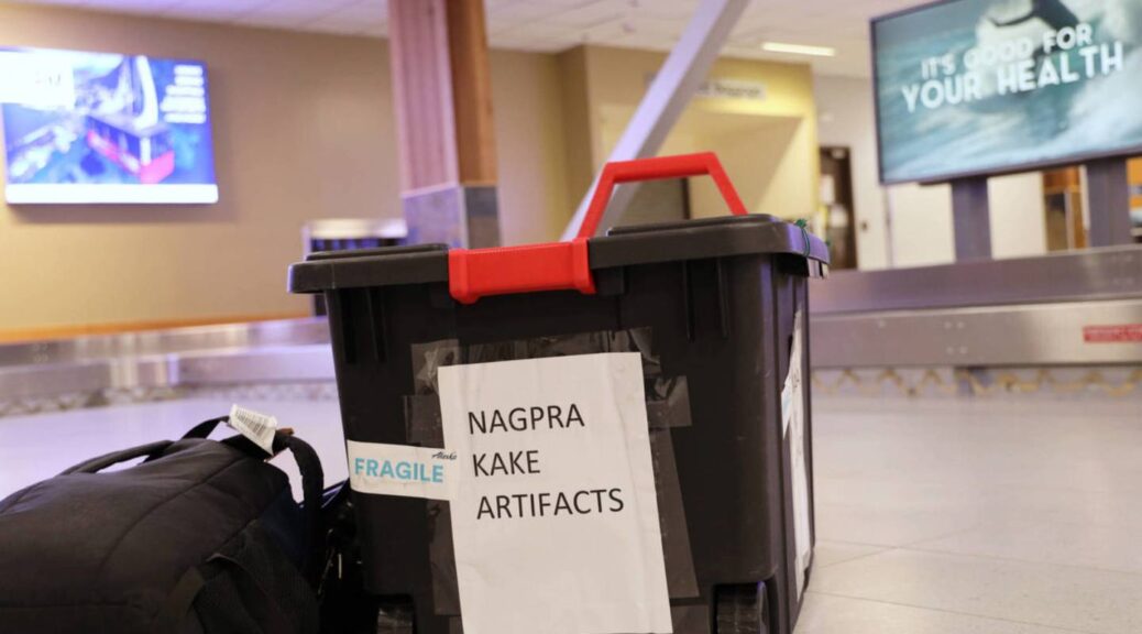
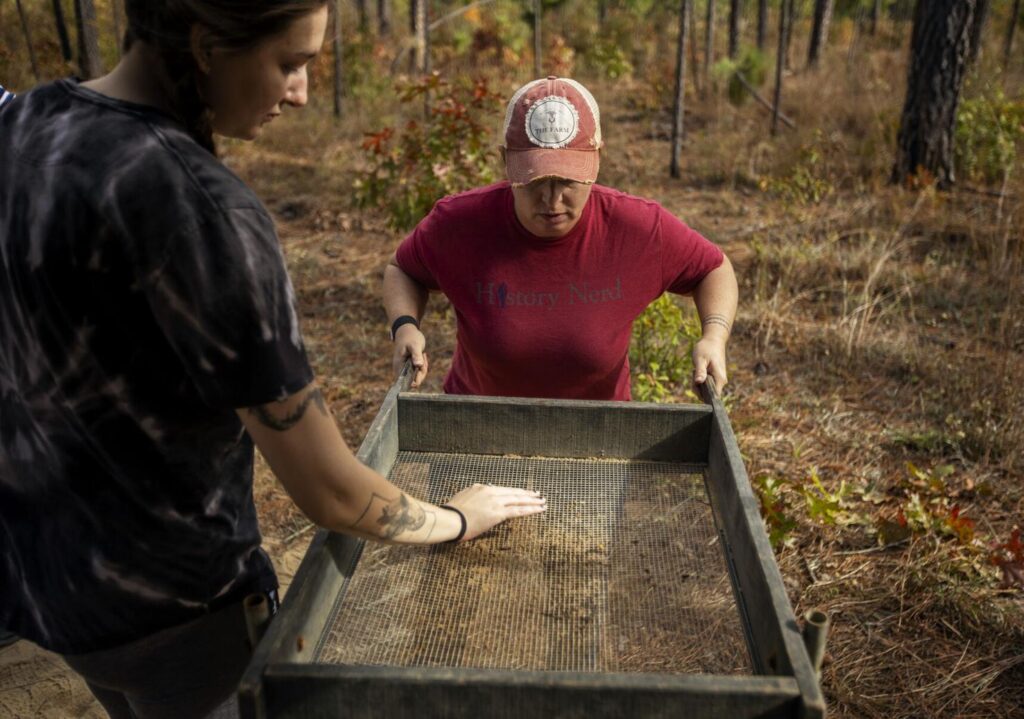
A black tote holding Alaska Native artifacts sits on the ground of the Juneau International Airport on Thursday, Nov. 17, 2022. It was flown from Seattle after being filled with 25 Alaska Native artifacts held at George Fox University in Oregon.
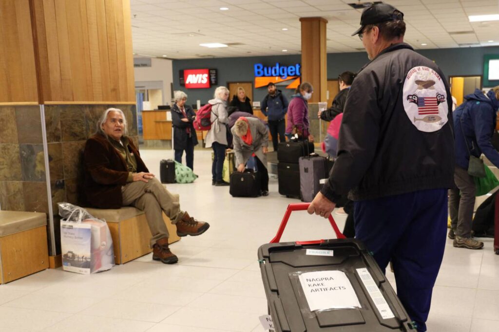
Nearing the end of his flight from Seattle to Juneau, Frank Hughes looked out his plane window to the ground below where the outline of the Organized Village of Kake slowly appeared beneath him.
An excitement built in him, one that he said made him feel like his heart had just skipped a beat. Though Hughes has lived in the small Southeast Alaska Native village for years and has come and gone from it too many times to count, this time was different — because he wasn’t alone in coming home.
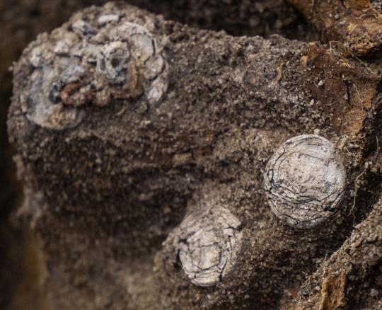
In the belly of the plane sat a sturdy black bin locked by zip ties and scattered with fragile stickers holding 25 Alaska Native artifacts ranging from spruceroot-woven baskets to ceremonial paddles to headdresses that were taken from the village in the early 1900s.
Many of the pieces are estimated to be more than 200 years old.
“We’re going home,” Hughes said. “These artifacts are coming home.”
Since 2018, Hughes has worked to bring the collections of artifacts that were found at George Fox University in Oregon back to Kake after discovering their existence while doing research for the Native American Grave Protection and Repatriation Act for which he served as coordinator. Hughes said during his work for NAGPRA he had done many Indigenous artifact repatriations across the country, but said he couldn’t believe it when he came across the artifacts from Kake.
Now, after nearly five years of waiting, Hughes, along with Lincoln Bean, vice chairman for the Organized Village of Kake, flew to the university this month to retrieve the artifacts and bring them home. The pair and the bin of artifacts made stops in Seattle and Juneau before heading to Kake on Nov. 18.
“When I looked at them, it was like looking at my past and my elders,” Bean said. “It’s some of the most beautiful art of weaving, headdresses I’ve never seen before. The apron for dancing, with some of the most intricate, beautiful beadwork you’ve ever seen in your life.”
How the collection of this small Southeast Alaska village’s cultural artifacts ended up nearly 1,000 miles away, stored off-display at what bills itself as the No. 1 Christian college in Oregon, is up for debate, Hughes and Bean explained.
The pair said they believe that some of the artifacts may have been given as a gift to visitors of the village. They said it is more likely, however, that most were taken by the Religious Society of Friends in Alaska — also known as Quakers — who built a mission in the village in late 1891, then left after the building was handed over to the Kake Memorial Presbyterian church in 1912.
“They cut it out and took it,” Hughes said about a wooden mask that was part of the collection of artifacts repatriated. The piece was likely the oldest of the collection and served as a marker on a tree identifying the territory. He said the mask would have to have been cut out of the body of the tree to be removed.
Quakers were missionaries in Alaska who during the 1800s and 1900s ran about 30 boarding schools for Indigenous children in the U.S. and its territories, including the Douglas Island Friends Mission School on Douglas Island.
Quakers were part of the historical movement in which many Alaska Native children were sent away from their families, communities and culture to boarding schools in the state — or across the country — and were forced to divorce themselves of their Indigenous identity in exchange for U.S. values and culture.
Though many of the boarding schools were closed by the late 1900s, the legacy of trauma and abuse from these schools still remains for many Alaska Native families and communities.
Hughes said though the pain still permeates from the past, repatriation serves as a way to bring healing to both the people living in Kake today and the spirits that live within the artifacts.
“We’re just trying to bring them home where they came from,” Bean said.
Hughes said when he first saw the artifacts in Oregon, he knew immediately that the spirits of his Tlingit ancestors were there with him.
“When we opened it up, the excitement and the spirits were alive, it’s like walking in an air-conditioned room — the spirits came alive,” Hughes said. “It’s good to see you, we’re happy to see you.”
Bean agreed and said the Tlingit culture is a gift from God and bringing home these items gives him a glimpse of his culture he didn’t know was missing.
“I’ve never seen anything like this,” Bean said. “It’s powerful looking back on people we know that were here before us — as a family, as a tribe — and it’s tangible, we can touch it.
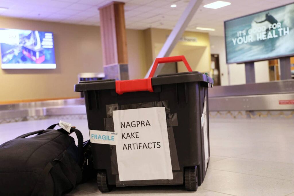
A black tote holding Alaska Native artifacts sits on the ground of the Juneau International Airport on Thursday afternoon, Nov. 17, 2022. It was flown from Seattle after being filled with 25 Alaska Native artifacts held at George Fox University in Oregon.
Hughes said he and Bean would present the artifacts, still unopened, to the village. Plans to open the box and welcome the artifacts home were on track to commence but likely wouldn’t happen until after Thanksgiving. Bean and Hughes said that the repatriation serves as a step toward healing and rebuilding the parts of their culture that were taken.
“We know who we are, we know where we come from, we know where we’re going,” Bean said.
See the face of an 18th century ‘vampire’ buried in Connecticut
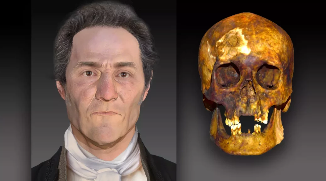
Using DNA extracted from a skull, a forensic artist created a facial reconstruction of a man believed to be a vampire from the 18th century.
In the late 18th century, a man was buried in Griswold, Connecticut, with his femur bones arranged in a criss-cross manner — a placement indicating that locals thought he was a vampire. However, little else was known about him.
More than 200 years later, DNA evidence is revealing what he may have looked like. (And yes, he was genetically human.)
After performing DNA analyses, forensic scientists from a Virginia-based DNA technology company named Parabon NanoLabs, and the Armed Forces DNA Identification Laboratory (AFDIL), a branch of the U.S. Armed Forces Medical Examiner System based in Delaware, concluded that at the time of death, the deceased male (known as JB55) was about 55 years old and suffered from tuberculosis.
Using 3D facial reconstruction software, a forensic artist determined that JB55 likely had fair skin, brown or hazel eyes, brown or black hair and some freckles, according to a statement.
Based on the positioning of the legs and skull in the grave, researchers suspect that at some point the body was disinterred and reburied, a practice often associated with the belief that someone was a vampire. Historically, some people once thought that those who died of tuberculosis were actually vampires, according to the statement.
“The remains were found with the femur bones removed and crossed over the chest,” Ellen Greytak, director of bioinformatics at Parabon NanoLabs and the technical lead for the organization’s Snapshot Advanced DNA Analysis division, told Live Science. “This way they wouldn’t be able to walk around and attack the living.”
To perform the analyses, forensic scientists began by extracting DNA from the man’s skeletal remains. However, working with bones that were more than two centuries old proved challenging.
“The technology doesn’t work well with bones, especially if those bones are historical,” Greytak said. “When bones become old, they break down and fragment over time. Also, when remains have been sitting in the environment for hundreds of years, the DNA from the environment from things like bacteria and fungi also end up in the sample. We wanted to show that we could still extract DNA from difficult historical samples.”
A common practice was to bury suspected vampires with their legs crossed so that way they couldn’t rise from the dead.
In traditional genome sequencing, researchers strive to sequence each piece of the human genome 30 times, which is known as “30X coverage.” In the case of the decomposed remains of JB55, the sequencing only yielded about 2.5X coverage.
To supplement this, researchers extracted DNA from an individual buried nearby who was believed to be a relative of JB55. Those samples yielded even poorer coverage: approximately 0.68X.
“We did determine that they were third-degree relatives or first cousins,” Greytak said.
Archaeologists originally unearthed the supposed vampire’s remains in 1990.
In 2019, forensic scientists extracted his DNA and ran it through an online genealogical database, determining that JB55 was actually a man named John Barber, a poor farmer who likely died of tuberculosis.
The nickname JB55 was based on the epitaph spelled out on his coffin in brass tacks, denoting his initials and age at death.
Revolutionary War–Era Graves Unearthed in South Carolina
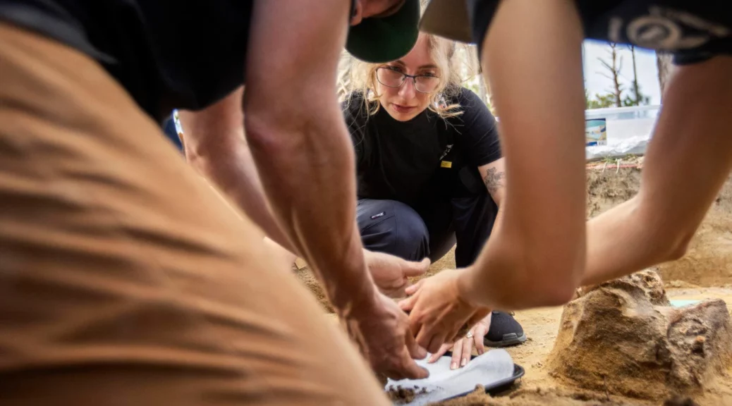
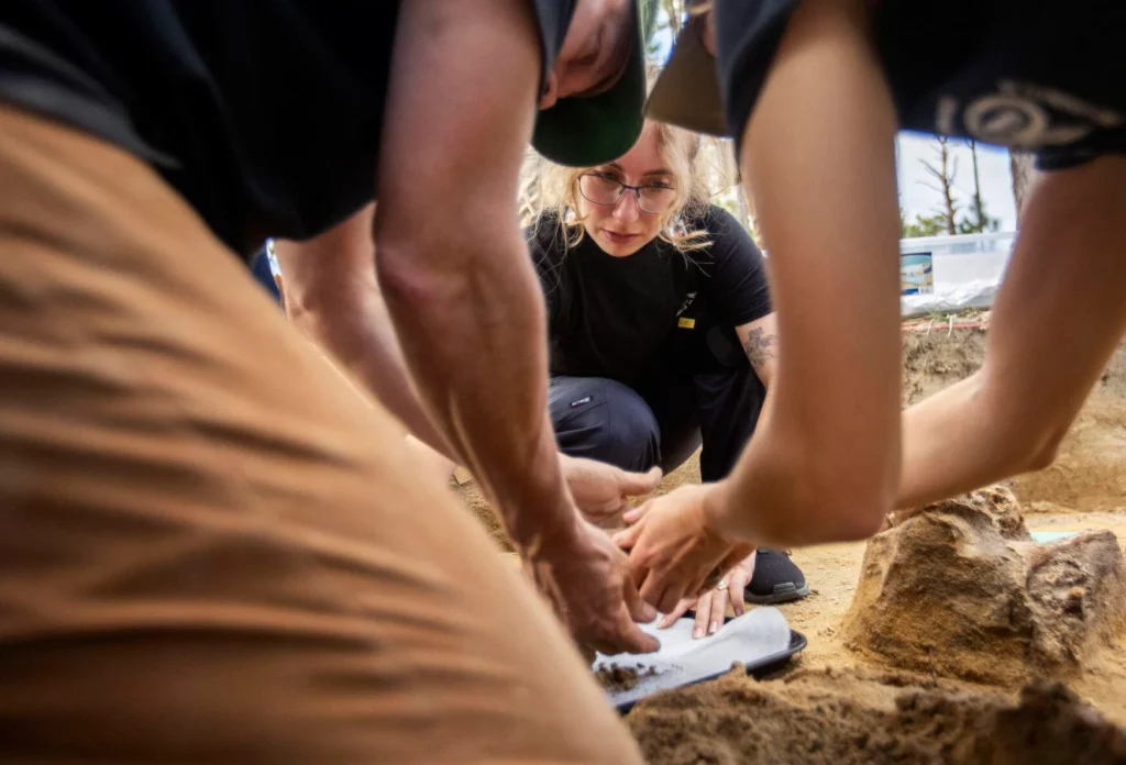
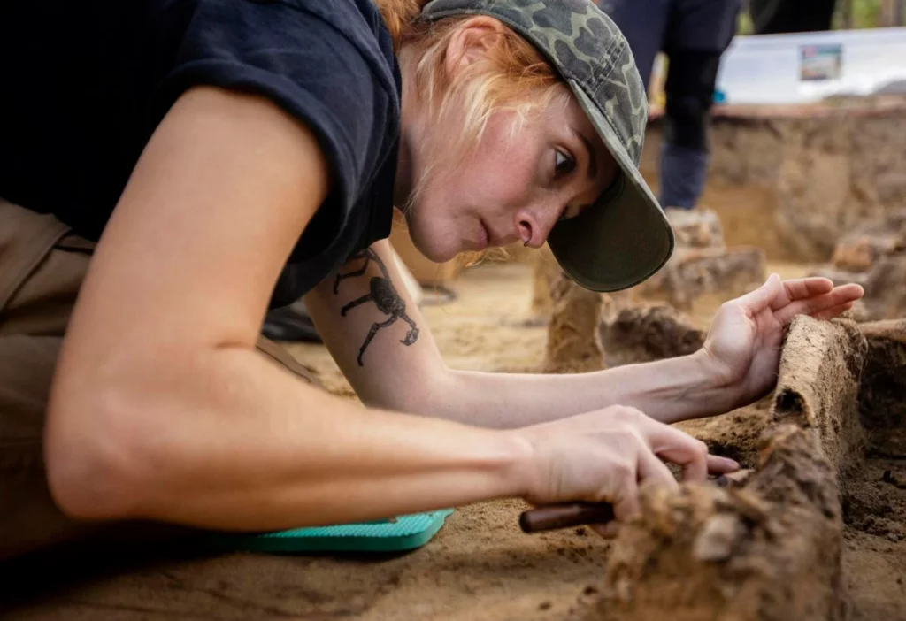
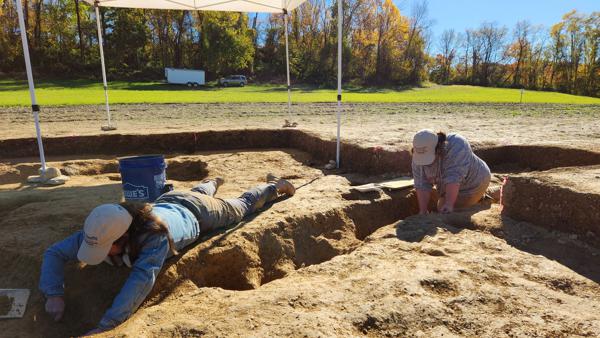
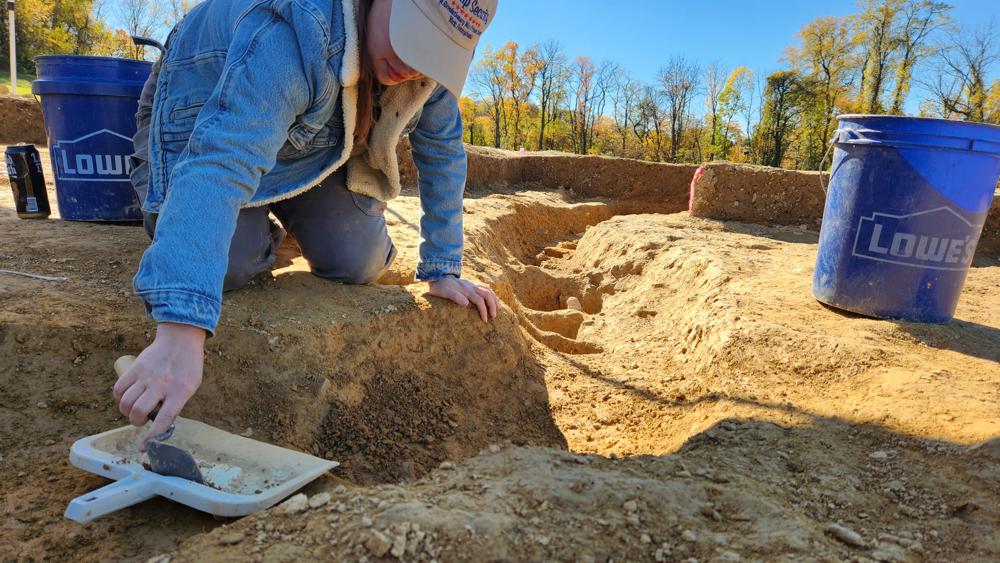
Bill Stevens (from left), Rachel Baker and Madeline Atwell, all forensic anthropologists with the Richland County Coroner’s Office, carefully remove skeletal remains on Nov. 4, 2022, from a gravesite located where the Battle of Camden was fought between American Patriots and the British. Gavin McIntyre/Staff
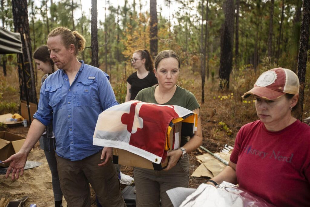
The bones came out, one by one, lifted from the earth by experienced hands, wrapped in foil and labelled, until the entire skeleton was liberated from this shallow gravesite. The coroners laid each package in a box. Someone unfurled a Maryland flag. Doug Bostick, executive director of the South Carolina Battleground Preservation Trust, offered words of thanks to the team.
“It’s so surreal,” he said of the find, “and real.”
Then his colleague David Reuwer voiced a loud cheer.
“Hip-hip …” he called.
“Hoozah!” came the collective response.
“Hip-hip …”
“Hoozah!”
“And for them, hip-hip …”
“HOOZAH!”
The box containing the remains of this Continental Army fighter from Maryland was carried slowly, in procession, to a nearby car as everyone gathered on this old battlefield stood respectfully, hand upon their chest.
Sara Rogers, with the South Carolina Institute of Archaeology and Anthropology, holds a box with the remains of a Revolutionary War soldier found at the site of the Battle of Camden. A Maryland state flag is draped over the box in honor of the fighter’s origins. Gavin McIntyre/Staff
The soldier, one of 14 discovered here in recent months, surely died a miserable death. His bones, and the skeletal remains of four others hastily buried next to him, were reminders of war’s terrible violence and time’s indifference.
These young men had been lost to the sandy soil, their determination in the face of an overpowering enemy largely forgotten. The battle is known, but not the individual fighters — men of the 1st and 2nd Maryland Brigades, the Delaware Continental Army, Armand’s Legion, and Virginia and North Carolina militias. This archaeological and forensic work changes that. The human remains, tattered though they are, will go to the lab of University of South Carolina anthropology professor Carlina Maria de la Cova for extensive analysis that surely will reveal new information about the Battle of Camden, a disaster for Continental Army Maj. Gen. Horatio Gates and the men under his command on that hot summer day of Aug. 16, 1780.
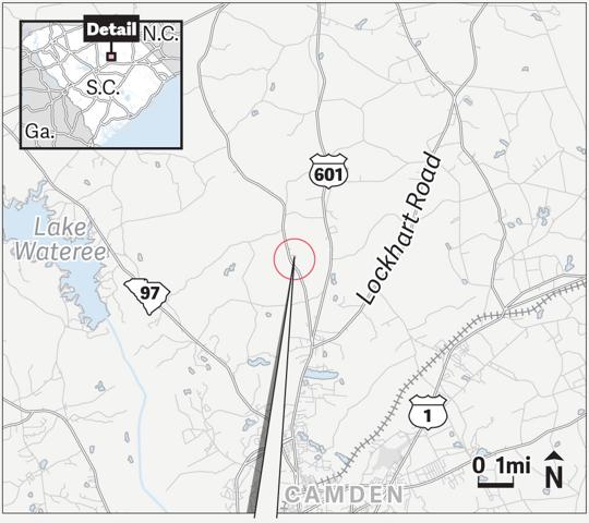
CAMDEN BATTLEFIELD: The Battle of Camden, fought on a hot summer day in 1780, was a major defeat for the Continental Army. An archaeological project has turned up artifacts and human remains. (SOURCE: ESRI)
A project that began as an effort to remove artefacts and prepare a historic battlefield for public access became something else when the bones were discovered. Thirteen of the dead appear to have been artlessly buried before the wild hogs could get to them. The corpse of a British fighter was set deeper in the soil and formally laid out, perhaps by friends who took extra care. One of the 14 dead found here appears to have been a Native American who possibly was part of the North Carolina Royal Volunteers, a Loyalist militia unit.
Embedded in the broken bones were musket balls. In one set of remains found across Flat Rock Road, the lead ball lodged in the spine of a teenager, perhaps 14 or 15 years old. Archaeologists know this because of the growth plates visible at the ends of long bones. The boy with the shattered spine was one of at least two teenagers found during this dig. It’s highly unusual to exhume human remains from a historic battlefield, and even more unusual to find this many in one place, Bostick said. Generally, if bones are encountered, an effort is made to minimize activities that disturb them.
But this time, thanks to the expertise of forensic anthropologists from the Richland County Coroner’s Office and support from the Department of Natural Resources, the team determined to scrutinize their find in order to glean new information about the Camden killing field in which 3,700 Patriots and 2,230 British fighters and American Loyalists faced off. Plans already are afoot for a grand reinterment ceremony April 20-23. The bones will be returned to their original resting places, enclosed by pine caskets made in an 18th-century style and protected by vaulted graves.
The battle
By the time the dust cleared, some 1,900 men — more than half of the American forces — were dead or wounded. Perhaps 290 injured Patriots were taken, prisoner. Many of the rest, the inexperienced militiamen, had abandoned the battlefield so quickly, just a few suffered injuries. On the British side, about 70 men perished and 245 were wounded, representing about 15 per cent of Gen. Charles Cornwallis’ total forces.
The British had the advantage from the beginning. In May, they had finally captured Charleston, and to support the occupation of the city, Cornwallis established satellite garrisons, staging grounds and supply depots in the South Carolina backcountry, including a significant installation in Camden. Many of his fighters, therefore, were local, rested and ready for action.
Gates, determined to push the British out, marched his troops from Greensboro, N.C., starting that July. When Cornwallis heard about the approach of the Continental Army, he hastened from Charleston to Camden and organized his men.
The face-off was a mismatch, with experienced British regulars confronting a motley assortment of novice militiamen on one side of the battlefield. Gates’ men were hungry and tired; some were sick with dysentery. In the absence of proper rations and rum, they had been fed green peaches and molasses. When the militiamen threw down their arms, turned and fled, the Patriot side collapsed, though the Maryland and Delaware divisions attempted to hold their ground against the dominant British side.
Buttons dating to the late 1700s, embossed with “USA,” were among artifacts found by archaeologists at the Revolutionary War battlefield near Camden on Friday Nov. 4, 2022. Gavin McIntyre/Staff
Steven Smith, research professor at the University of South Carolina’s Institute of Archaeology and Anthropology, said he and colleague James Legg first started exploring the Camden battlefield with metal detectors in 1998. Over the years, they have found and plotted around 4,000 artefacts. During the COVID pandemic, they opted to spend much of the time in the open air with their equipment; it was an easy way to stay safe from the virus.
The site, several miles north of the city, was designated a National Historic Landmark in 1961 and placed on the National Register of Historic Places in 1966. The S.C. Battleground Preservation Trust secured nearly 300 acres and transferred ownership of the property to the Katawba Valley Land Trust in 2019. In September, the archaeologists started excavating for human remains. Collectors had told them about eight known burials. Legg found three sites; Smith found one. Then they encountered another, and another, until they had identified one double grave, one triple grave, one quintuple grave and four graves that each contained the bones of a single person.
“It was a disposal process,” Legg said. “The Continentals fought like Vikings in this battle, but they were overrun.”
It’s said that every battlefield is a burial ground. And there is little time for reverence.
The excavation
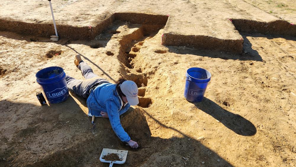
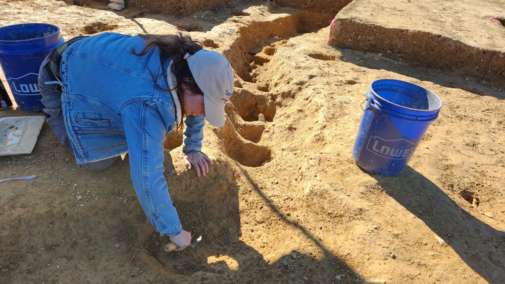
Bill Stevens, Richland County deputy coroner and a forensic anthropologist, is kneeling in the shallow gravesite with his two colleagues, Madeline Atwell and Rachel Baker. Loblolly pines tower overhead, but their spacing allows plenty of sunlight to reach the ground. A few flying bugs run accidentally into human obstacles.
The trio have exposed a cluster of five skeletons, digging delicately through the compact sand several inches beyond the bones that now are elevated atop earthen pedestals. Some of the appendages are intertwined and it’s difficult to determine which arm bone belongs to which individual. The dig looks like a miniature Bryce Canyon, except it wasn’t erosion that caused these formations, but an odd combination of human conflict and a researcher’s tiny spade.
Madeline Atwell, a forensic anthropologist with the Richland County Coroner’s Office, carves out a bone from the remains of a Revolutionary War soldier found at the site of the Battle of Camden on Friday Nov. 4, 2022. Gavin McIntyre/Staff
The coroners already have removed nine sets of remains; this is the last gravesite to receive their meticulous attention. Gently, they insert the small blade between the sand pedestal and the skeleton, dislodging enough material to free the bone. These shallow burial sites have been disturbed over the decades by wild creatures, loggers, wagons, road workers and farmers. It’s remarkable that the skeletal remains are intact.
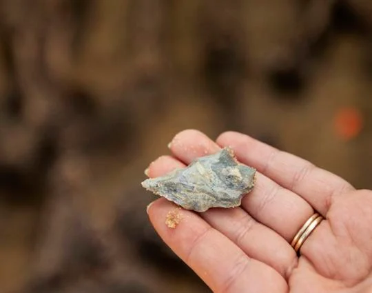
Inside this grave, archaeologists find more than bones. A beautifully made arrowhead, thousands of years old, is lodged in the sand. Several musket balls, the cause of injury and death, are clearly visible. Pewter buttons embossed with “USA” lay among the other objects.
The number of interested spectators is growing. Charles Baxley, chairman of S.C. American Revolution 250th commission has arrived, along with Bonnie Moffat, state regent of the Daughters of the American Revolution. Baxter is overseeing an ambitious project to educate residents and visitors about the war and the founding of the nation. The work here will become an important part of the commission’s narrative, he said.
“These are America’s first veterans, and these veterans were unceremoniously dumped into a hole,” he said.
A Native American arrowhead was among the artifacts found during an archaeological dig at the site of the Battle of Camden on Friday Nov. 4, 2022. The arrowhead likely is thousands of years old. Gavin McIntyre/Staff
Moffat said her organization is arranging to install perhaps 10 historic markers at battlefields across the state in conjunction with the 250th-anniversary celebration. Each marker costs about $4,800, she said. One is planned for Camden.
The S.C. Battleground Preservation Trust has been busy in recent years securing several properties and arranging for public access. It has been partnering with the nonprofit American Battlefield Trust, based in Washington, D.C., to develop the Liberty Trail, a network of Revolutionary War sites in South Carolina. A website, https://www.battlefields.org/learn/maps/liberty-trail, features details about the various historic confrontations and provides maps for those interested in visiting these sites. Now the trust is raising money, as much as $250,000, to help pay for the Camden project and reinterment events, Bostick said.
The reinterment
Battlefield archaeology is a relatively new field of study, Legg said. The first big project took place in 1984-85 at the site of Gen. George Armstrong Custer’s last stand at the Battle of Little Bighorn in Montana. A grass fire ignited by a tossed cigarette had exposed artifacts and inspired scholars to investigate the area, Legg said. They found a lot: spent cartridges, fired bullets, personal items and human remains.
In 1988, Legg and Smith performed excavation work at a Civil War battle site on Folly Island where they discovered, and removed, 19 sets of human remains, including what was left of the Black soldiers of the 55th Massachusetts Regiment who died there. This was one of the first formally organized Black units to fight on behalf of the United States. Legg and Smith arranged for a reburial at the Beaufort National Cemetery. The Camden battlefield now is well-marked with stakes indicating the top of the head and the bottom of the feet of each skeleton exhumed so archaeologists know precisely where the custom pine caskets sealed with hand-wrought nails are to lay, Smith said.
This will be no ordinary reinterment.
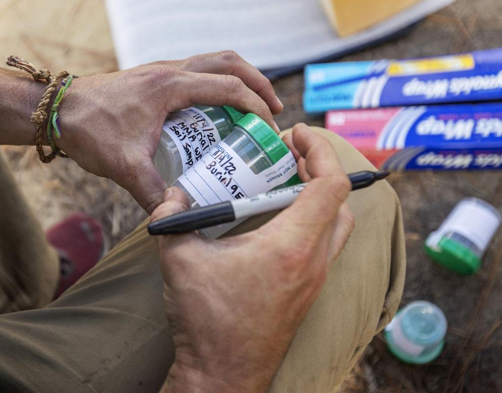
Robert Gibbes, with the South Carolina Department of Natural Resources, marks containers for soil samples during the removal of human remains from a gravesite on the Camden battlefield on Friday Nov. 4, 2022. Gavin McIntyre/Staff
After about five months of study in the lab, the skeletal remains unearthed at the old battlefield will lie in state at the Kershaw-Cornwallis House from April 20 until the morning of April 22, Bostick said. On April 21, reenactors will set up an encampment by the house. An outdoor concert is planned for that evening.
The next morning, participants will process a mile north to Bethesda Presbyterian Church for a joint Anglican-Presbyterian religious service honouring the fallen soldiers. That afternoon, people will gather at the battlefield for a secular ceremony and reburial. Organizers have informed Gov. Henry McMaster of the events, and they have reached out to the state’s congressional delegation and to British officials. Horse-drawn caissons already are reserved.
Bostick said he expects some or all of the events to be live-streamed.
The X-rays and strontium isotope analysis likely will shed light on exactly how these men died, their age at the time of death, and the precise circumstances of their death. The DNA analysis will take a bit longer to complete, perhaps returning results during the summer.
Linsay Mitchell, an intern with the Richland County Coroner’s Office, helps Stacey Ferguson, of the Historic Camden Foundation, on Nov. 4, 2022, sift through dirt from a gravesite where five soldiers killed in the 1780 Battle of Camden were buried. Gavin McIntyre/Staff
The Battle of Camden “is the outstanding symbol of a series of disastrous setbacks suffered by the American side in the South during The War for Independence,” the National Park Service noted on its National Registry of Historic Places nomination form. “These losses, the surrender of Charleston, the wipe-out at Waxhaws, and then Camden, represent the lowest point to which American fortunes sank in that struggle.”
It was a rout that prompted Gates, the commanding officer, to flee along with many of his men, abandoning the now outnumbered Continental regulars to their fate. Their commander, Maj. Gen. Johann de Kalb, was mortally wounded. Congress wanted an inquiry into Gates’ actions, but it never came to pass. Gates was reassigned and Gen. Nathanael Greene assumed command of the Southern forces. It was a consequential change of leadership, a turning point in the war. Over the next two years, Greene and the fighters he commanded succeeded in driving the enemy from the Carolinas and Georgia. On Dec. 14, 1782, the British completed their evacuation of Charleston, boarding ships at Gadsden’s Wharf and sailing off. The war was coming to an end.
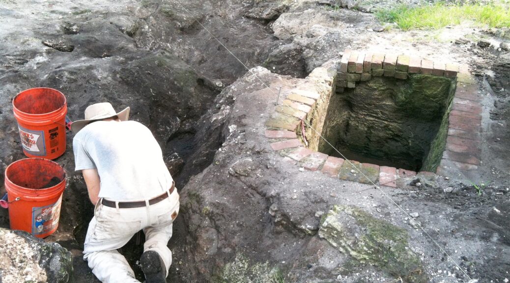
Revolutionary War Prison Camp Found in Pennsylvania
In this photo provided by John Crawmer, Jane C. Skinner and Samantha Muscella excavate post holes at the bottom of a stockade trench, Thursday, Oct. 27, 2022, in York, Pa. Researchers say they have solved a decades-old riddle by finding remnants of the stockade and therefore the site of a prison camp in York, that housed British soldiers for nearly two years during the American Revolutionary War.
Researchers say they solved a decades-old riddle this week by finding remnants of the stockade and therefore the site of a prison camp in York, Pennsylvania, that housed British soldiers for nearly two years during the American Revolutionary War.
The location of Camp Security was thought to have been on land acquired by the local government nearly a decade ago. On Monday, an archaeological team working there located what they believe to be the prison camp’s exterior security fence.
The camp housed more than 1,000 English, Scottish and Canadian privates and noncommissioned officers for 22 months during the war, starting with a group of prisoners who arrived in 1781, four years after their surrender at Saratoga, New York. By the next year, there were some 1,200 men at the camp, along with hundreds of women and children.
In this photo provided by John Crawmer, Jane C. Skinner excavates post holes at the bottom of a stockade trench, Thursday, Oct. 27, 2022, in York, Pa. Researchers say they have solved a decades-old riddle by finding remnants of the stockade and therefore the site of a prison camp in York, that housed British soldiers for nearly two years during the American Revolutionary War.
Fieldwork at the site, which also includes the lower-security Camp Indulgence, has gone on for decades, but the exact spot of Camp Security — where prisoners from the 1781 Battle of Yorktown, Virginia, were kept — had been unknown until a telltale pattern of post holes in a foot-deep trench was uncovered.
“This has been a long project, and to finally see it come to fruition, or at least know you’re not nuts, that’s wonderful,” said Carol Tanzola, who as president of Friends of Camp Security led fundraising for the project.
Lead archaeologist John Crawmer said the location site had been narrowed down after about 28 acres (11 hectares) were ploughed for metal detection and surface collection of artefacts in 2020. That further reduced the search area to about 8 acres (3 hectares), where long exploratory trenches were dug last year.
Those trenches helped the team identify post holes that in turn led to the pattern of holes and a stockade trench that matched stockades at other 18th-century military sites, Crawmer said.
Next spring, Crawmer and other researchers hope to determine the full size of the stockade and perform a focused search for artefacts within and around it.
“Was it circular or square, what’s inside, what’s outside?” Crawmer said. “As we do that, we’re going to start finding those 18th-century artefacts, the trash pits. We’ll be able to start answering questions about where people were sleeping, where they were living, where they were throwing things away, where the privies are.”
Crawmer said there is evidence the vertical posts that formed the security stockade were not in the ground for very long and that they may have been dug up and reused after the camp was closed in 1783.
A contemporaneous account of camp life by a British surgeon’s mate said there was a “camp fever” that might have killed some of the prisoners, and a list of Camp Security inmates was located in the British National Archives. No human remains have been found at the site.
Historians confirmed local lore about the general location of Camp Security and Camp Indulgence after a 1979 archaeological study of a small portion of the property produced buckles, buttons and other items associated with British soldiers of the period. That survey also found 20 coins and 605 straight pins that may have been used by prisoners to make lace.
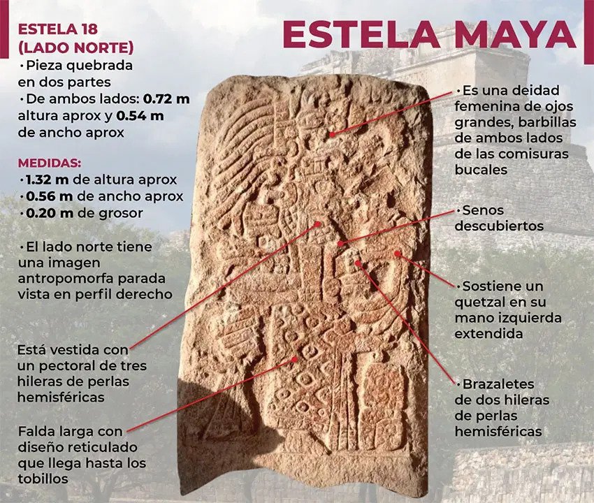
The stela was found in Uxmal, a Maya city founded around A.D. 700.
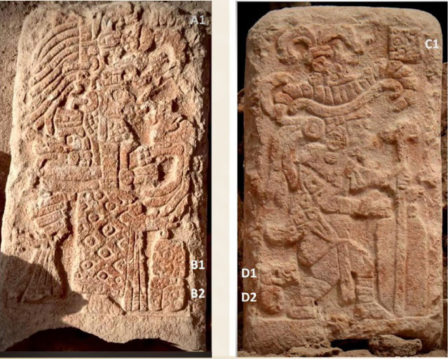
In the archaeological site of Uxmal in the Yucatán peninsula, a Maya stela depicting a god and a goddess has been discovered by a technical team headed by the archaeologist José Huchim Herrera. The monument could represent the duality between life and death.
The director of the National Institute of Anthropology and History INAH, Diego Prieto, announced during AMLO’s Thursday press conference the finding of the Maya stela, which he said “is a commemorative dual stela because it is carved on both sides.”
The north-facing side of the monument features the figure of a goddess with big eyes, a bare chest, and barbels at the corner of the mouth, Prieto said.
The imagery likely represents death, as such depictions were common in the Puuc and Chenes cultural regions in the southern Yucatán peninsula.
The woman depicted is also holding a quetzal bird in her left hand and wears a pectoral decoration with three rows of pearls, bracelets with pearl details and a long skirt.
An INAH graphic highlighting features found on the north-facing side of the stela.
On the south-facing side, Prieto continued, the stela shows the image of a god with a wide-brimmed headdress adorned with feathers and an owl’s head, as well as bracelets, loincloth, and leg bandages.
The man wears a cape and holds a cane in his left hand and a bundle of some kind in his right hand.
The stela was discovered as part of the Program for the Improvement of Archeological Sites (Promeza), which undertakes archaeological projects along the route of the Maya Train.
The director of INAH said that “the importance of the discovery lies in the fact that it was found ‘in situ,’” meaning in the same place the Maya left it: the sunken patio of the ancient city of Uxmal.
Located 62 kilometers south of Mérida, the city of Uxmal is part of the Puuc Route (a collection of five ancient Maya sites in Yucatán) and was founded in A.D. 700.
Uxmal was designated a UNESCO World Heritage Site in 1996.
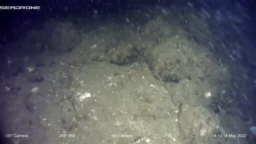
An 11,100-year-old trap proves people lived in Alaska 1,000 years earlier than believed
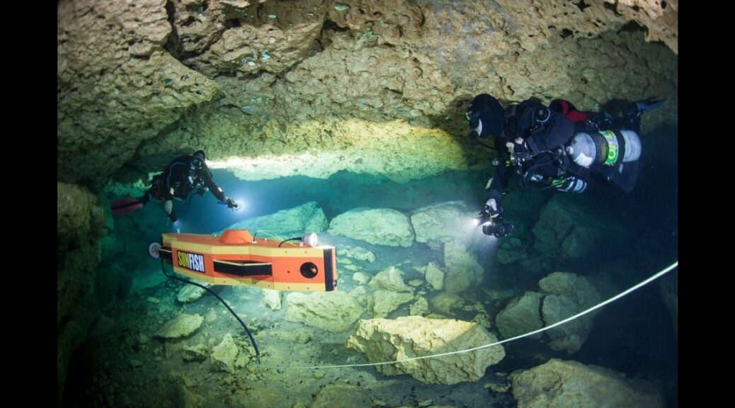
The weir was found as part of a project organized by the Sealaska Heritage Institute and SUNFISH Inc. to explore submerged caves in southeastern Alaska “to seek evidence of early human occupation.” A SUNFISH autonomous underwater vehicle was used in the project. Photo Jill Heinerth, Stone Aerospace
Remains of an elaborate stone fish trap have been discovered on the seafloor off Southeast Alaska, and scientists say it proves Indigenous people occupied the region 1,000 years earlier than previously believed.
Known as a fish weir, the ancient trap dates back about 11,100 years, the Sealaska Heritage Institute reported in a news release. That makes it likely “the oldest stone fish weir ever found in the world … and it is the first one ever confirmed underwater in North America,” scientists said.
It was discovered over the summer as part of a project funded by NOAA Ocean Exploration to search seafloor caves for evidence of early human occupation, according to the release.
The trap sits about 170 feet below the surface of Shakan Bay, on the west side of Prince of Wales Island, officials told McClatchy News. It takes the shape of five to six “semi-circular structures” that are up to 6 feet wide. Time has worn the walls down to about 1 foot in height, the institute said.
“Likely the rocks were piled much higher 11,100 years ago. … People would have maintained the weir seasonally by restacking rocks and adding more rocks and possibly wooden stakes,” the institute said.
Such traps were typically built close to shore, in spots that would have been covered at high tide. However, the change in seafloor levels has left the weir “over 2 km (1.2 miles) from the closest modern shoreline.”
“It further substantiates the great antiquity of Native people in Southeast Alaska,” said anthropologist Rosita Worl of the Sealaska Heritage Institute. “It also demonstrates that Native people had acquired knowledge about salmon behaviour and migrations, then developed the technology to harvest a significant number of salmon.”
[Image: Image from a remotely operated vehicle of semi-circular stacked stones on the seafloor, part of a larger weir (fish trap) complex. Image courtesy of Dr. Kelly Monteleone, Our Submerged Past.]
Sonar evidence of a structure at the site was first recorded in 2010, but “funding constraints” prevented experts from confirming their theories until this year, the institute said. A robotic underwater craft was used to investigate the structure, piloted by archaeologist Kelly Monteleone at the University of Calgary.
She reports “the entire vessel was bouncing with excitement” when it was confirmed to be a weir in May. “It wasn’t just me that was convinced (in 2010), but the burden of proof was on me,” Menteleone told McClatchy News.
“Other archaeologists and locals were extremely supportive based on the sonar. But, as my dissertation advisor taught me, I had to be sure before it became an archaeological site, i.e. before we were ‘sure’ it was actually there. So for the last 12 years, this location has been a ‘potential’ weir.”
Examples of ancient fish weirs have been found around the world, and often employed the use of pile stones, reeds and/or wooden posts, experts say. They were often built as “low arced walls” across coastal gullies. “During high tide, the fish would swim over the stone walls, and as the tide ebbed, the fish would be trapped behind them, allowing fishers to catch them with nets, spears and other means,” the institute says. Other weirs have been found in Southeast Alaska, but the oldest dated to only around 5,740 years ago, the institute reports.
The age of the weir in Shakan Bay was established “based on sea level reconstruction,” officials said. The world believes it is the work of people who had been in the region long enough to develop sophisticated skills. “It would have taken time for our people to learn enough about the environment and fish behaviour to develop the technology to make the weir and to fish it successfully,” she said in the release.
NOAA Ocean Exploration was a primary financial backer of the project, and it reports the team will return to Southeast Alaska next summer to continue exploring submerged caves and rock shelters using a SUNFISH autonomous underwater vehicle.
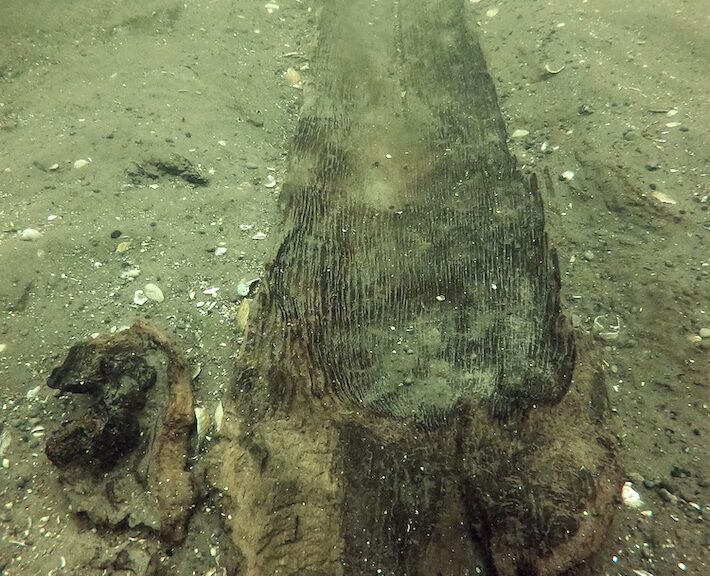
Second Ancient Native American Canoe Discovered in Wisconsin
Wisconsin Historical Society maritime archaeologists, alongside partners from Wisconsin’s Native Nations, recovered a 3,000-year-old dugout canoe from Lake Mendota in Madison today, less than one year after their recovery of a 1,200-year-old canoe that drew international attention in November 2021.
Radiocarbon dating performed on the latest canoe places it in 1000 B.C., making it the oldest ever discovered in the Great Lakes region by roughly 1,000 years.
The 3,000-year-old dugout canoe is carved from a single piece of white oak and measures approximately 14.5 feet in length. It was initially located by Wisconsin Historical Society maritime archaeologist Tamara Thomsen during a recreational dive in May of this year.
Discussions about recovering it from the lakebed began immediately following the discovery, in collaboration with Wisconsin’s Native Nations.
It was found in the same area the first canoe was discovered, suggesting that the location of Lake Mendota’s shoreline may have changed over time and could have once been much lower, according to Dr. James Skibo, Wisconsin Historical Society state archaeologist.
“Finding an additional historically significant canoe in Lake Mendota is truly incredible and unlocks invaluable research and educational opportunities to explore the technological, cultural, and stylistic changes that occurred in dugout canoe design over 3,000 years,” said Skibo.
“Since it was located within 100 yards of where the first canoe was found at the bottom of a drop-off in the lakebed, the find has prompted us to research fluctuating water levels and ancient shorelines to explore the possibility that the canoes were near what is now submerged village sites.”
Although it is likely that water transportation dates back to the arrival of Native peoples in this region, this discovery provides the earliest direct evidence.
The 3,000-year-old canoe helps to tell a complete story of the continuum of Native life in Wisconsin and the Great Lakes region. Members from the Ho-Chunk Nation and Bad River Tribe were present at the canoe recovery.
“The recovery of this canoe built by our ancestors gives further physical proof that Native people have occupied Teejop (Four Lakes) for millennia, that our ancestral lands are here and we had a developed society of transportation, trade and commerce,” said Ho-Chunk President Marlon WhiteEagle.
“Every person that harvested and constructed this caašgegu (white oak) into a canoe put a piece of themselves into it. By preserving this canoe, we are honouring those that came before us. We appreciate our partnership with the Wisconsin Historical Society, working together to preserve part of not only our ancestors’ history but our state’s history.”
Wisconsin Historical Society archaeologists, along with skilled volunteers, conducted the excavation and recovery efforts.
The canoe was hand-excavated in preparation for today’s recovery mission and then securely transported to the State Archive Preservation Facility in Madison for preservation and storage.
It will be cleaned and cared for by Tribal members and Society staff before being hand-lowered into a large preservation vat also containing the 1,200-year-old canoe discovered in 2021. Together the canoes will undergo a two-year preservation process that will conclude with freeze-drying to remove any remaining water.
“I was amazed when a 1,200-year-old canoe was uncovered last year, but this discovery of a canoe dating back to 1000 B.C. is just extraordinary,” said Wisconsin Gov. Tony Evers. “This incredible finding provides an opportunity for us to work in concert with Tribal Nations to not only study but celebrate the history of the Indigenous people who’ve called this land home since long before Wisconsin became a state, and I look forward to learning more about this artefact’s origins.”
Traces of Native American Village Found in Florida
An archaeological bonanza is being unearthed in St. Augustine. This dig is revealing that a Native American village could be bigger — or at least in a different place — than previously imagined.
That same site would later become one of the state’s first commercial orange groves. Some people may be familiar with the site on Bridge Street, where an old blue house stands crumbling and vegetation has taken over.
However, in the last few months, the house has been sold and is being restored.
According to a First Coast News report, St. Augustine city archaeologist Andrea White and her colleagues have found pottery and postholes from Palica, a Native American village, under a nineteenth-century house in St. Augustine’s Lincolnville neighbourhood.
What most people these days don’t see are the archaeologists on the site. They’ve been working in the backyard and even under the house.
“It’s one of the first opportunities any archaeologists have had to work at this location,” said Andrea White, St. Augustine City Archaeologist.
She and St. Augustine Research and Collections Archaeologist Katherine Sims, along with some archaeology volunteers, have been carefully studying the site.
The house restoration and archaeological dig are revealing some surprises. One of those surprises is the mission site of the Native American village called Palica.
“It was only mapped once,” Sims said.
That was in the 1700s.
Later, archaeologists compiled maps and thought Palica was elsewhere in St. Augustine’s Lincolnville neighbourhood.
“When we started this project, we didn’t anticipate finding deposits from Palica on this property,” Sims said. “Once we started work, we immediately realized there is definitely Palica material here! Yes, it was a huge surprise.”
Before the house was built, Native Americans lived here on a Catholic mission site in the early 1700s. Archaeologists have found pottery, but the big find was under the floor of the house where archaeologists found post holes.
Those are basically evidence of a Native American building, and that’s a big deal.
“These all date to Palica,” White said. “We are 100 per cent confident about the age of these. We’re really excited!”
Archaeologists believe the Palica mission was abandoned in the mid-1700s and 50 to 100 years later, the first part of this house was built. It was part of the Yallaha plantation which was one of Florida’s first commercial orange groves.
Some of the original structure is still part of the house. That original portion date to the early 1800s. The house is being restored, but old parts are being salvaged such as roof shingles that are stamped “Florida” on the underside from the 1800s.
Because the house was built a couple of feet above the ground, the house became a protector of the archaeological artefacts on the ground.
“What’s great about a historic structure is that normally people don’t’ go built something under a house, so it helps preserve everything,” White said.
That includes another surprise under the floor. Archaeologists found a donkey burial, estimated to be from the late 1700s before the house was built.
Laid with respect, not just tossed into the ground, it’s easy to think the animal was possibly someone’s hard-working farm animal during the land’s agricultural time period.
And so this house and this land are still relinquishing secrets about a story hundreds of years old.