2,000 Ancient Figurines Unearthed on Greek Island
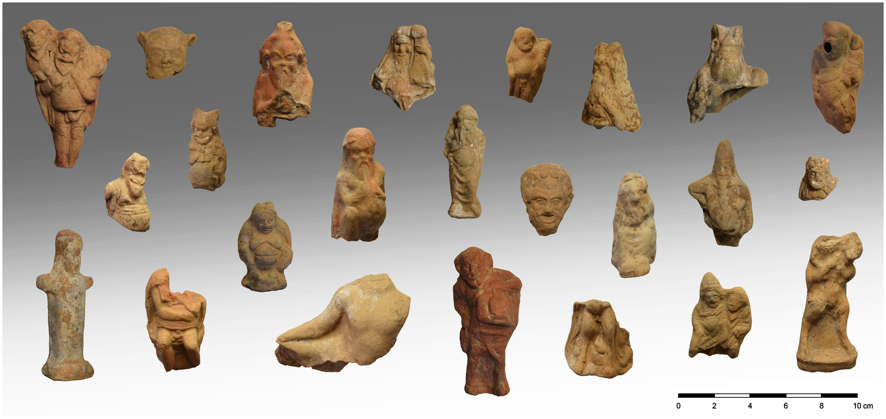
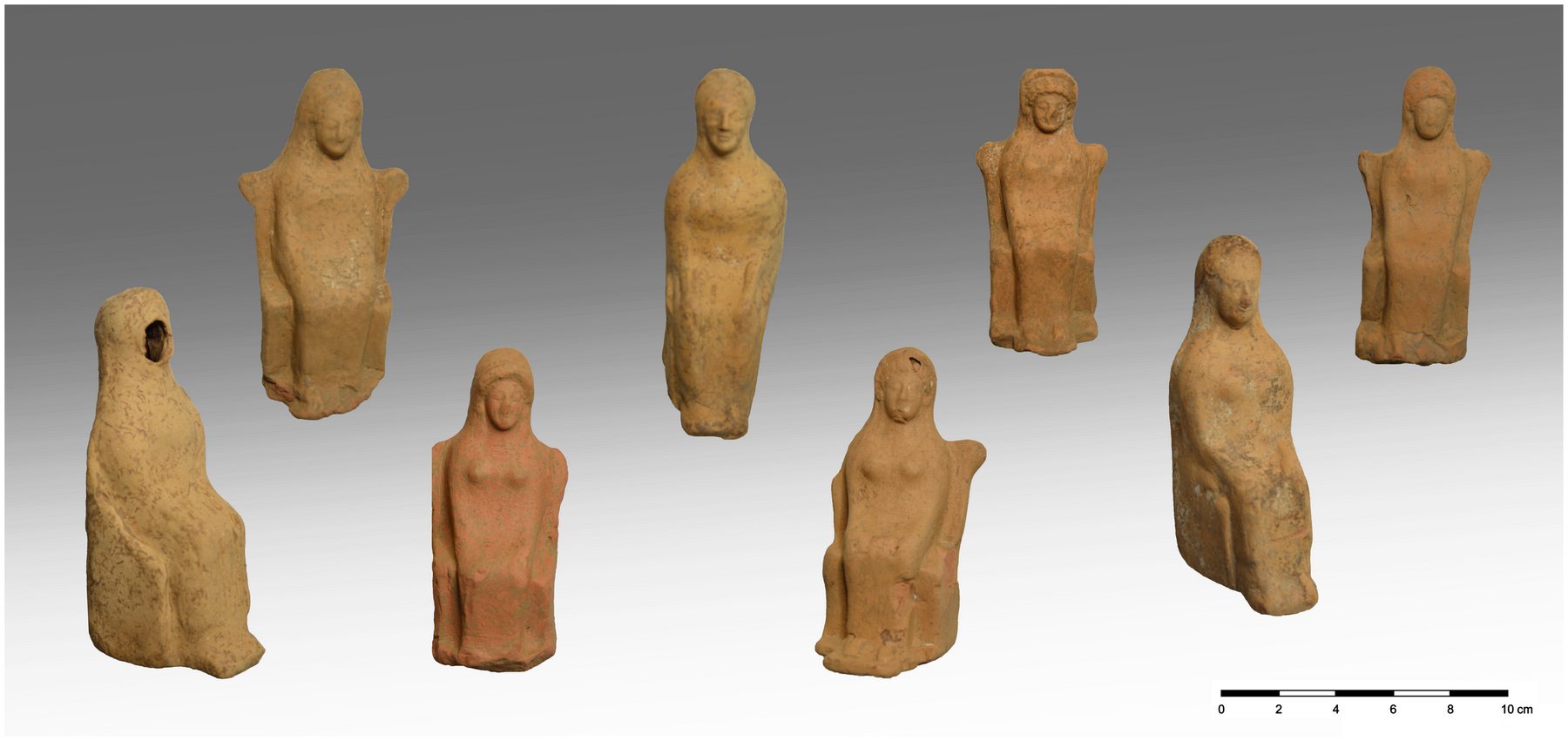
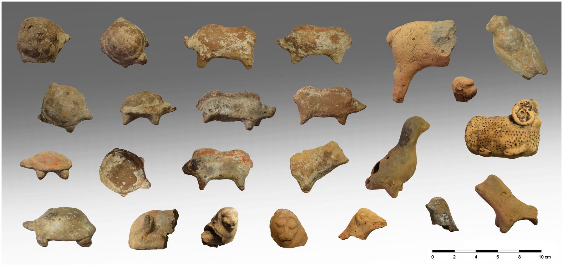
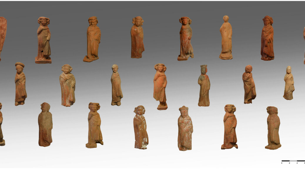
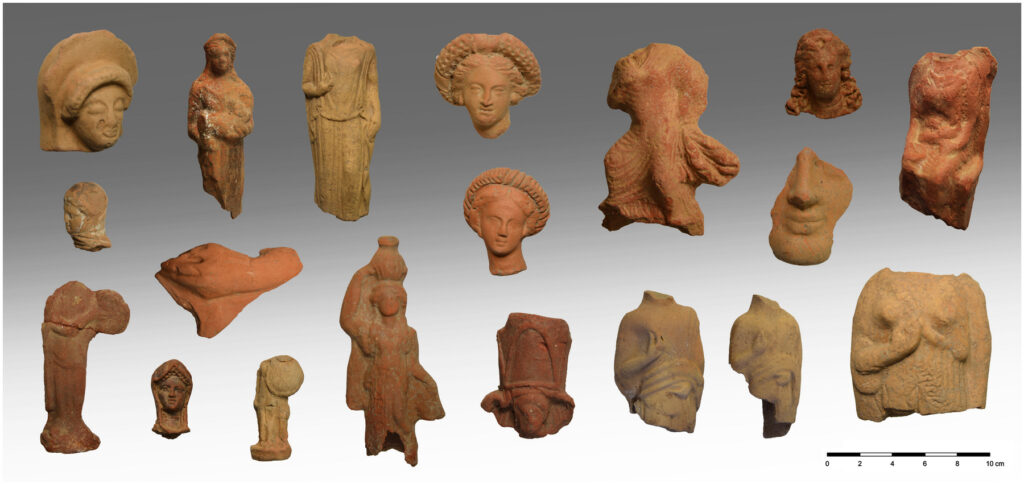
An excavation of the ancient acropolis on the Cycladic island of Kythnos has unearthed more than 2,000 intact votive figurines deposited by worshippers at the sanctuary of Demeter and Persephone over the course of seven centuries.
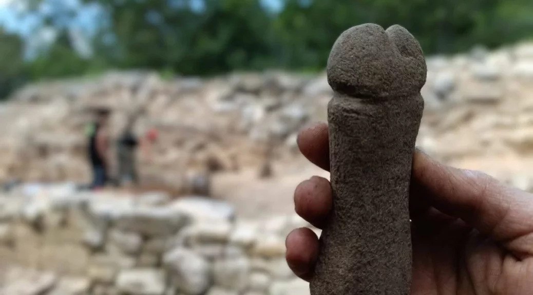
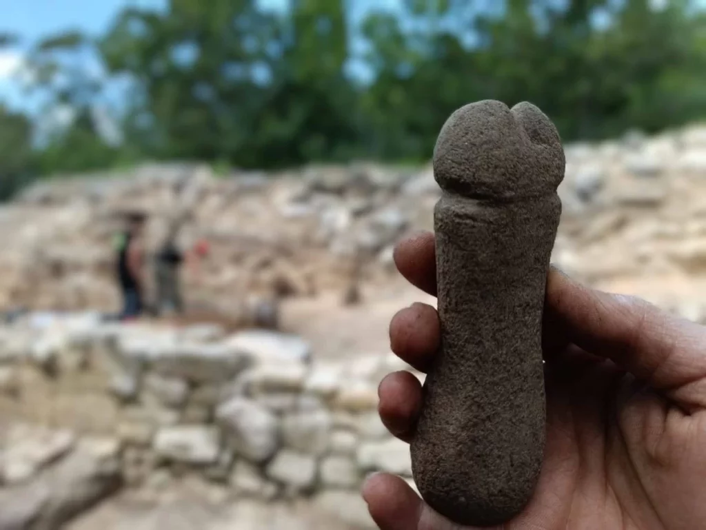
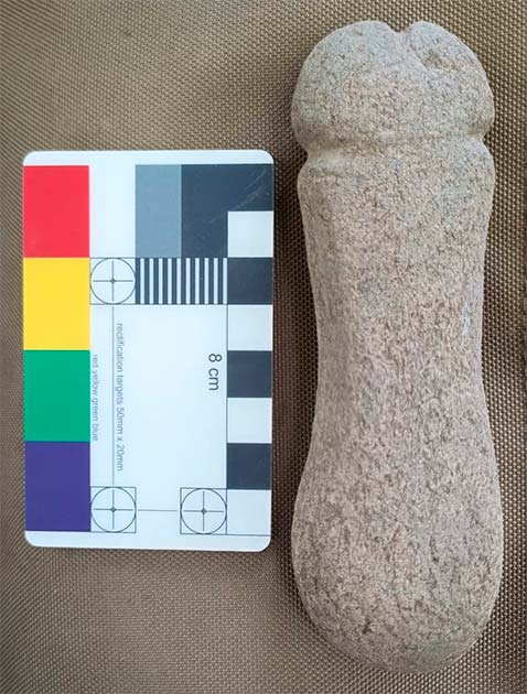
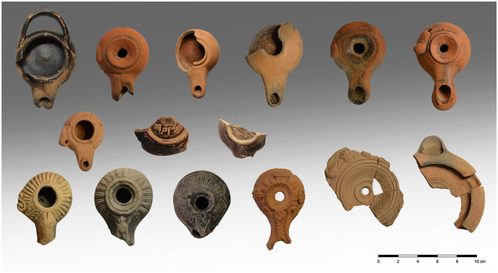
Hundreds of clay figurines of women, children, actors, Dionysian characters, pigs, turtles, lions, rams, birds and many other animals were recovered, as were hundreds of lamps, miniature vases, marble and alabaster vessels, copper, silver bone and glass jewelry.
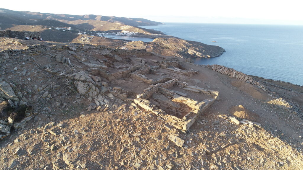
One of the oldest settlements in the Cycladic Islands, the ancient city of Kythnos was continuously inhabited from the 12th century B.C. to the 7th century A.D.
The sanctuary complex was built on the northern part of the plateau overlooking the ocean.
It was constructed in stages, with the earliest building dating to the 7th century B.C.
The temple complex was in active use until the 4th century A.D.
Recent excavations have focused on three buildings (3, 4 and 6). In 2021, votive offerings were found under the last floor of Building 5, but the motherload of votive figurines was discovered in Building 3.
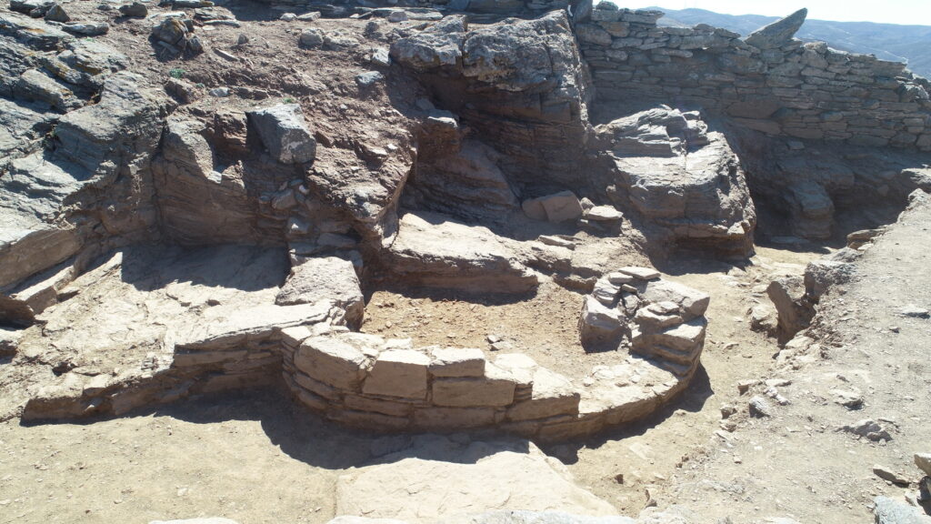
They were concentrated in the abandoned embankments in the eastern side of the building. Natural recesses in the rock walls appear to have been used as niches for votive offerings.
Another concentration was found along the south wall of the western part of the building.
Flat stones projecting off the wall at regular intervals at the same height suggest there was once a long wooden shelf where votive objects were left.
An inscribed monumental slab was found inside the door of Building 3. It had been moved from its original location.
The inscription dates to the late Hellenistic period and is the name of a magistrate, likely an official of the sanctuary itself. Several inscribed drinking vessels and votives were also found referring to the two deities of the sanctuary.
The excavation by Greece’s University of Thessaly and the Culture Ministry also found luxury pottery imported from other parts of Greece, ornate lamps, and fragments of ritual vases used in the worship of Demeter and Persephone at Eleusis, an ancient Athens suburb.
It is unclear to what extent the site on Kythnos was associated with Eleusis — one of the most important religious centers in ancient Greece, where the goddesses were worshipped during secret rites that were only open to initiates forbidden to speak of what they saw. The sanctuary at Eleusis is known to have owned land on the island.