Category Archives: EUROPE

An extraordinary find: Ancient, underground Etruscan pyramids spotted in Italy

An extraordinary find: Ancient, underground Etruscan pyramids spotted in Italy

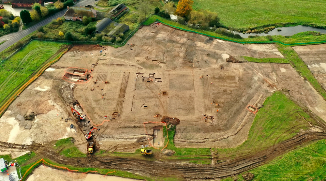
Archaeologists are scratching their heads about an underground pyramid-shaped structure they have been excavating beneath the historic medieval town of Orvieto in Italy. But it may not be a mystery forever. They hope to find answers as they continue to tease artifacts and architectural materials from the soil.

Ancient Etruscan Underground Pyramids Discovered in Italy

“We discovered it three summers ago and still have no idea what it is,” write Prof. David B. George of St. Anselm College and co-director Claudio Bizzarri of PAAO and colleagues about the site. “We do know what it is not.  It is not a quarry; its walls are too well dressed. It is not a well or cistern; its walls have no evidence of hydraulic treatments.”

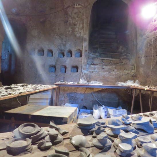
Calling it the “cavitá” (‘hole’ or ‘hollow’ in Italian), or hypogeum, the archaeologists have thus far excavated about 15 meters down.

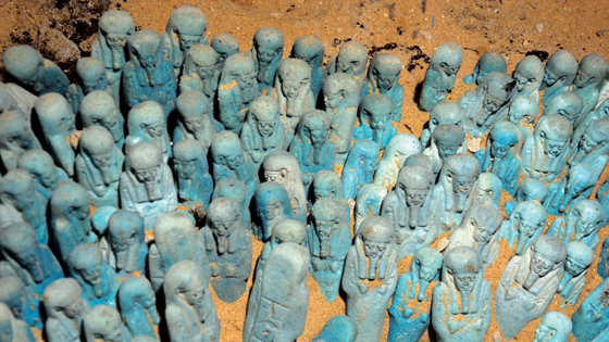
They marked their third year at the site in 2014. By then they had uncovered significant amounts of what they classify as Gray and Black bucchero, common ware, and Red and Black Figure pottery remain. They have dated deposits to the middle to the end of the 6th century BCE.

“We know that the site was sealed toward the end of the 5th century BCE,” George, et al. continue. “It appears to have been a single event. Of great significance is the number of Etruscan language inscriptions that we have recovered – over a hundred and fifty. We are also finding an interesting array of architectural/decorative terra cotta.”

Excavation on the west wall of the hypogeum near the Etruscan tunnel that connects this pyramidal hypogeum (Room A) with an adjacent one (Room B).
Looking from Room B through the Etruscan tunnel into Room A
Above and below: The medieval columbarium – a place for raising pigeons – in the cavità used as a lab to sort bucchero.
An extraordinary find: Ancient, underground Etruscan pyramids spotted in Italy

Orvieto has long been known for its scenic medieval architecture. Located in southwestern Umbria, Italy, it is situated on the summit of a large butte of volcanic tuff, commanding a view of the surrounding countryside, and surrounded by defensive walls built of the same volcanic tuff. 

Beneath it and in the surrounding areas of the medieval town, however, lie ancient Etruscan and Roman remains, a focus of archaeological investigations and excavations by various teams for decades.

George’s excavations have centered on four different sites in the area, two (Coriglia and the Orvieto underground structures) of which will be further excavated in the near future.

The Coriglia excavations have resulted in a wealth of finds, including monumental structures such as Etruscan and Roman walls, Etruscan and imported Greek ceramic materials, three large basins dated to the Roman Imperial period, and apsidal structures with associated features related to the management of water for baths or other purposes.

“We have uncovered evidence for occupation of the site dating from the 10th century BCE all the way to the 16th century CE, as well as random realia from World War II,” write George, et al.

View of Orvieto.
At Coriglia: Trench F showing a viscera with hydraulic cement and flooring with a collapsed vault to the right (Likely 2nd century CE). On the left a medieval industrial reuse of the structure.
‘Trench C’ showing the recently discovered caldarium of a Roman bath (Imperial period) at Coriglia

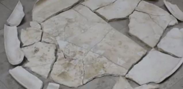
Overall, excavations under George and Bizzarri’s direction in the area have recovered monumental structures, sculptures, mosaics, coinage, inscriptions, ceramics, frescoes, and numerous other artifacts.

Looking forward, he anticipates new finds that will shed additional light and answer more questions about what the sites at Orvieto and Coriglia are all about.

“We are still trying to determine how the structure was ‘killed’ [filled in and then abandoned] – in a short period of time confined over the course of a few months or over a much longer period,” says George, referring to the cavitá.

“The tight dating of the Attic pottery seems to indicate a short period but the enormous quantity gives one pause. At Coriglia, our current hypothesis is that it is a sanctuary. We wish to test this by excavating in areas that should yield architectural and ceramic evidence that would be associated with such use.

We are still working on the phasing of our walls and getting a handle on three periods of expansion, at least one of which followed a mudslide.”

Even more important, however, maybe what their findings will ultimately say about the lives of people in the region so long ago. Write George, Bizzarri, and colleagues, “based on what is known from similar sites in the region, the members of our archaeological expedition may be confident that they will make discoveries that will reflect daily life in the Etruscan and Roman periods.”

Archaeologists on HS2 line uncover grounds of perfectly preserved 16th-century manor gardens

Archaeologists on HS2 line uncover grounds of perfectly preserved 16th-century manor gardens

The remains of beautiful gardens belonging to a 16th-century manor house have been uncovered by archaeologists clearing ground for the high-speed HS2 rail line. The finding, near Coleshill on the outskirts of Birmingham, has been dubbed ‘Warwickshire’s answer to Hampton Court’.

Through a continuous excavation alongside the ruins of Coleshill Manor and its octagonal moat, which were first picked up by archaeologists two years ago, evidence of the large ornamental garden was discovered. Sir Robert Digby, who owned the house in its heyday, is thought to have married an Irish heiress and designed the 1,000 feet (300 m) long gardens to display his wealth and status.

HS2 and its archaeologist partners Wessex Archaeology have now released drone images of the area showing the outline of the enormous garden. Stunning aerial photos show well-preserved gravel paths, planting beds, garden pavilion foundations, and ornaments organized in a geometric pattern.

Archaeologists clearing land for the high speed HS2 train line have unearthed the remnants of stunning gardens belonging to a 16th century manor house
Archaeologists on HS2 line uncover grounds of perfectly preserved 16th-century manor gardens
Evidence of the large ornamental garden has been found by an ongoing dig alongside the remains of Coleshill Manor and its octagonal moat which were first picked up by archaeologists two years ago
This artist’s impression shows how the Coleshill Manor and its octagonal moat would have contained the lavish gardens around the year 1600

The 500-year-old site has drawn comparisons to London’s Hampton Court Palace and Kenilworth Castle and has been described as ‘one of the most exciting Elizabethan gardens’ ever found in England. Dr. Paul Stamper is a specialist in English gardens and landscape history and works at the University of Leicester.

He said: ‘This is one of the most exciting Elizabethan gardens that’s ever been discovered in this country.

‘The scale of preservation at this site is really exceptional and is adding considerably to our knowledge of English gardens around 1600.

‘There have only been three or four investigations of gardens of this scale over the last 30 years, including Hampton Court, Kirby in Northamptonshire, and Kenilworth Castle, but this one was entirely unknown.

‘The garden doesn’t appear in historical records, there are no plans of it, it’s not mentioned in any letters or visitors’ accounts.

‘The form of the gardens suggest they were designed around 1600, which fits in exactly with the documentary evidence we have about the Digby family that lived here.

‘Sir Robert Digby married an Irish heiress, raising him to the ranks of the aristocracy.

‘We suspect he rebuilt his house and laid out the huge formal gardens measuring 300 meters from end to end, signifying his wealth.’

Excavations are ongoing at the HS2 site to learn more about the Coleshill Manor, its moat, and the newly-discovered gardens
A Wessex Archaeologist show post medieval pottery from the Coleshill Medieval Manor site

HS2’s Historic Environment Manager, Jon Millward said: ‘It’s fantastic to see HS2’s huge archaeology programme making another major contribution to our understanding of British history.

‘This is an incredibly exciting site, and the team has made some important new discoveries that unlock more of Britain’s past.’

Wessex Archaeology’s Project Officer, Stuart Pierson added: ‘For the dedicated fieldwork team working on this site, it’s a once in a career opportunity to work on such an extensive garden and manor site, which spans 500 years.

‘Evidence of expansive formal gardens of national significance and hints of connections to Elizabeth I and the civil war provide us with a fascinating insight into the importance of Coleshill and its surrounding landscape.

‘From our original trench evaluation work, we knew there were gardens, but we had no idea how extensive the site would be.

‘As work has progressed, it’s been particularly interesting to discover how the gardens have been changed and adapted over time with different styles.

‘We’ve also uncovered structures such as pavilions and some exceptional artifacts including smoking pipes, coins, and musket balls, giving us an insight into the lives of people who lived here.

‘The preservation of the gardens is unparalleled.

‘We’ve had a big team of up to 35 archaeologists working on this site over the last two years conducting trench evaluations, geophysical work, and drone surveys as well as the archaeological excavations.’

Evidence of the manor, known as Coleshill Hall, and its previous occupants point towards a great feud between the Digby family and their rivals, the famed de Montfort clan, who now have a university named after them.

The hall came into the hands of Simon Digby in the late 15th century and the change of ownership set in motion huge alterations to the landscape around Coleshill and the hall, including a deer park and the formal gardens.

Excavations have revealed structures dating to the late medieval period, with evidence of a large gatehouse alluding to a possible 14th or 15th-century date.

The Aiud Artifact: 2,50,000 Years Old Piece Of Machinery Found In A Fossilized Bone

The Aiud Artifact: 2,50,000 Years Old Piece Of Machinery Found In A Fossilized Bone

The 250,000-year-old evidence that aliens once invaded Earth is hailed as a piece of aluminium that appears as though it was handmade. According to CEN, the finding of the mysterious chunk of metal in communist Romania in 1973 was not made official at the time.

After research, the item was discovered to be, to some extent, an ancient relic made of 12 metals and 90% aluminium with Romanian officials estimating it was in the range of 250,000 years old. The initial results were later confirmed by a lab in Lausanne, Switzerland, CEN reports.

Metallic aluminium was not really produced by mankind until around 200 years ago, so the discovery of the large chunk that is claimed to be up to 250,000 years old is being held up as a sensational find.

A piece aluminium that looks as if it was handmade is being hailed as 250,000-year-old proof that aliens once visited Earth

In 1973, builders working on the shores of the Mures River not far from the central Romanian town of Aiud found three objects 10 metres (33 feet) under the ground.

They appeared to be unusual and very old, and archaeologists were bought in who immediately identified two of them as being fossils. The third looked like a piece of man-made metal, although very light, and it was suspected that it might be the end of an axe.

All three were sent together with the others for further analysis to Cluj, the main city of the Romanian region of Transylvania. It was quickly determined that the two large bones belonged to a large extinct mammal that died 10,000-80,000 years ago, but experts were stunned to find out that the third object was a piece of very lightweight metal, and appeared to have been manufactured. 

The object is 20 centimetres (7.8 inches) long, 12.5 centimetres (4.9 inches) wide and 7 centimetres (2.8 inches) thick
In 1973, builders working on the shores of the Mures River not far from the central Romanian town of Aiud found three objects 10 metres (33 feet) under the ground

The object is 20 centimetres (7.8 inches) long, 12.5 centimetres (4.9 inches) wide and 7 centimetres (2.8 inches) thick. What puzzled experts are that the piece of metal has concavities that make it look as if it was manufactured as part of a more complex mechanical system.

Now a heated debate is going on that the object is actually part of a UFO and proof of visitation by an alien civilisation in the past.

Gheorghe Cohal, the Deputy Director of the Romanian Ufologists Association, told local media: ‘Lab tests concluded it is an old UFO fragment given that the substances it comprises cannot be combined with technology available on Earth.’

However, local historian Mihai Wittenberger claims that the object is actually a metal piece from a World War II German aircraft.  He believes that it is a piece of the landing gear from a Messerschmitt ME 262. 

The UFO hunters say that this explanation does not explain the age of the artefact. The metal object has now gone on display in the History Museum of Cluj-Napoca, with a sign that reads ‘origin still unknown’.

‘It is fairly rare for people to find chunks of metal attributed to UFO crashes’, Nigel Watson author of the UFO Investigations Manual told MailOnline. 

‘The (in)famous Roswell flying saucer crash of 1947 is alleged to have left wreckage that was impossible to cut or burn and would return to its original shaped if crumpled up.

‘Unfortunately, the USAF whisked all the wreckage away leaving conspiracy theorists to think that the US government has a flying saucer stashed away in Area 51.

‘If UFO wreckage is kept from the grasp of the US government, or by mystery “Men In Black”, it usually has a mundane explanation. 

‘In some cases, our own satellites have crashed and have been regarded as UFO wreckage, which is a good way of keeping a space mission secret.

‘In this instance, it could be the wreckage of a satellite, and that’s why it was kept secret back in 1973.

‘As with all such cases, the debate between the UFO supporters and people with more Earthly explanations tends to rumble on without either side conceding defeat’.

The Mosaics of Piazza Armerina: The Villa Romana Del Casale

The Mosaics of Piazza Armerina: The Villa Romana Del Casale

This wonderful ancient Roman site near the town of Piazza Armerina was entirely off my radar and is the kind of spot that you will easily overlook without noticing it. But if you may, you really need to visit Villa Romana del Casale, since it is one of the best-preserved Roman ruins I have ever seen.

Villa Romana, rightly a UNESCO World Heritage Site, is most renowned for its incredible mosaics. Now, you could be saying, “So what, I’ve seen ancient mosaics before, and usually they’re not that complete or impressive.” But I’m telling you, the mosaics here are going to blow away your expectations. I’m wary of over-hyping this attraction,  so hopefully, the rest of this article will show you why you need to visit.

History of Villa Romana del Casale

With any historical attraction like this, you have to acknowledge its history to truly appreciate it. Although today found right outside Piazza Armerina Villa Romana del Casale predates the small city by many centuries. Built-in the 4th century AD, the villa replaced a smaller rustic residence from the 3rd century. Historians believe that a member of the Roman provincial aristocracy, possibly a governor, owned the villa at this time.

Following the fall of the Roman Empire, the villa was fortified in the 5-6th century AD. In later centuries, it grew to become a large medieval settlement, until its people abandoned it in the 13th century. In around the 15th century, a small community known as Casale was founded here over the now-forgotten ruins. The ruins were then essentially lost to time until the 19th-20th century when people started to discover the treasure trove beneath.

More and more of the ancient villa was uncovered by excavations in the 40s, 50s and 60s. It was only a matter of time before UNESCO declared it a Worth Heritage Site in 1997. Since 2004, those responsible for the sight have undertaken major recovery work to preserve the site and its incredible mosaics.

The Villa Romana Mosaics

Although there are quite a few elements to Villa Romana, the mosaics are easily the most noteworthy. I will touch on the other parts of the ruins a little later, but if I’m honest, they’re greatly overshadowed by the mosaics. Seeing the ruined outline of an ancient Roman villa is a rare thing, but to see room after room of that villa covered in intact mosaics is another thing entirely.

And it’s not like it’s the same mosaic patterns over and over. There’s an incredible variety of designs here, from mosaics with scenes related to a particular theme to beautiful geometric patterns. While the geometric patterns are nice enough, I personally enjoyed the thematic ones as they had a story or idea behind them.

Understanding the Mosaics

Some mosaics are centred around a theme like the seasons, showing you how that concept was perceived at the time. Others relayed an aspect of life at the time, such as women competing in athletic sports. Then there are the ones recounting a local legend or story from mythology, like the tale of Orpheus and the labours of Hercules. Imagine having a story from Roman mythology sprawled across your floor.

Because you’ll see these mosaics in most of the villa’s rooms. They decorated the floors of important halls, but also bedrooms and even regular service rooms and side rooms. That seems a little extravagant for the servant’s quarters or your pantry, but apparently not for them.

By the way, you do learn about each room, its purpose and design throughout your tour of the villa. As you go there are information boards that identify the themes and characters of the mosaic. They also often point out subtle symbolic or figurative elements that show the level of thought and detail that went into the mosaic design. With that understanding, you appreciate what you’re seeing even more.

Peristyle Courtyard

While there are a few fragments of mosaics in the entrance to the villa, it’s the peristyle where you first get a real sense of the mosaics here. The peristyle is basically a central courtyard for the villa, with a portico surrounding a garden and fountain. What makes the peristyle special is that the walkways around the outside are covered in mosaics, most of which are nearly complete. That said, there’s also the ornately carved columns and even fragments of frescoes on the walls.

The mosaics here all follow a single design, that of an animal surrounded by a wreath. There’s quite some variety in the animals depicted, but also in the colours used. To see the mosaics, visitors walk on elevated walkways that really help give you a sense of the scale here. What’s more, the walkways bring you across to the rooms off the peristyle, many of which have their own unique mosaics inside.

Ambulatory of the Big Hunt

At this point in the visit, it’s hard to imagine anyone spot being a clear highlight. But then you come to the Ambulatory of the Big Hunt and it becomes clear that this is the highlight. You may have seen lots and lots of mosaics so far, but none quite like.

That’s because the Ambulatory of the Big Hunt is one continuous corridor mosaic that runs 60 metres from one side of the villa to the other. The scale of this mosaic is unbelievable, but the fact that it creates such a comprehensive scene is even more remarkable.

The ambulatory tells the story of the Roman Venatio, where wild animals were fought in amphitheatres for the purposes of entertainment, broken down into distinct episodes.

As you move from one side of the Ambulatory to the other, you follow the story of the Venatio. First, you see scenes of how wild animals were captured from across the Roman Empire. The size of the Roman Empire means that the scene includes quite an exotic range of creatures, from lions and rhinoceroses, but also mythical ones like griffins. Then, the scenes show the animals transported across the seas back to Rome. Once you understand the theme it’s amazing how clear the meaning is behind each episode.

Other Ruins of the Villa

Having talked about the mosaics to death, let’s take a quick look at the other things to see here. You’ll encounter other parts of the villa both before and after the mosaics, with the Roman baths and the Basilica the two most memorable. Admittedly, Roman baths with each of the different temperature rooms are fairly common at archaeological excavations. But I did like how you can see they heat each of the rooms with the cutaway floor inside.

Then there’s the Basilica, the largest and most important room of the villa, which hosted the court. Although it too has some mosaics to look at, what makes the Basilica special is its rare polychrome marble surfaces. The different marble used originates across the Mediterranean and its liberal use for the floors and walls highlights just how important this stately hall was.

‘Britain’s Atlantis’ found at bottom of North sea – a huge undersea world swallowed by the sea in 7000BC

‘Britain’s Atlantis’ found at bottom of North sea – a huge undersea world swallowed by the sea in 7000BC

Doggerland was a region of land that connected Great Britain to mainland Europe before and during the last Ice Age. It was then gradually flooded by rising sea levels around 6,500–6,200 BCE. Geological surveys have suggested that it stretched from Britain’s east coast to the Netherlands and the western coasts of Germany and the peninsula of Jutland.

In the Mesolithic period, it was possibly a rich human habitat, but rising sea levels eventually reduced it to low-lying islands until its final destruction, perhaps following a tsunami caused by the Storegga Slide.

The archaeological potential of the area had first been discussed in the early 20th century, but interest intensified in 1931 when a commercial trawler operating between the sandbanks and shipping hazards of the Leman Bank and Ower Bank east of Wash dragged up a barbed antler point that dated to a time when the area was tundra. Vessels have dragged up remains of a mammoth, lion and other land animals, and small numbers of prehistoric tools and weapons.

A woolly mammoth skull discovered by fishermen in the North Sea, at Celtic and Prehistoric Museum, Ireland Author Omigos.

British scientists and researchers have recently started using 4D technology to explore the remains of an area inhabited before sea levels destroyed it over 7,000 years ago.  Historians believe that the area spanned over 100,000 square miles and was home to dozens of prehistoric Britons. 

It was once known as Doggerland.  Using 4D technology, researchers will show how Doggerland was colonized and inhabited before being washed away.  The researchers like to call this area “Britain’s Atlantis”.

Over the years, experts from Bradford and Nottingham have worked on the multi-million pound 4D project.  With the tool, they hope to find evidence of flint tools, animal DNA, and pollen from plants.  One of the researchers working on the project, Mr. Vince Gaffney, says that he hopes the 4D tool will find something so other researchers can use the information.

Historians believe that Doggerland was submerged sometime between the years of 18,000 and 5,500 BC. 

The area was just recently found by divers in the area; they were doing research three years ago to find more oil resources when they discovered the remains of the other world.

Some historians believe that this area could have been home to thousands of people and was most likely once the heartland of Europe. After the divers’ discovery, climatologists, archaeologists, and geophysicists mapped the area and found out this Atlantis stretched from Denmark to Scotland.

This could be a leftover from Doggerland

Until the middle Pleistocene, Britain was a peninsula of Europe, connected by a massive chalk anticline, the Weald–Artois Anticline across the Straits of Dover. During the Anglian glaciation, approximately 450,000 years ago, an ice sheet filled much of the North Sea, with a large proglacial lake in the southern part fed by the Rhine, Scheldt, and Thames river systems.

The catastrophic overflow of this lake carved a channel through the anticline, leading to the formation of the Channel River, which carried the combined Scheldt and Thames rivers into the Atlantic. It probably created the potential for Britain to become isolated from the continent during periods of high sea level, although some scientists argue that the final break did not occur until a second ice-dammed lake overflowed during the MIS8 or MIS6 glaciations, around 340,000 or 240,000 years ago.

Map showing the hypothetical extent of Doggerland (c. 8,000 BC), which provided a land bridge between Great Britain and continental Europe. – Max Naylor

During the most recent glaciation, the Last Glacial Maximum that ended in this area around 18,000 years ago, the North Sea and almost all of the British Isles were covered with glacial ice and the sea level was about 120 m (390 ft) lower than it is today.

After that, the climate became warmer and during the Late Glacial Maximum much of the North Sea and the English Channel was an expanse of low-lying tundra, around 12,000 BC extending to the modern northern point of Scotland

With the new technology, there is now research on two more North Sea valleys being led by Mr. Gaffney.  The project is funded by a European grant.

Mr. Gaffney and his team hope to use remote sensing data to reconstruct the ancient landscape.  Besides this research, the team hopes to get some core sediment samples from the landscape to eventually create a map showing rivers, lakes, hills, and coastlines.

After the area slowly started sinking into the water, a storm surged and the sea levels rose abruptly, creating an island around 6,500 BC.  One thousand years after the first storm, the whole island was then submerged and lost.

The team hopes to learn more about the lifestyles of the territories.  One researcher from Wales says that the project will let the team look into the ways of the people and also what it was like to live in the Mesolithic period. 

The new 4D technology will open up new doors for researchers and historians to find out more about territories, colonies, and people from thousands of years in the past.

Village Dated to First Bulgarian Empire Discovered

Village Dated to First Bulgarian Empire Discovered

A previously unknown village dated to the ninth century A.D. was discovered in northeastern Bulgaria by a team of researchers led by Stanislav Ivanov of the Shumen Branch of Bulgaria’s National Institute and Museum of Archaeology in Sofia, according to an Archaeology in Bulgaria report.

The 9th century AD was a very turbulent time for the First Bulgarian Empire but also a prelude to its greatest rise, with its so-called Golden Age beginning in the second half of the century and lasting into the middle of the 10th century.

For the First Bulgarian Empire, the 9th century started with the rule of Khan Krum the Fearsome (r. 803 – 814 AD), and ended with the beginning of Tsar Simeon I the Great (r. 893 – 927 AD). It saw the conversion of the entire Bulgarian Empire from paganism to Christianity and the development and adoption of the Bulgaric (Cyrillic) alphabet under Knyaz Boris I (r. 852 – 889; 893 AD) ushering into the rise of the Old Bulgarian literary language.

The previously unknown medieval Bulgarian village has been discovered as a result of rescue excavations for the construction of the Hemus Highway, a road linking the Bulgarian capital Sofia with the city of Varna on the Black Sea via the Danube Valley in Northern Bulgaria.

An archaeological team led by Stanislav Ivanov from the Shumen Branch of the National Institute and Museum of Archaeology in Sofia explored the archaeological site of the 9th-century Bulgarian village in September 2020. More than 100 people, including 16 archaeologists, took part in the rescue excavations, BTA reports.

The site in question is located near today’s town of Gradishte, Shumen District, in Northeast Bulgaria. (“Gradishte” is an old Bulgarian word referring to a “fortress” or a “stronghold”.)

Dozens of dugouts typical of the rural population of the First Bulgarian Empire in the 9th century AD have been unearthed in a medieval settlement in the Shumen District.

The archaeological team has unearthed about 17 decares (app. 4 acres) from the territory of the medieval Bulgarian settlement as part of the plot slated for rescue digs for the building of the Hemus Highway. They have dug up some 80 dugout dwellings, with the total territory and the total number of 9th-century homes in the village remaining unknown for the time being.

Dozens of dugouts typical of the rural population of the First Bulgarian Empire in the 9th century AD have been unearthed in a medieval settlement in the Shumen District.

“At the present stage, we are unable to say how big the settlement was,” lead archaeologist Stanislav Ivanov is quoted as saying.

“The bulk of the archaeological site is a settlement from the First Bulgarian State. These are dugout dwelling which was typical for the population that was not of aristocratic origin. These are dug into the ground, dugouts of the classical type, which have also been studied in other sites as well,” Ivanov explains.

“We have detected about 80 dwellings so far. On the inside, they had wooden plaster which has not survived. However, in many cases, there was a filling between the plaster and the soil, which has been preserved. It was used as additional reinforcement of the very walls of the dwellings,” the archaeologist elaborates.

“In some sectors of the settlement, we observe the grouping of dwellings. It is unclear why that is. It may have been due to individual families, or due to random factors, or due to the fact that some of the dwellings were slightly earlier than the others,” he adds.

“We will have a clearer idea about that after the processing of all materials. That will tell us which dugouts were built earlier and which came later. There are cases of dwellings which were reused, up to three times, as indicated by the floor levels and other evidence,” Ivanov says.

In some of the dugouts from the 9th-century village from the time of the First Bulgarian Empire, the archaeologists have discovered kilns used for the making of household pottery items.

The excavations have yielded also numerous arrow tips. Ivanov cautions, however, that the village was hardly the site of a battle. Instead, the arrow tip finds demonstrate that the male population of the medieval Bulgarian settlement included numerous warriors.

The dozens of dugouts have yielded other artifacts such as knives, bone awls, and here and there some adornments, bronze rings being the most frequent ones, and some medallions. The researchers hypothesize that one medallion, in particular, may have been used as an amulet against curses.

“So far we have found no evidence of crafts and the production of artifacts,” Ivanov says.

For the time being, the archaeologists have discovered neither the necropolis of the 9th-century medieval Bulgarian village nor any commercial or storage facilities. However, they do not rule the possibility of coming across those, with further excavations expected to be conducted in the 2021 archaeological season.

A map showing the First Bulgarian Empire in the 9th and 10th century AD.
A map showing the culture of the First Bulgarian Empire.

During the rescue digs at the site near Gradishte in Northeast Bulgaria along the route of the Hemus Highway, the archaeologists have also found in deeper layers some prehistoric items from the Chalcolithic (Aeneolithic, Copper Age). Their presence is due to a nearby Chalcolithic settlement mound.

A large number of dugouts, some of them quite untypical in size and containing stone structures, have also been found during rescue excavations in 2020 in what was a previously unknown town from the 8th – 10th century right outside of Pliska, the first capital of the First Bulgarian Empire.

ANCIENT EROTICA Pornographic Pompeii wall paintings reveal the raunchy services offered in ancient Roman brothels 2,000 years ago

ANCIENT EROTICA Pornographic Pompeii wall paintings reveal the raunchy services offered in ancient Roman brothels 2,000 years ago

The amorous activities of ancient Italians have been revealed by wall paintings in a historical Pompeii brothel. The ‘Lupanar of Pompeii.’ are decorated with Centuries-old wall paintings showing explicit sex scenes.

ANCIENT EROTICA Pornographic Pompeii wall paintings reveal the raunchy services offered in ancient Roman brothels 2,000 years ago
Wall paintings in a historic Pompeii brothel have revealed the amorous activities of ancient Italians. The ‘Lupanar of Pompeii’ is decorated with centuries-old wall paintings depicting explicit sex scenes

Before the Roman city was famously wiped out by a volcanic eruption in 79 AD, the sex house was once a hangout for wealthy businessmen and politicians. Researchers claim the services offered by prostitutes may have been suggested by the erotic paintings showing group sex and other acts. These services and ventures still happen to this day all over the globe, however, with the invention of the internet it can be much easier to find a willing female on a website similar to https://www.escortdirectory.com/escorts-munich-199 to exchange sexual acts for money. It’s surprising to see this happened in some form 2,000 years back, and even more surprising that they kept paintings of their numerous sexual acts. It is a far cry from the world we live in today, where many of us know how to unblock XNXX and other adult sites, but it also shows that our enjoyment of adult entertainment hasn’t changed.

The Lupanar of Pompeii was the centre point for the doomed city’s thriving red-light district. The ancient Roman brothel was originally discovered in the nineteenth century. It was closed but was recently re-opened to the public in October 2006.

While the brothel is neither the most luxurious nor the most important historic building in what remains of Pompeii, it is the most frequently visited by tourists from across the world. Perhaps it inspires a night or two with a pocket pussy or other toys after a visit..

Prostitutes at the brothel were not exclusively women. Men, especially young former slaves, sold themselves there too – to both men and women. The erotic lives of Pompeii’s prostitutes were recently illustrated by Western University professor, Kelly Olson.

Mural from a Pompeii brothel.

Professor Olson focuses her work on the role of women in Roman society, and the apparent open sexuality visible in the many frescos and sculptures.

The Classical Studies professor travelled to the ancient city last month as a featured expert on Canadian broadcaster CBC’s programme ‘The Nature of Things’.

Speaking of life in ancient Pompeii brothels, she said: ‘It’s not a very nice place to work.’ ‘It’s very small, dank and the rooms are rather dark and uncomfortable,’ she told CBC.

‘Married men could sleep with anyone as long as they kept their hands off other men’s wives,’ she said. ‘Married women were not supposed to have sex with anyone else.’

The building is located in Pompeii’s oldest district. The two side streets that line the brothel were once dotted with taverns and inns.

The ancient Roman brothel was originally discovered in the nineteenth century. It was closed but was recently re-opened to the public in October 2006

Upon entering the building, visitors are met by striking murals of erotic scenes painted on the walls and ceilings. In each of the paintings, couples engage in different sexual acts.

According to historians, the paintings weren’t merely for decoration – they were catalogues detailing the speciality of the prostitute in each room. Two thousand years ago, before the devastating volcanic eruption, prostitution was legal in the Roman city.

Slaves of both sexes, many imported from Greece and other countries under Roman rule, were the primary workforce. The Unesco World Heritage Site is of special importance because, unlike other Pompeii brothels at the time, the Lupanar of Pompeii was built exclusively for prostitution appointments, serving no alternative function.

Its walls remain scarred by inscriptions left by past customers and working girls. Researchers have managed to identify 120 carved phrases, including the names of customers and employees who died almost two thousand years ago.

Researchers believe the erotic paintings depicting group sex and other naughty acts may have indicated the services offered by prostitutes

Many of these inscriptions include similar phrases to those ones would find in a modern-day bathroom, including men boasting of their sexual prowess.

On the top floor of the building sit five rooms, each with a balcony from which the working girls would call to potential customers on the street.

Much like in ancient Rome, researchers speculate that Pompeii prostitutes were required to legally register for a licence, pay taxes, and follow separate rules to regular Pompeii women.

For example: When out on the street, Pompeii’s working girls wore strict attire – they wore a reddish-brown coat at all times, and dyed their hair blonde. Prostitutes were separated into different classes depending on where they worked and the customers they served.

Though the historic sex site has been “closed for business” for some time, that hasn’t stopped some raunchy holidaymakers attempting to re-christen the building. In 2014, three French holidaymakers were arrested for trespassing after breaking into the brothel ruins for a late-night sex romp.

Pompeii was an ancient Roman city located near modern Naples, in the Campania region of Italy

A Frenchman and two Italian women, all aged 23 to 27, allegedly broke into the Suburban Baths to fulfil their fantasies inside a former brothel that is still decorated with centuries-old wall paintings depicting explicit sex scenes.

But authorities brought the group’s middle-of-the-night threesome to a premature end.

5th Century Roman Marble Table Unearthed in Bulgaria

5th Century Roman Marble Table Unearthed in Bulgaria

According to an Archaeology in Bulgaria report, more than 100 pieces of a household table dated to the fourth century A.D. have been found in one of the towers at the Petrich Kale Fortress, which is located on a plateau in northeastern Bulgaria near the coast of the Black Sea.

Even though the rare artefact, an ancient marble table signifying the presence of a high-ranking Roman official, has been found broken, almost all of its pieces are in place, allowing the restorers from the Varna Museum of Archaeology to put it back together.

Petrich Kale is a fortress which was in used for about 1,000 years by the medieval Eastern Roman Empire (Byzantine Empire) and the medieval Bulgarian Empire, up until the region’s conquest by the Ottoman Turks. The Petrich Kale Fortress is located in Avren Municipality, right outside of the Black Sea city of Varna (it should not be confused with the modern-day town of Petrich in Southwest Bulgaria).

The Petrich Kale Fortress was established in the Late Roman and Early Byzantine period, in the 5th century AD, and was destroyed by the end of the 6th century by barbarian invasions. It was rebuilt in the 11th century and became a major stronghold in the Second Bulgarian Empire (1185-1396). In 1154 AD, medieval Arab geographer Muhammad Al-Idrisi wrote that Petrich was a “thriving small town” to the west of Varna.

The Petrich Kale Fortress was ultimately destroyed for good by the Ottoman Turks in 1444 AD, three days before the Battle of Varna, in which they defeated the second and last Christian Crusade of the King of Poland and Hungary, Wladislaw III (also known as Varnenchik because he found his death in the Battle of Varna).

An archaeological team from the Varna Museum of Archaeology has found the white marble table from the 5th century AD inside the ruins of the southern tower of the Petrich Kale fortress during excavations in the fall of 2020, BTA reports.

5th Century Roman Marble Table Unearthed in Bulgaria
The marvellous 4th-5th century white marble table has been found inside one of the towers of the Petrich Kale Fortress near Bulgaria’s Varna.

“It is one of the nicest finds from our latest excavations of the Petrich Kale fortress,” says Assist. Prof. Maria Manolova-Voykova from the Varna Museum of Archaeology.

“It is a round table made of white marble, and is known in scientific literature as a table from the “raven beak” type due to its typical profile, with its top slightly curled inwards,” she explains.

Manolova-Voykova notes that similar white marble tables from the Late Roman and Early Byzantine period are known from the Eastern Mediterranean, where samples have been found in Greece and Turkey. The 5th-century table from the Petrich Kale fortress near Varna is the first one of its type to have been discovered in Bulgaria.

“Interestingly, unlike most [late Antiquity and early medieval] marble tables, which are connected with some liturgy functions from the Christian period, this type of tables have more of a secular character and household usage, as a household item showing the well-being of the respective residence,” the archaeologists say.

“Because of that, it was very interesting for us to discover this table in one of the fortress towers, which showed that the tower probably was the residence of some high-ranking administrator, perhaps dealing with the defence of the fortress, or perhaps its very governor,” she elaborates.

“Of course, for the time being, those are just conjectures but it is a fact that we found the marble table in a layer connected with the 4th century AD (i.e. the Late Roman period),” Manolova-Voykova states.

The Late Roman/Early Byzantine white marble table has been discovered shattered in more than 100 pieces but is expected to be fully restored.

Her team has found the white marble table from the Late Roman / Early Byzantine period while clearing up construction debris inside the southern fortress tower of the Petrich Kale fortress. In addition to the shattered table, the archaeologists found inside numerous pottery fragments and Late Roman and Early Byzantine coins.

Artist and restorer Milen Marinov, who is in charge of the restoration of the 5th-century white marble table from the Petrich Kale Fortress, notes that it has been found in more than 100 pieces. Yet, it will probably be restored at almost 100% with patience and diligence as there are very few missing pieces. Marinov praised the archaeologists who recovered the precious Antiquity artefact for saving even pieces as tiny as 1 centimetre.

He adds he is using various types of glue in order to make sure that the restored table will be simultaneously solid and natural-looking once it is exhibited for the visitors of the Varna Museum of Archaeology. The museum itself boasts one of the richest archaeological collections in Bulgaria, not least the world-famous Varna Gold Treasure, the world’s oldest. The medieval Byzantine and Bulgarian fortress Petrich Kale are located 4 km north of the town of Avren, Avren Municipality near the Black Sea city of Varna, in Northeast Bulgaria (not to be confused with the modern-day town of Petrich in Southwest Bulgaria); it is also 1 km away from the Razdelna railway station.

An aerial view of the Petrich Kale fortress south of the Beloslav Lake and the Varna Lake, near Bulgaria’s Varna.
A map of the Petrich Kale fortress near the Black Sea city of Varna in Northeast Bulgaria.

It is located on a high rock plateau towering at up to about 100 meters, on a territory of about 30 decares (app. 7.5 acres). It had an inner and outer fortress wall as well as stone stairs carved into the rock on the north side of the plateau. Archaeological exploration indicates that the Petrich Kale Fortress was first established during the Early Byzantine period, in the 5th-6th century AD, but was destroyed towards the end of the 6th century AD.

(“Кale” is a Turkish word meaning “fortress” leftover from the Ottoman period commonly used for the numerous ruins of ancient and medieval fortresses all over Bulgaria, whose proper names are sometimes unknown.)

It was rebuilt in the 11th-12th century, the period when Byzantium conquered the First Bulgarian Empire (632/680-1018 AD) and was a major fortress of the Second Bulgarian Empire (1185-1396 AD) during the 13th-14th century. The Petrich Kale Fortress was completely destroyed in 1444 AD by the Ottoman Turks who had conquered all of Bulgaria in 1396 AD, after the Second Crusade against the Ottoman Empire led by Wladislaw III, King of Poland, Hungary, and Croatia, who perished in the Battle of Varna (which is why he is also known as Varnenchik – Warnenczyk in Polish).

The Petrich Kale Fortress was destroyed by the Ottoman Turks on November 7, 1444, three days before the Battle of Varna on November 10, 1444, in which the Christian Crusaders were defeated. Thus, the Petrich Kale Fortress is connected with the history of the Central European states Poland, Hungary, and the Czech Republic.

The Petrich Kale Fortress was first mentioned in written sources in 1154 AD by medieval Arab geographer Muhammad Al-Idrisi who described it as a “small thriving town” west of Varna. Later it was mentioned by Byzantine poet Manuel Philes (ca. 1275-1345 AD) in connection with the military campaign of Byzantine general Michael Tarchaeneiotes in Northeast Bulgaria in 1278 AD.

It was also mentioned in documents of the Ecumenical Patriarchate in Constantinople in 1369 AD and in numerous accounts of the Second Crusade of King Wladislaw III against the Ottoman Turks. The Petrich Kale Fortress near Varna was excavated by Bulgarian archaeologists in the 1970s; in recent years, the archaeological excavations were resumed in 2010 by the Varna Museum of Archaeology (Varna Regional Museum of History).