The Ancient Giants Of Nevada And The Mystery Of Lovelock Cave
Was North America once inhabited by a race of giants? According to an old legend supported by several challenging archaeological finds, it is possible. Many Native American tribes tell stories about the long-forgotten existence of a race of humans that were much taller and stronger than ordinary men.
These giants are described as both brave and barbaric and legends often mention their cruelty towards whomever they pleased.
The Paiute, a tribe that settled in the Nevada region thousands of years ago, have an outstanding legend about a race of red-haired giants called the Si-Te-Cah.

In the Northern Paiute language, ‘Si-Te-Cah’ literally means ‘tule-eaters.’
Legend has it that the giants came from a distant island by crossing the ocean on rafts built using the fibrous tule plant.
As odd as it may sound, this legend repeats itself all over the Americas, suggesting it might be an incomplete chronicle of a real event that happened long ago.
In Crónicas del Perú, sixteenth-century Spanish conquistador Pedro Cieza de León recorded an ancient Peruvian tale about the origin of the South American giants.
According to legend, they “came by sea in rafts of reeds after the manner of large boats; some of the men were so tall that from the knee down they were as big as the length of an ordinary fair-sized man.”
Could the giants of Peru and the Si-Te-Cah have been survivors of a massive cataclysm who took refuge on the American continent?
Legend tells that the Si-Te-Cah waged war on the Paiute and all other neighbouring tribes, spreading terror and devastation. Finally, after years of conflict, the tribes united against the common enemy and began to decimate them.
The last remaining red-haired giants were chased off and sought shelter inside a cave. The tribes started a fire at the cave entrance, suffocating and burning alive the Si-Te-Cah. Those driven out by the smoke were also killed.

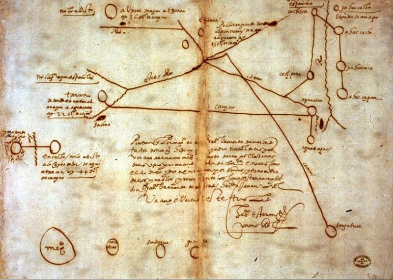
In 1886, a mining engineer named John T. Reid happened to hear the legend from a group of Paiutes while prospecting near Lovelock, Nevada.
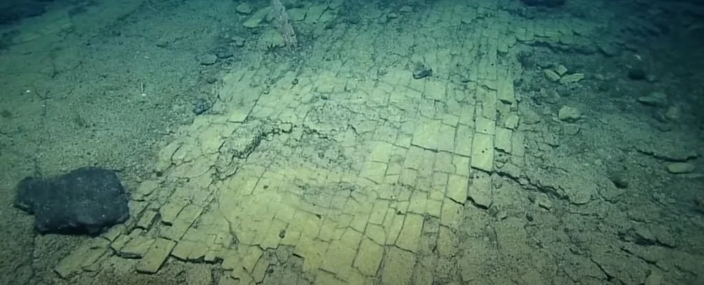
The Indians told him that the legend was real and the cave was located nearby. When he saw the cave for himself, Reid knew he was onto something.
Reid was unable to begin digging himself but news spread and soon, Lovelock cave was attracting attention. Unfortunately, the attention was profit-driven as guano deposits were discovered inside.
A company started by miners David Pugh and James Hart began excavating the precious resource in 1911 and had soon shipped more than 250 tons to a fertilizer company in San Francisco.
Any artefacts that might have been discovered were probably neglected or lost.
After the surface layer of guano had been mined, strange objects started to surface.
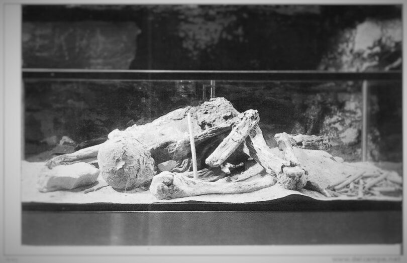
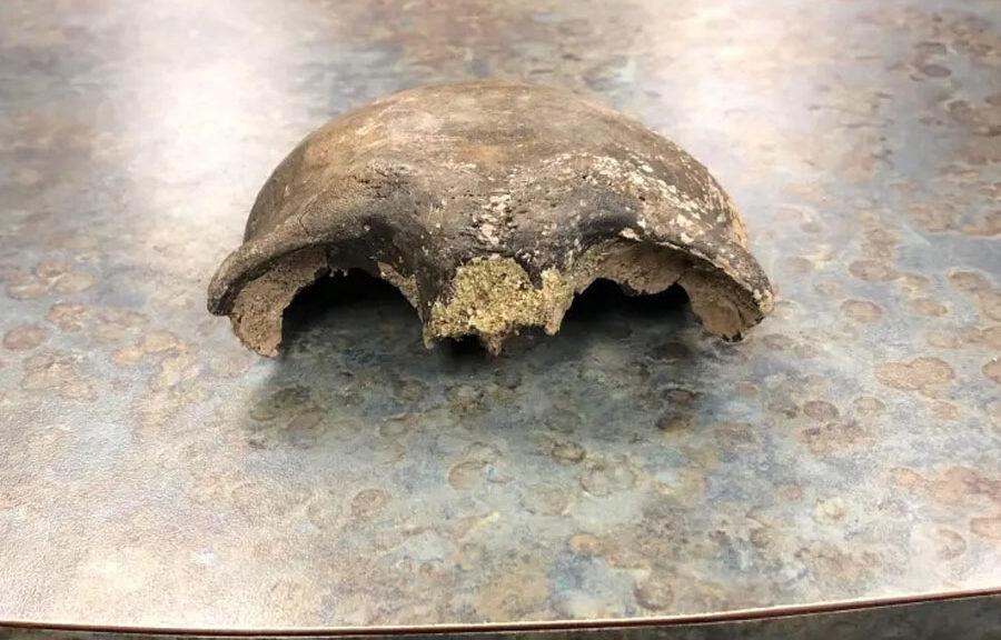
This led to an official excavation being performed in 1912 by the University of California and another one took place in 1924. Reports told about thousands of artifacts being recovered, some of them being truly unusual.

Measuring between 8 to 10 feet in height, these mummies have since been referred to as the Lovelock Giants.

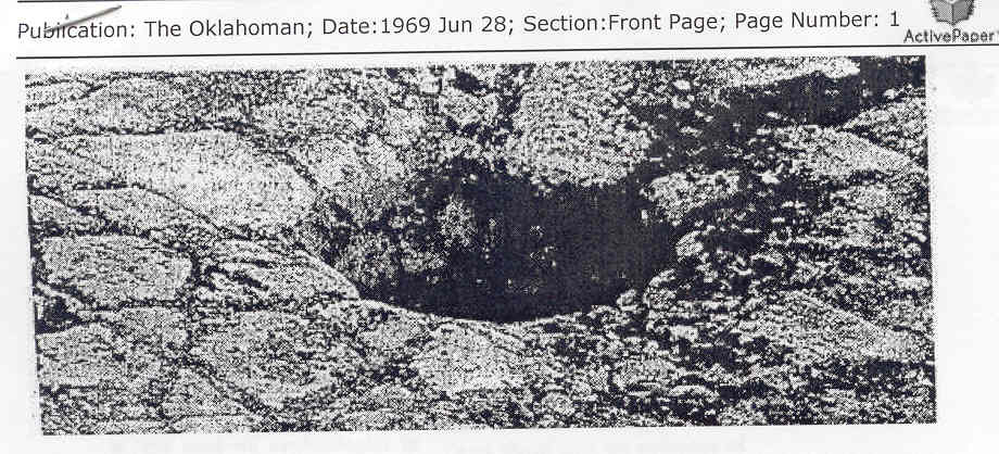
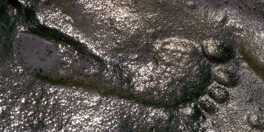
A piece of evidence that remains on-site until this day is a giant hand print, embedded on a boulder inside Lovelock Cave. We won’t go into further debate pertaining to this aspect and its implications.

Around the same time as the second Lovelock Cave excavation, another dig revealed a set of equally-disturbing finds.
According to a 1931 article published in the Nevada Review-Miner, two giant skeletons had been found buried in a dry lake bed close to Lovelock, Nevada.
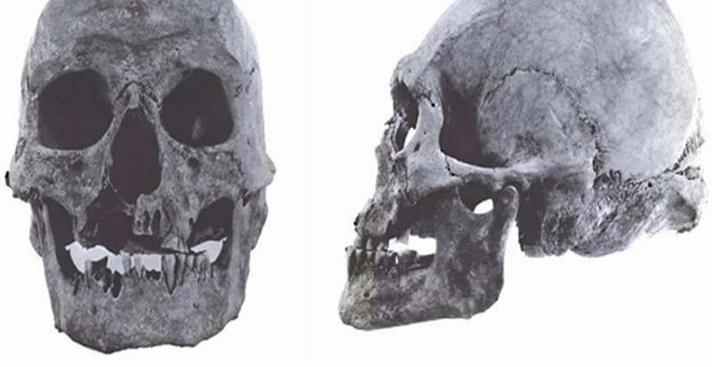
The oversized remains measured 8.5, respectively 10 feet in height and were mummified in a manner similar to the one employed by ancient Egyptians.
Another common trait between these mummified giant remains and the ones discovered as far south as Lake Titicaca is the presence of red hair.
While some scientists believe the reddish colour is a result of the interaction with the environment in which they were buried, the mummies verify the legends, which described the Si-Te-Cah and their kin as red-haired giants.
Proponents of alternative history believe these violent giants were none other than the biblical Nephilim, the forsworn offspring of the ‘Sons of God’ with the ‘daughters of men.’
If this is true, there’s little chance we might get to see any of the giant mummies. Those interested in keeping history secret will never disclose their location.