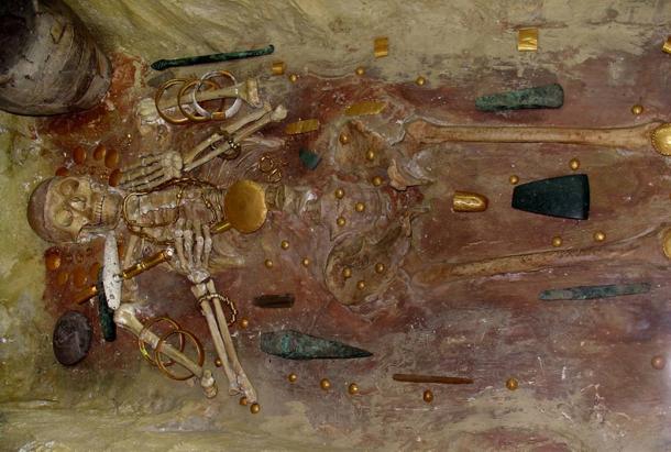
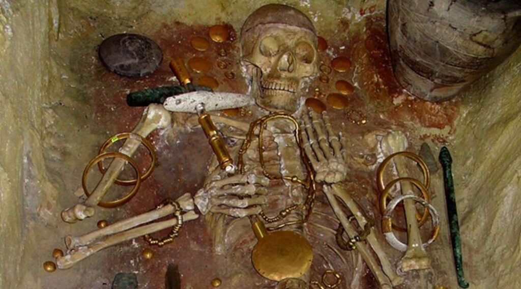
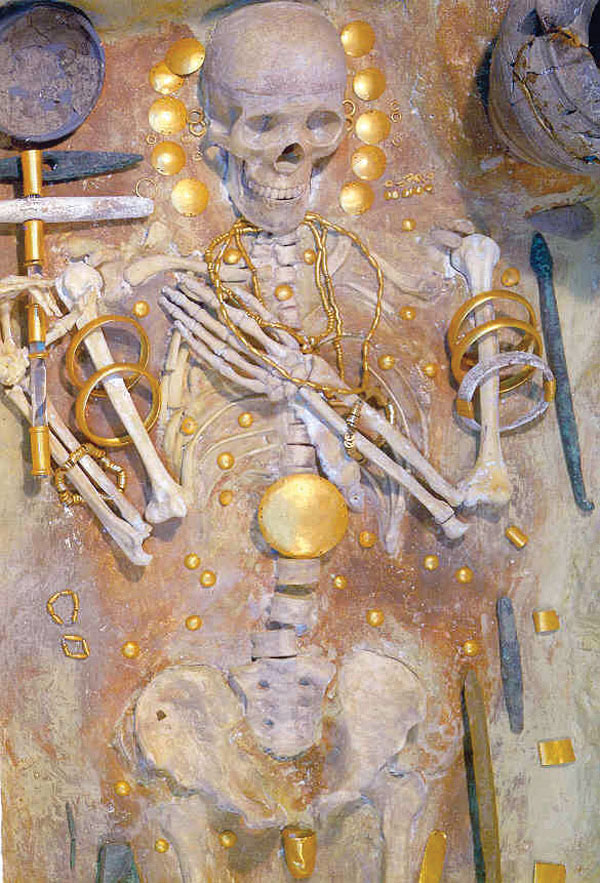
Pyramids Discovered In Russia Twice As Old As Egyptian Could Rewrite Human History
The discovery of the world’s earliest pyramids on the Kola Peninsula may confirm the existence of an ancient civilisation on Russian territory. The civilization likely predates the Egyptian civilization for a long time.
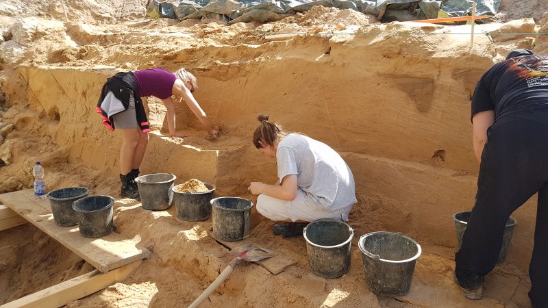
Archaeological excavations of the Kola Peninsula’s pyramids, which are believed to be at least two times older than Egyptian pyramids, have been resumed last year. It is still not known by whom or how they were built.
The mystery of the pyramids of Kola Peninsula
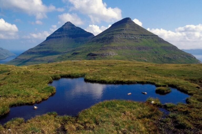
The Kola Peninsula is a peninsula located in the Murmansk area of Russia’s European portion. The Barents and White Seas flow across it. The area is around 100,000 square kilometres. The north has tundra vegetation, whereas the south has forest tundra and taiga. The peninsula’s climate is somewhat chilly all the year.
The extraordinary discovery of the world’s oldest pyramids on the Kola Peninsula indicates the existence of the legendary Hyperborea. The Kola Peninsula has recently become a fascinating place for scientific researchers and enthusiasts.
Many of the scientists who made a scientific expedition to this enigmatic place believe that the Kola peninsula may be the ancestral home to Earth’s most ancient civilization. Scientists’ discoveries of step pyramids and massive stone slabs that were precisely cut 9000-40000 years ago provide compelling evidence for this incredible idea.
Were the Hyperboreans responsible for the Kola Pyramids?

Archaeologists have studied intriguing pyramid structures on the Kola peninsula, which have the potential to rewrite our history. The pyramids have been built with precision and are thought to be at least 9,000 years old, which could be even older than Göbekli Tepe, the world’s oldest temple.
The earliest known investigation of the Kola pyramids took place in the early 1920s when Russian scholar Alexander Vasilyevich Barchenko (1881–1938) arrived with a scientific team to explore the enigmatic, undiscovered ancient monuments in Russia’s unexplored part. However, Barchenko was not a mainstream scientist, and to date, his beliefs are controversial, as well as intriguing at the same time.
Barchenko became persuaded that the Kola pyramids were built by the lost civilisation of Hyperborea, a mythological island according to the ancient Greeks. Hecataeus of Miletus (550 BC-476 BC), the earliest recorded Greek historian, believed the Hyperborean holy site located “on an island in the ocean…beyond the country of the Celts.”
According to Diodorus Siculus (90 BC-30 BC), a Greek historian, God Apollo visited the unknown country of Hyperborea on his swan drawn chariot on a regular basis.
“Opposite to the coast of Celtic Gaul there is an island in the sea, not smaller than Sicily, situated to the north—which is inhabited by the Hyperboreans, who are so named because they live beyond the North Wind,” Diodorus said. “This island has a pleasant climate, fertile soil, and is abundant in everything, producing twice a year.”

According to the Diodorus’ statement in Historic Library, Greek goddess Leto, the daughter of the Titans Coeus and Phoebe, the sister of Asteria, and the mother of Apollo and Artemis, was born in Hyperborea, and as a result, the locals worship Apollo more than any other God. They are, in a sense, his priests, because they constantly praise him and lavish him with awards.
“There is a lovely Apollo grove on this island, as well as a spectacular circular temple decorated with many dedicated offerings. There is also a city dedicated to the same God, the majority of whose residents are harpers who constantly play their harps at the temple and sing songs to the God praising his deeds. The Hyperboreans speak a unique dialect and have a strong connection to the Greeks, particularly the Athenians and the Delians…”
It is also said that the moon appears very close to the earth in this island, that certain eminences of a terrestrial form can be clearly seen in it, that Apollo visits the island once every nineteen years, during which period the stars complete their revolutions, and that for this reason, the Greeks distinguish the cycle of nineteen years by the name of “the great year.”
Hyperborea has never been discovered, but that, according to many theorists, doesn’t imply it didn’t exist. Hyperborea’s submerged ancient remains may yet be unearthed. Could the abandoned Kola Pyramids in Russia’s North be the remnants of a long-lost, sophisticated ancient civilization about which we know almost nothing?
According to Barchenko’s view, people came from the northern areas around 12,000 years ago. A massive flood drove Aryan tribes residing there to flee the area during the so-called Golden Age, which occurred around 10,000-12,000 years ago. The Aryan tribes left the Kola Peninsula and travelled to the south.

After studying Masonic literature, the late Russian scientist gradually came to believe that the Hyperboreans were a highly sophisticated society capable of atomic energy, levitation, and flight. He also believed that Sami shamans living on the Kola Peninsula were the keepers of Hyperborea’s old wisdom.
Bashenko was a keen student of religious and mystical matters, and while his hypotheses were never proven, they are nevertheless of considerable interest to scholars of alternative ancient history. On April 25, 1938, Bashenko was killed in Moscow as part of the Great Purge.
Inside the Kola Pyramids, there are unknown voids and chambers
Later in 2007, a Russian expedition team attempted to investigate the Kola Pyramids. Among these experts were Pulkovo Observatory press secretary Sergey Smirnov, candidate of physical and mathematical sciences, Valery Chudinov, Professor of the Russian Academy of Natural Sciences, and Dmitry Subetto, Professor, doctor of geological and geographical sciences.
The voyage was more arduous and risky than the researchers had anticipated. The Kola Pyramids are in a secluded area, and the inhabitants, the Lapps, we’re hesitant to show them the route.
According to one of the team members, Russian experts viewed the pyramids from a helicopter, but owing to extensive foliage, not all buildings were visible from the air.
Their chopper nearly crashed, but they made it to the old site and studied these strange buildings. The Kola pyramids, according to Russian geologists, are two 50-meter-high structures linked by a bridge and aligned to the cardinal points.
“We carried a unique device, the most sophisticated geophysical equipment – the Oko georadar – on the expedition,” one of the researchers explained.
Like an x-ray, the instrument “shines through” the interior space of any item. The geologists reached an unambiguous conclusion: the heights are anthropogenic in origin; hence, they are not natural hills, but man-made pyramids ― the product of human hands. Inside the pyramids, there are gaps and undiscovered rooms.
The Russian pyramids’ function, purpose and who constructed them are still unclear. They might have been utilised as an astronomical observatory in ancient times or might be used as sacred ground. For now, what is known about the Kola Pyramids is that they are far older than the Egyptian pyramids, and their presence adds another intriguing segment to human history. In the end, the enigma of the Russian Pyramids in the Kola Peninsula has remained unexplained to this day.