Extraordinary Carving Discovered Inside Ancient Maya Pyramid
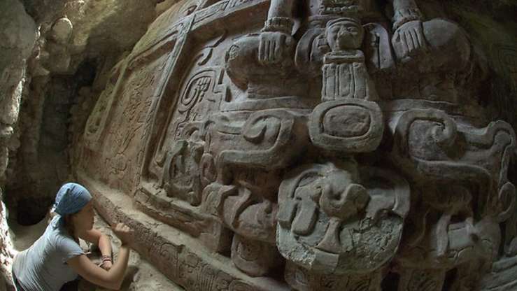
An enormous stone design by the ancient Mayan civilization that has persisted for centuries locked within a pyramid in Guatemala shows a battle of superpowers in 6th Century Central America, archaeologists have said.
The massive frieze with inscriptions and the vividly coloured painting was found at the Holmul archaeological excavation at a dig in the northeast Peten region of the country. Archaeologists claim that the evidence indicates that the region’s rulers were embroiled in a political clash of the titans between the kings of Kaanul – the Snake Kingdom – and the kings of Tikal.
The frieze, which is eight metres wide and two metres tall and stands along the exterior of a multi-roomed rectangular building, was found in a 20-metre high pyramid built in the 8th Century, in a style typical of the Maya. Much of the building still remains encased under the rubble of the later 20m-high structure. The carving is painted in red, with details in blue, green and yellow.
Francisco Estrada-Belli, director of the Holmul Archaeological Project that made the discovery, said: ‘This is a unique find. It is a beautiful work of art and it tells us so much about the function and meaning of the building, which was what we were looking for.’
The carving depicts human figures in a mythological setting, suggesting they may be deified rulers. It shows three human figures wearing elaborate bird headdresses and jade jewels seated cross-legged over the head of a mountain spirit known as a witz.
A cartouche on the headdress contains glyphs identifying each individual by name. The central figure’s name is the only one that is legible but the inscription says Och Chan Yopaat, meaning ‘the storm god enters the sky.’
Two feathered serpents emerge from the mountain spirit below the main character and form an arch with their bodies. Under each of them is a seated figure of an aged god holding a sign that reads ‘the first tamale.’


In front of the serpents’ mouths are the two additional human figures, also seated on mountain spirit heads. At the bottom of the carving, there are bands of glyphs that reveal the grand frieze was commissioned by the ruler of Naranjo – a superpower kingdom south of Holmul.
In the dedication, king Ajwosaj Chan K’inich claims to have restored the local ruling line and patron deities. The images and glyphic text on the frieze also provide information about political actors in the Maya Lowlands well beyond this small kingdom.
The writing says the ruler, was also referred to as a ‘vassal of the Kaanul king’ the snake lord.
‘When this building was erected, Kanul kings were already on their way to controlling much of the lowlands, except Tikal of course,’ said Estrada-Belli.
Mr Estrada-Belli told NBC News: ‘It’s all a grand scheme of building a Maya empire. Sometimes the Kaanul kings were on top. Sometimes Tikal was on top. But there was nothing chaotic about it.’

According to Alex Tokovinine, a Harvard University Maya epigrapher who worked on the project, the text places the building in the decade of the 590s and provides the first glimpse of the remarkable extent of Ajwosaj’s political and religious authority.
‘It also reveals how a new order was literally imprinted on a broader landscape of local gods and ancestors,’ she said.
At the time, the Tikal kings had established new dynasties and far-reaching alliances with kingdoms throughout the Maya Lowlands, perhaps thanks to a connection with Mesoamerica’s greatest state, Teotihuacan.
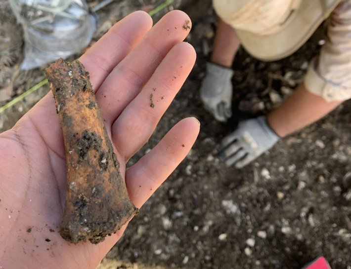
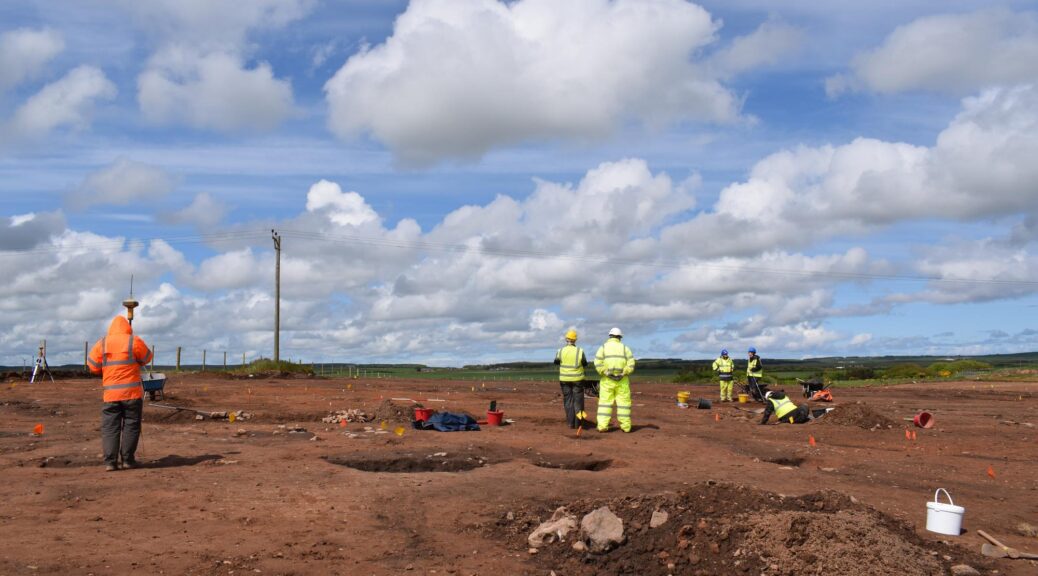
Tikal suffered a defeat in the year 562 by the Kanul ‘Snake’ kingdom, which, for the following 180 years, would come to dominate most other Lowland kingdoms. The find came as the team excavated in a tunnel left open by looters. The archaeologists unearthed a tomb associated with the pyramid last year containing an individual accompanied by 28 ceramic vessels and a wooden funerary mask.
It was found in a cavity dug into the stairway leading up to the building and the skeleton of an adult male and his ceramic offering were preserved by large limestone slabs that kept the tomb free of debris.
Intriguingly his incisor and canine teeth had been drilled and filled with jade beads, while two miniature flower-shaped ear spools were also found. The archaeologists said the iconography on the vessels discovered in the tomb bore clear references to the nine lords of the underworld as well as to the aged sun god of the underworld.
There were two sets of nine painted bowls decorated with the water lily motif and nine red-painted plates and one spouted tripod plate decorated with the image of the god of the underworld emerging from a shell. Because of the unusually high number of vessels and the jade dental decorations, Mr Estrada-Belli believes the individual found may have been a member of the ruling class at Holmul.