Possible Burial Place of St. Nicholas Uncovered in Turkey
Archaeologists in southern Turkey have just uncovered the original burial place of Father Christmas himself, formally known as St. Nicholas, but whose modern nicknames of Santa Claus, Saint Nick and Kris Kringle are known by children the world over.
While researchers already knew that the saint’s body was buried in the fourth century A.D. church in Turkey’s Antalya province, the holy man’s remains were stolen around 700 years after he died, so the specific spot where he was originally interred was a mystery.
Now, clues gathered during a new excavation of this church, including the ecclesiastical building’s similarity to the Church of the Holy Sepulchre in Jerusalem and the placement of a fresco depicting Jesus, hint at exactly where St. Nick’s body was likely laid to rest.
Located on Turkey’s southern coast, the modern town of Demre boasts the Church of St. Nicholas, built in A.D. 520 on top of an older church where the Christian saint served as bishop in the fourth century A.D. Then known as Myra, the small town was a popular Christian pilgrimage spot following St. Nicholas’ death and burial there in A.D. 343.
Very little is known about Nicholas’s life, but legends abound — he is said to have rescued three girls from prostitution, to have chopped down a demon-possessed tree, to have resurrected three murdered children who were pickled in brine, and to have gotten into a fist-fight during the First Council of Nicaea in A.D. 325, according to Britannica(opens in new tab). And, of course, Nicholas was said to have frequently given away his inherited wealth anonymously to the poor, eventually leading to the legend of St. Nick as Santa Claus.
Unfortunately, in A.D. 1087, “some wise and illustrious men of Bari [Italy]… discussed together how they might take away from the city of Myra… the body of the most blessed confessor of Christ, Nicholas,” according to a contemporaneous manuscript translated from Latin by late medievalist Charles W. Jones.
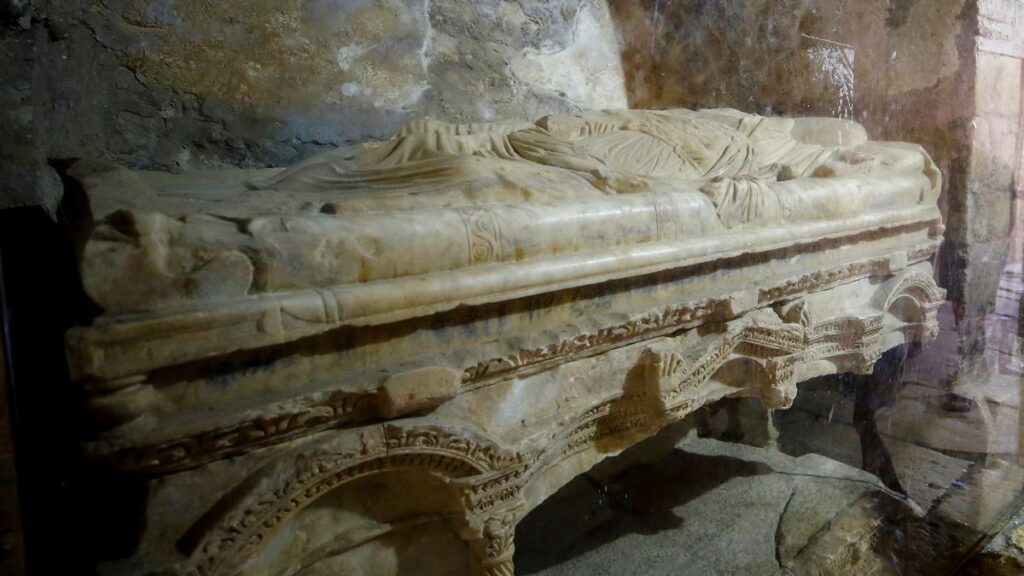
Their plan was to “break open the floor of the church and carry away the holy corpse.” The group succeeded, carting off most of the skeletal remains of St. Nicholas, and leaving just a few bones and a broken sarcophagus in Myra.
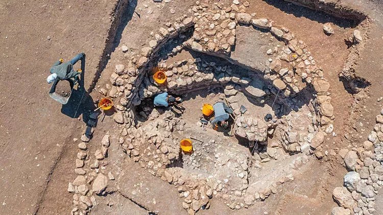
In spite of this desecration, the church of St. Nicholas in Demre itself has survived for more than a millennium, with archaeological excavation beginning at the end of the 20th century.
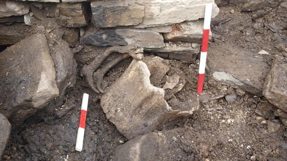
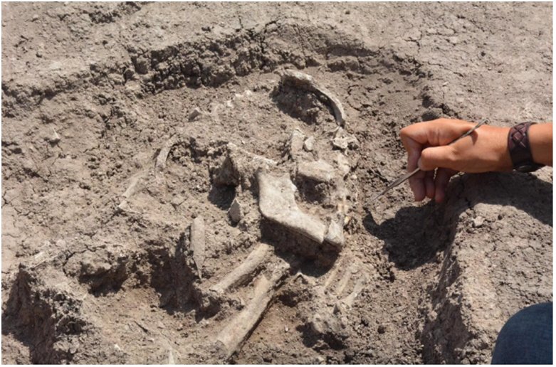
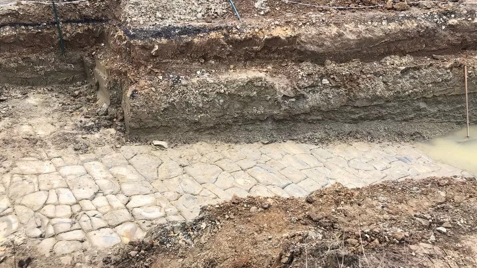
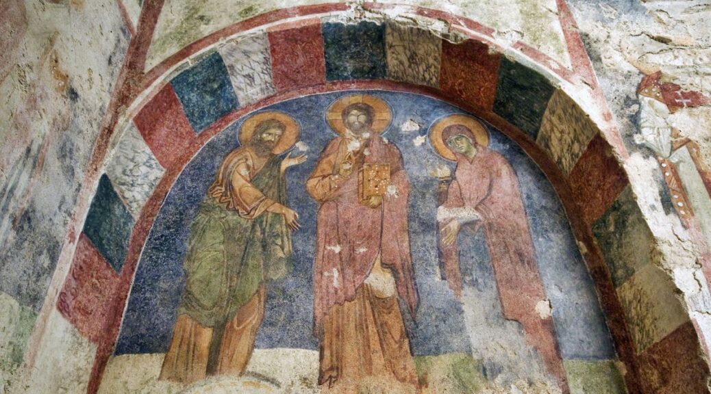
Through this work, researchers discovered the foundations of the earliest church, covered by many feet of sand and silt. Last week, Osman Eravşar, chairman of the Antalya Cultural Heritage Preservation Regional Board, announced the discovery of the location of St. Nicholas’s tomb at the base of a fresco of Jesus.
In an interview(opens in new tab) with the Turkish news organization DHA (Demirören Haber Ajansı), Eravşar noted that the current excavations have revealed “the floor on which St. Nicholas’s feet stepped” from the original church.
“This is an extremely important discovery, the first find from that period,” DHA’s English coverage quoted Eravşar as saying.
The original burial place of St. Nicholas has also been found, according to Eravşar. When the Bari contingent removed the saint’s bones in the 11th century, they also shoved some sarcophagi aside, obscuring their original location. Eravşar told DHA that “his sarcophagus must have been placed in a special place, and that is the part with three apses covered with a dome.
There we have discovered the fresco depicting the scene where Jesus is holding a Bible in his left hand and making the sign of blessing with his right hand.” A marble floor tile with the Greek words for “as grace” could mark his exact grave.
Supporting that hypothesis is the shape of the church itself. Just as the Church of the Holy Sepulchre has an unfinished dome on top, so does the Church of St. Nicholas at Myra.
When it was restored by Emperor Alexander II of Russia in the 1860s, the dome was never completed. This unfinished dome may have been a purposeful attempt to link St. Nicholas with the story of Jesus’s crucifixion and ascension into the sky.
“It’s not unusual for churches to be built atop one another,” William Caraher, an archaeologist at the University of North Dakota with a speciality in early Christian architecture, who was not involved in the excavation, told Live Science in an email. “In fact, the presence of an earlier church on a site has been a reason to build a church since Early Christian and Byzantine times.”
But Caraher thinks that the marble floor tile with Greek letters could be from some other context, reused possibly in antiquity because of the common word “charis” (grace) etched into it.
Caraher noted that St. Nicholas is significant in Orthodox and Catholic traditions, with churches and chapels dedicated to him throughout the Mediterranean. “I think many people — from eager kiddos on Christmas Eve to world-weary science reporters and grizzled archaeologists — have at some point in their lives hoped to get a little glimpse of the real St. Nick,” Caraher said.