Category Archives: WORLD

The ‘boiler room’ of the bath in the Ancient City of Metropolis was unearthed
The ‘boiler room’ of the bath in the Ancient City of Metropolis was unearthed

The ‘boiler room’ of the bath in the Ancient City of Metropolis was unearthed

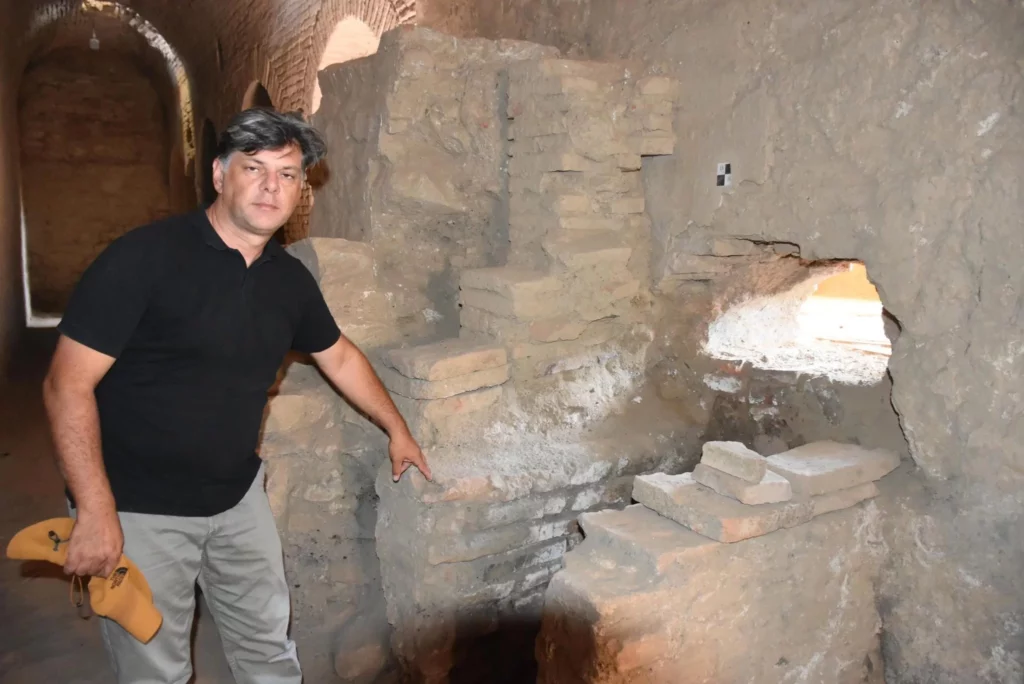
The vault section, called the ‘boiler room’, which provides a heat source, has been unearthed in the historical bath of the ancient city of Metropolis in the Torbalı district of İzmir.

The ancient city of Metropolis, which was founded on a hill between Yeniköy and Özbey villages in the west of Torbalı Plain, is the first residential area of Torbalı, which is situated 45 kilometers east of Izmir. Metropolis means Mother Goddess city.

The excavations carried out by the Ministry of Culture and Tourism in the Ancient City of Metropolis are supported by Torbalı Municipality, Metropolis Lovers Association, Sabancı Foundation, and İzmir Metropolitan Municipality.

 The first settlement traces around Metropolis date back to the Stone Age (Neolithic) Tepeköy, Dedecik, Kuşçuburun. Although the Hellenic community on the acropolis was founded after the ninth century BC, the city’s greatest growth occurred in the third century BC.
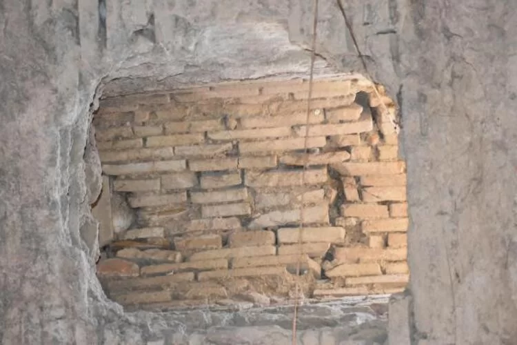
In the ancient city, where many monumental structures were unearthed, this year’s excavations are carried out around the Hellenistic theater, one of the city’s most important structures. With the works carried out for the last 2 years, the boiler room in the historical bath of the ancient city was also unearthed.

Head of the Metropolis Ancient City Excavation, Manisa Celal Bayar University Department of Archeology lecturer Professor Dr. Serdar Aybek said, “The building where the bath is located has a large area of 6 thousand square meters. This is an extremely large area, it needs meticulous work.”

The vaulted gallery we are in is one of the most important halls of the building. The area used as the ‘service corridor’. Along with its terrace, it is one of the most original examples of stone and brick architecture in Anatolia.
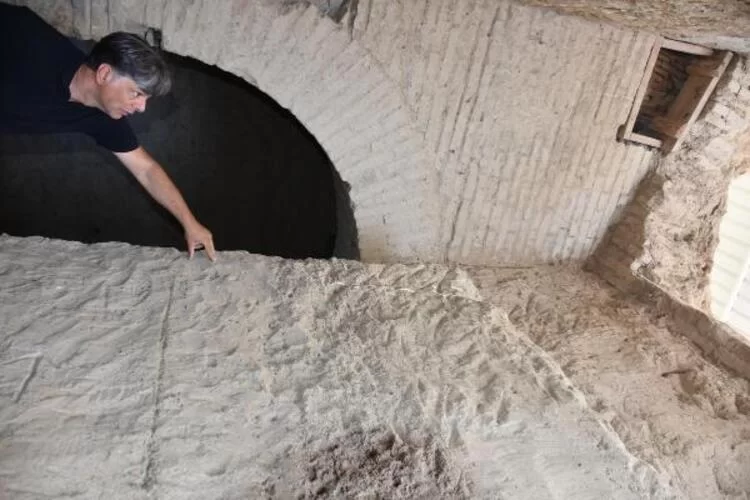
Aybek also added that the bath was built in different phases and dates back to 1800 years ago. First, while it had a small area in the 1st century AD; It was expanded in the 2nd century AD, and its halls were enlarged. Additional buildings such as the vault section have been included in the plan to heat the newly enlarged halls.

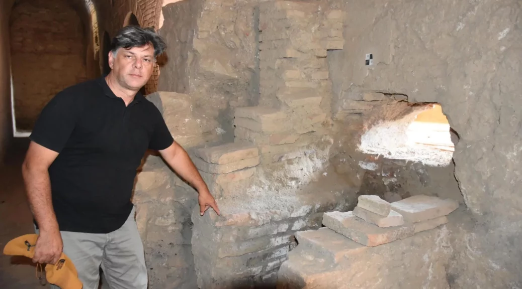
Stating that the vault section unearthed can be seen as the ‘boiler room’ that provides the heat source of the bath in modern terms, Professor Aybek said, “The ‘Hypocaust’ method, which is the central heating system established by the Romans, used.”

“The baths are heated by means of perforated bricks placed on both the floor and the wall. The boilers, which are the first step of heating, are located here.

The bath is heated by burning the region’s red pine trees in furnaces positioned below ground level, below the three pools in the main area of the bath,” he said.
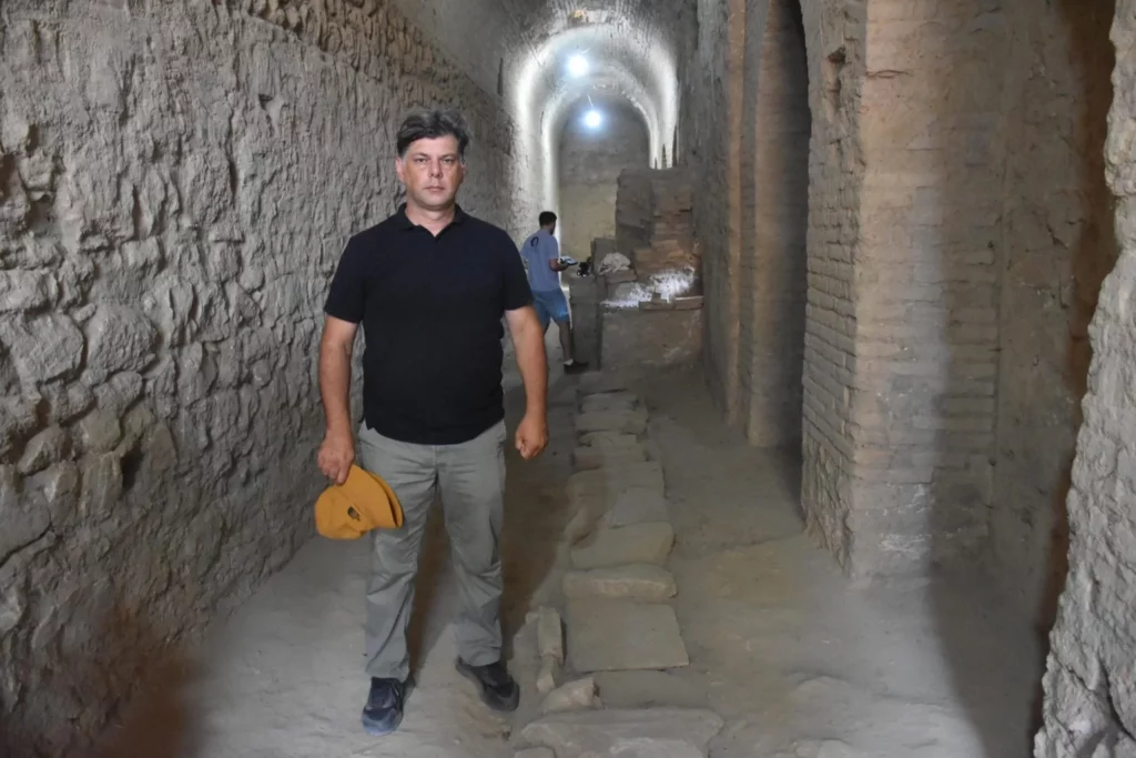
Professor Aybek stated that it was a pleasant surprise that the vault section was still standing with its terrace: “We saw that the building was at terrace level and completely preserved. This part was completely unearthed through archaeological excavations.”

We uncovered the well-preserved structure by excavating about 9 meters of earth fill. This part reveals only a part of the bath.

This is one of the most important structures of the Metropolis here. It has facilities and management units such as sports and dining halls. This is the place that constitutes the most important attraction center of the city,” he said.
Rock Ship of Masuda, Japan’s mysterious monolith

Rock Ship of Masuda, Japan’s mysterious monolith

Rock Ship of Masuda, Japan’s mysterious monolith

Located in the Takaichi District of Nara Prefecture, Japan, the village of Asuka is famous for its mysterious stones. The ancient origins of the village date back to the Tumulus period, also known as Kofun Jidai (c. 3rd century–538 C.E.).

Kofun Jidai period (AD 250–552) is characterized by a specific type of earth mound in the shape of a key and surrounded by moats. However, the area is known for its many Buddhist temples, shrines, and statues.

Stone monuments that do not match Buddhist-style sculptures or construction on the hills surrounding Asuka attract curious visitors and explorers.

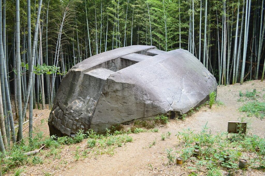
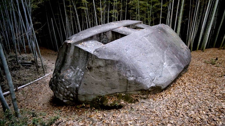
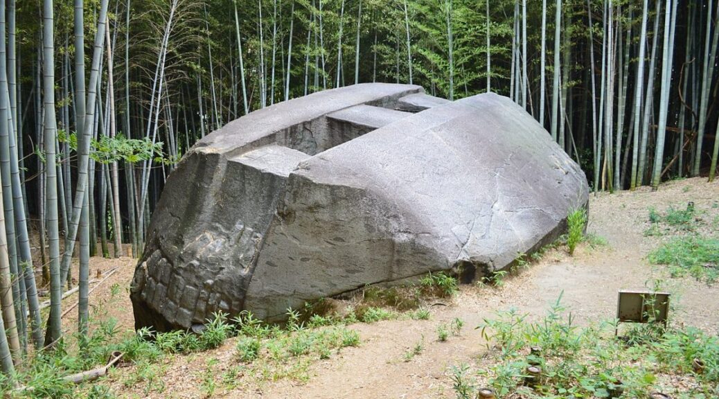
Masuda-no-iwafune (literally “Rock Ship of Masuda”, 益 田 岩 船 in Japanese), or Rock Ship of Masuda, is the name of the largest of these monuments.  Its function is still unknown and it is located atop a hill close to Okadera Station. 

The largest of the mysterious rock mounds, the rock ship is made of solid granite and measures 11 meters (36 feet) by 8 meters (26 feet), 4.5 meters high (15 feet), and weighs approximately 800 tons as it stands. 

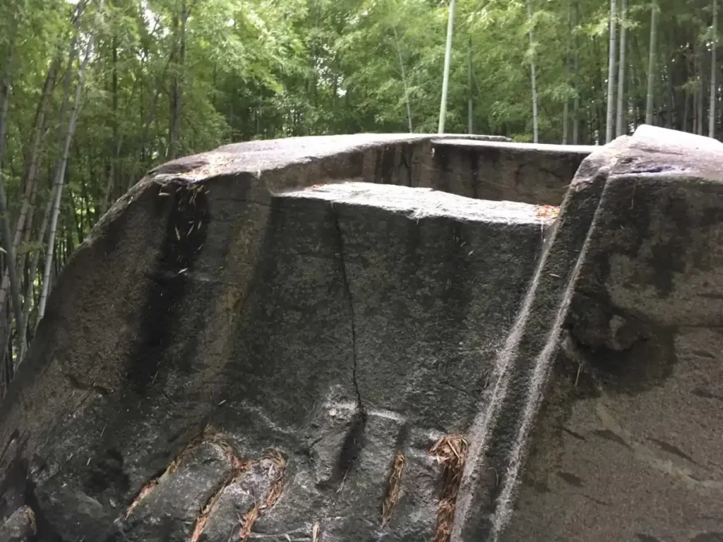
It’s a carved mound, with two holes each about a meter square in the center, going through to the ground.

The “rock ship” moniker is most likely due to its canoe-like appearance or location near Lake Masuda. However, as part of regional development, the nearby body of water has been drained.

The side of the slope facing the top has been smoothed at a 45-degree angle to the ground. Close to the ground, trellis-shaped chisel marks can be seen on the other three sides.

These marks are most likely related to how the builders smoothed the surface of the rock. Because granite is notoriously difficult to carve (even with modern tools), this sculpture captivates experts and scientists who regard it as a technical marvel.

Masuda-no-iwafoune’s construction is said to be strikingly similar to that of another Japanese stone enigma, Ishi-no-Hden. Though it is now a shrine dedicated to the Shinto god shiko Jinja, no one knows who carved it or why, though it is thought to have two holes in the center, similar to Masuda-no-iwafune, though they aren’t visible.

The most popular theory about the stone’s construction is that it was used as an astronomical observation point. Its orientation alignment with the slope suggests that the monolith may be linked with the Japanese lunar calendar (important for early agriculture) and to the first astronomical observations. However, some experts disagree with this.

Other historians contend that the rock designates a royal burial ground, of which only the entrance would have been finished at the time. This still doesn’t explain the unusual features of the structure.

With no conclusive information regarding the significance of this enigmatic stone spaceship, the whys, and wherefores of its existence remain a mystery to this day.

Arrowhead from the Biblical Battle Discovered in the Hometown of the Giant Goliath’s

Arrowhead from the Biblical Battle Discovered in the Hometown of the Giant Goliath’s

Arrowhead from the Biblical Battle Discovered in the Hometown of the Giant Goliath’s

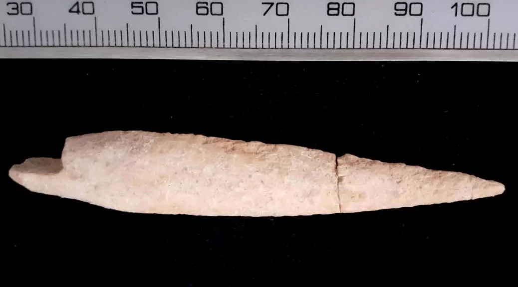
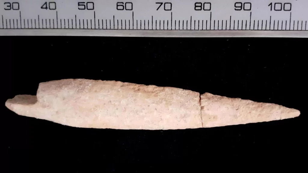
A bone arrowhead discovered in the ancient Philistine city of Gath might have been used and fired off by the city’s defenders as part of the last stand described in the Bible.

According to the Hebrew Bible, a king named Hazael), who ruled the kingdom of Aram from around 842 B.C. to 800 B.C., conquered Gath (also known as Tell es-Safi) before marching on Jerusalem. “Hazael king of Aram went up and attacked Gath and captured it. Then he turned to attack Jerusalem,” the Book of Kings says (2 Kings 12:17). 

Archaeological investigations in Gath, in what is now Israel, have revealed that major damage occurred in the late ninth century B.C., when the Bible claims Hazael destroyed Gath, which was home to the Philistines (Israel’s foes). Goliath, the giant warrior killed by King David, was born in Gath, according to the Hebrew Bible.

Archaeologists found a bone arrowhead in the ruins of a street in the lower city in 2019 that may have been shot by the city’s defenders in a desperate attempt to halt Hazael’s army from conquering Gath, according to an article published recently in the journal Near Eastern Archaeology.

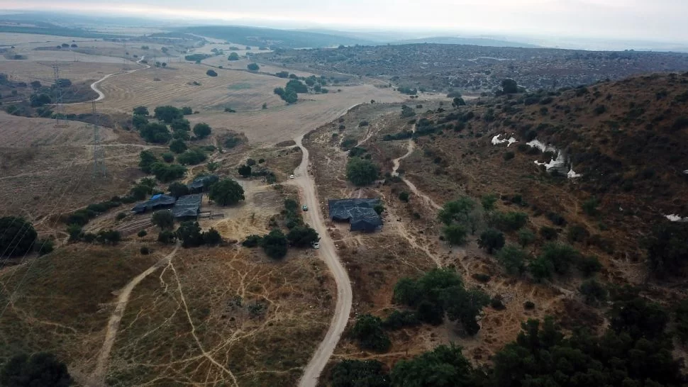
The army of King Hazael of Aram may have passed through the lower city (shown here) while conquering Gath.

The arrowhead has an impact fracture on its tip, and the arrowhead “had been broken close to the mid-shaft, perhaps as a result of this impact,” the archaeologists said The damage suggests the arrowhead hit a target, they added. 

Desperate manufacturing in Gath

This arrowhead might have been made in a Gath workshop that was feverishly trying to make as many bone arrowheads for the city’s defenses as possible.

The workshop, which was discovered in 2006, is located roughly 980 feet (300 meters) away from where the bone arrowhead was found.

Inside this workshop, archaeologists uncovered several bones from the lower forelimbs and hind limbs of domestic cattle, suggesting that people in the workshop were in the process of making bone arrowheads.

“The assemblage represents bones at different stages of working — from complete bones, waste, to almost finished products,” the researchers wrote in the article. 

The defenders may have chosen cattle bone because the material was readily available and crafting a good arrowhead from it didn’t take long. One of the researchers, Ron Kehati, a zooarchaeologist with the Tell es-Safi/Gath Archaeological Project made a replica of the bone arrowhead in about an hour, study co-author Liora Kolska Horwitz, who is also a zooarchaeologist with the project, told Live Science. 

This workshop “may have functioned as an emergency, ad hoc production center to supply arrowheads to fight the forces of Hazael of Aram, who put the site under siege,” the researchers wrote in the article.

The team plans to resume excavations at the site this summer and future discoveries may provide more clues to the fall of Gath.  

The Secret of the Shipwrecks at Theodosius Harbor: 1,600 Years Old Women’s Sandals and Comb

The Secret of the Shipwrecks at Theodosius Harbor: 1,600 Years Old Women’s Sandals and Comb

The 1,600-year-old sandals and comb unearthed during the excavations of Theodosius Harbor (Portus Theodosiacus), the second-biggest harbor built on the coast of the Marmara Sea, fascinate those who see it.

Excavations conducted concurrently with the construction of the Marmaray and Metro rail projects initiated to provide a solution to Istanbul’s transportation problems have resulted in the most extensive archeological survey in the city’s history.

As a result, detailed information about Istanbul’s prehistoric periods has been obtained, an area that has hosted different cultures for thousands of years and unites the cultures of the East and the West.

Before 2004, information about the settlement history of Istanbul was based on excavations outside the Historic Peninsula; settlements in these areas could be traced to 2,500 years ago.

The Secret of the Shipwrecks at Theodosius Harbor: 1,600 Years Old Women’s Sandals and Comb
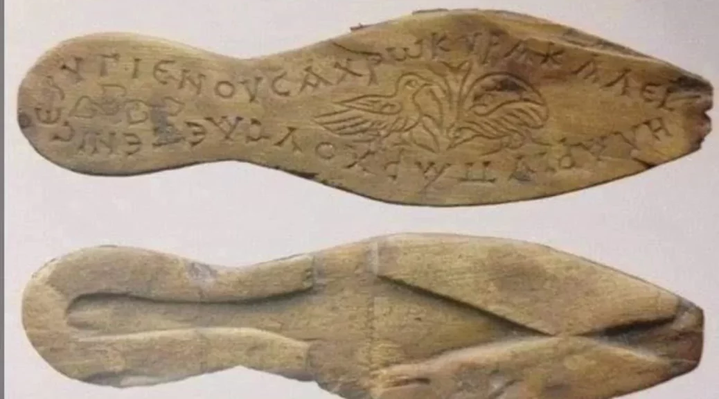
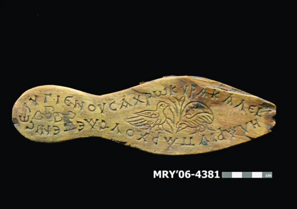
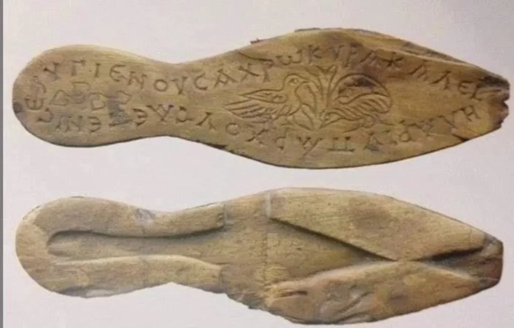
The ancient sandals were discovered almost intact in the Istanbul dig.

The astonishing finds were discovered during digs prompted by the Marmaray project. One of these interesting finds was sandals with wooden soles belonging to a woman.

The sandals had a Greek message that reads: “Use in health, lady, wear in beauty and happiness.”

Researchers came to differing conclusions about the sunken ships discovered in the harbor of Theodosius, which dated from different centuries. It was suggested that the ships might have sunk during a hurricane, tsunami, or other natural disaster.

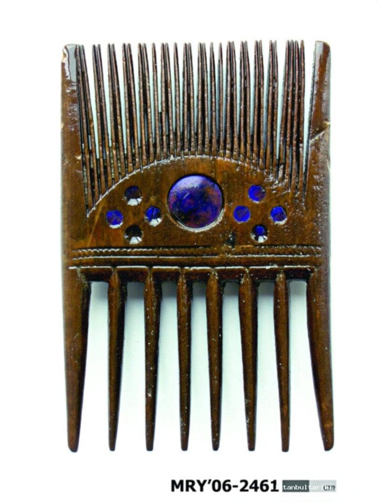
A comb was found at the excavations of the Harbor of Theodosius.

The idea that the ships were simply abandoned after serving their purpose is one of the most widely held theories. In the fourth of nine stratigraphic segments in the excavation field, researchers discovered evidence of the effects of the earthquake and tsunami that occurred in AD 553.

Another theory is that the southwesterly wind, known as kaçak (fugitive) in Turkish, which begins suddenly in the Marmara Sea during the summer months, caused these vessels to sink.

Above the vessels, a thick layer of sea sand formed. The accumulation that filled the harbor protected and preserved the sunken ships.

The rapid burial of the ships created an anoxic environment that preserved rigging tools like tackles, pulleys, ropes, and toggles as well as everyday items like combs, leather sandals, straw baskets, and wooden plates as well as a variety of organic and inorganic artifacts like stone and iron anchors.

Around the harbor, a number of fragments of sunken ships and items from earlier eras were also discovered.

Archeologists discover 2000-year-old Roman coins on the deserted Swedish island of Gotska Sandön

Archeologists discover 2000-year-old Roman coins on the deserted Swedish island of Gotska Sandön

Archeologists discover 2000-year-old Roman coins on the deserted Swedish island of Gotska Sandön

Archaeologists found 2,000-year-old Roman coins on the Swedish deserted island of Gotska Sandön.

Previously, ancient Roman coins were discovered on the Swedish island of Gotland. Finding similar ancient items on the deserted island of Gotska Sandön, on the other hand, is unusual. Because of its location, it is a unique discovery.

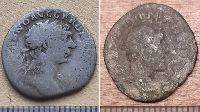
The coins stem from the time of Emperor Trajan, who ruled the Roman Empire in the years 98-117, and Antoninus Pius, who ruled between 138 and 161.

The discovery was made by a team of experts from Södertörn University and the Gotland Museum.

Archaeologists, to this day, have not been able to identify the historical role of the island within the Baltic region’s different historical eras. The island has been inhabited since the Stone Ages, as seal bones, slaughter remains from cows, and a battle glove was previously excavated.

A silver denarius showing the face of Roman emperor Trajan.

In a statement, Johan Rönnby, professor of marine archeology at Soderon University, which runs the excavations in collaboration with the Gotland Museum, stated that “These are exciting finds that raise several questions.”

Archaeologists are now debating whether the discoveries are shipwreck remains strewn across the beach. A large number of hearths and fireplace remains have been discovered along the island’s coast. Another theory is that the coins are somehow related to these activities.

A local lighthouse keeper claimed to have discovered a Roman coin on the island in the late 1800s, which was met with skepticism. The recent discoveries may vindicate him.

“Finds of Roman silver coins are not unusual for Gotland, but are for Gotska Sandon. What makes this find interesting is precisely the location,” Daniel Langhammer of the Administrative Board in Gotland County said.

Gotska Sandon islands.

Gotland, Sweden’s largest island and a key point in the Baltic Sea maritime trade, is rich in medieval treasures.

The number of Arab dirhams discovered on the island, in particular, is astounding, dwarfing any other site in Western Eurasia. These coins made their way north along the Silver-Fur Road through trade between Rus merchants and the Abbasid Caliphate.

The 9-km long and 6-km wide Gotska Sandon island is part of Gotland County and has been a national park since 1909.

Chelmsford: Roman Apollo ring with links to Snettisham hoard found

Chelmsford: Roman Apollo ring with links to Snettisham hoard found

Chelmsford: Roman Apollo ring with links to Snettisham hoard found
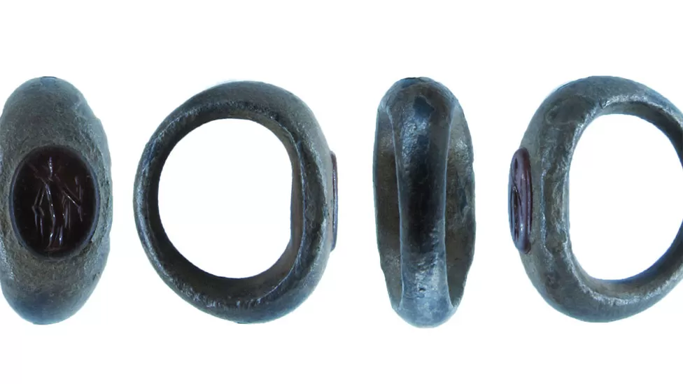
The silver ring’s carved gemstone is a dark orange-red colour and “is probably a carnelian”, experts said in their report to the Essex Coroner

A silver ring unearthed in an Essex field may be connected to a famous Roman jeweller’s hoard found in Norfolk in 1985, a historian has said. The ring is inset with a carnelian carving of the god Apollo. It was found by a metal detectorist near Chelmsford.

Its 2nd Century wearer would have hoped for the god’s protection, Essex finds liaison officer Lori Rogerson said.

The ring seemed to be from the same workshop as the Snettisham hoard of carved gemstones, she added.

The large hoard was found buried in a pot during building work and included 110 unmounted gemstone intaglios – carved gemstones used as seals – silver jewellery and ingots, 110 coins, and tools, Its contents are now at the British Museum.

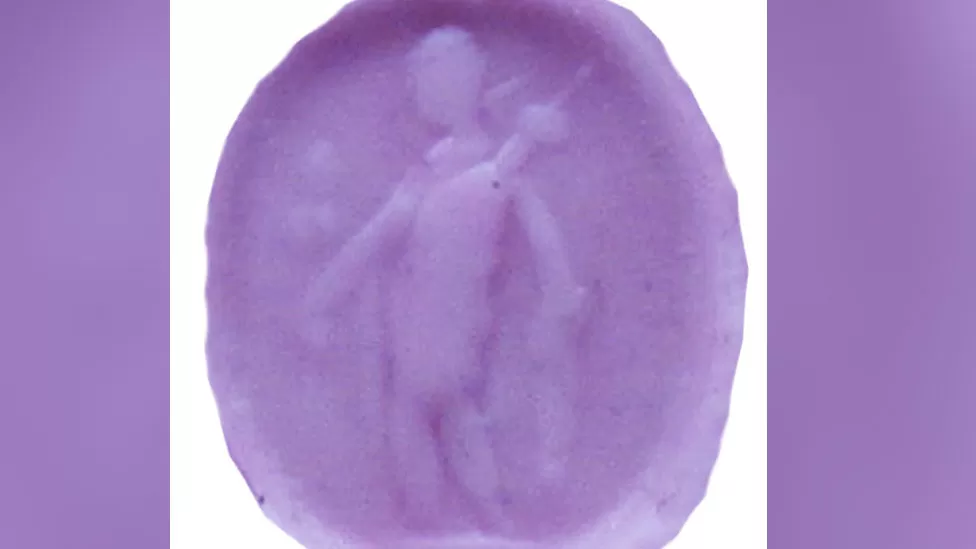
Miss Rogerson said the way it had been carved using long strokes and the fact it dated from AD125 to 175 suggested a connection to the Norfolk hoard.

The seal would leave an impression of Apollo holding a laurel wreath when pressed into wax (above)

The ring would have been used as a seal to sign documents by “literate men and women in wider Romano-British society which grew around military towns… leaving an impression of the engraved image in wax”, she added.

But it would also have been a “very personal” object.

“We know these people would have had a very close personal relationship with their gods and goddesses,” she said.

“Apollo, being the god of healing and prophecy, would hopefully have protected the wearer from harm or illness.

“It’s also really interesting because it’s evidence of a pagan religion that has its roots in Ancient Greece being worshipped by Romano-British society.”

Another ring unearthed at Upper Winchendon, near Aylesbury, Buckinghamshire, in 2018 is also believed to have links to the Snettisham workshop.

The Essex ring was declared treasure by a coroner and Chelmsford Museum hopes to acquire it.

Unpredictable Rainfall May Have Helped Destabilized Ancient Maya Societies

Unpredictable Rainfall May Have Helped Destabilized Ancient Maya Societies

Unpredictable Rainfall May Have Helped Destabilized Ancient Maya Societies

Reduced predictability of seasonal rainfall might have played a significant role in the disintegration of Classic Maya societies about 1,100 years ago. The decline in seasonal predictability potentially destabilized Classic Maya societies in a new study recently published in Communications Earth & Environment.

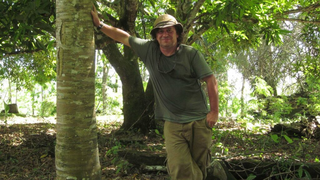
University of New Mexico archaeologist Keith Prufer is among the authors, along with colleagues at the Potsdam Institute for Climate Impact Research (PIK) and Potsdam University. The findings may have significance for populations in the region facing climate change today. 

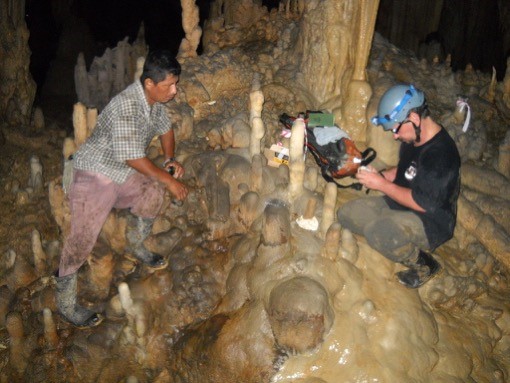
The research team studied variations in stable isotope signatures from a stalagmite collected in a cave in Belize near an archaeological site in the former heartland of the Maya. The carbon and oxygen isotope ratios are sensitive recorders of local and regional rainfall dynamics. 

This paper is a continuation of 18 years of research by Prufer, UNM colleagues, and an international team of scientists into the past climate in the Belize tropics.  

Prufer has been a principal investigator for the research program, with funding from the National Science Foundation and the Alphawood Foundation. 

“The climate record was generated from a cave called Yok Balum, located near the ancient Maya city of Uxbenká. That ancient city figures prominently in this article and is important because it is the closest to the site of the climate data and because of two decades of research there exploring the timing of the collapse,” Prufer explained. 

This paper is a collaboration with the Potsdam Institute for Climate Impact Research in Germany to get advanced time-series modeling to understand the patterning of seasonal variation. The lead at PIK, Tobias Braun, used this study for his dissertation. 

Also included in the research team from UNM are Ph.D. candidate student Erin Ray and Victor Polyak, a senior research scientist in the UNM Department of Earth and Planetary Science. Ray worked to assemble the cultural data, such as the data that records the dynastic history of the Maya from their hieroglyphs, and demographic data. Polyak originally developed the high-precision chronology for the climate and seasonality records. 

“A key ingredient for Maya agriculture was the timely arrival of sufficient rainfall. Farming in subtropical Central America is tough because freshwater is only available during the summer rainy season.

Changes of onset and intensity of the rainy season can have serious repercussions for Central American societies,” Braun noted in a PIK press release about the newly published study. While most scientists agree that repeated intense droughts were one of the key factors that led to the fragmentation of urban centers and population dispersal in lowland Maya societies, evidence at seasonal time scale was so far missing. And this is exactly what the study takes into focus.  

The significance of this record is three-fold, according to Prufer. 

“First, it is a novel climate record for the American tropics with such high resolution – one to seven samples per year over a 1,600-year period − allowing us to look at changes in seasonality from year to year. It is also the first such record to incorporate advanced time series modeling to evaluate seasonal variation in the neotropics and link those changes directly to quantitative cultural records,” Prufer explained. 

Second, the research sheds new light on an enduring question in Maya archaeology: What caused the population decline and disintegration of political institutions at the end of the Classic Period between 250 and 850 CE

Prufer and his colleagues found that changes in seasonality would have challenged food production in this region where all agriculture is directly dependent on rainfall by making the timing for planting harvesting much more difficult − or impossible − to predict from year-to-year. 

“The collapse was significant,” he noted. “Over the course of perhaps 100 to 150 years, populations as high as 5 to 10 million people declined by as much as 60 to 70 percent, and a complete form of governance was abandoned.” 

Third, this research has significance for farming today. The past is an indication of what might be expected in a dire future. 

“With modern global climate change, seasonality patterns are again far less predictable than they were only a couple of decades ago,” Prufer pointed out. “This is forcing modern Maya farming communities − and everyone else − to rethink how they produce food and how to achieve food security, considering their dependence on the timing of the rainy season and the seasonal distribution of rainfall, which is no longer predictable.

“This is important because farming requires both traditional knowledges of when to clear fields and plant, as well as a reliable amount of rainfall each season. When this breaks down, it causes food shortages and human suffering. This case study has implications for collective responses to climate change across the global tropics, a region that feeds over 2 billion people.” 

Intact Ball Game Carving Discovered at Chichen Itza

Intact Ball Game Carving Discovered at Chichen Itza

Intact Ball Game Carving Discovered at Chichen Itza
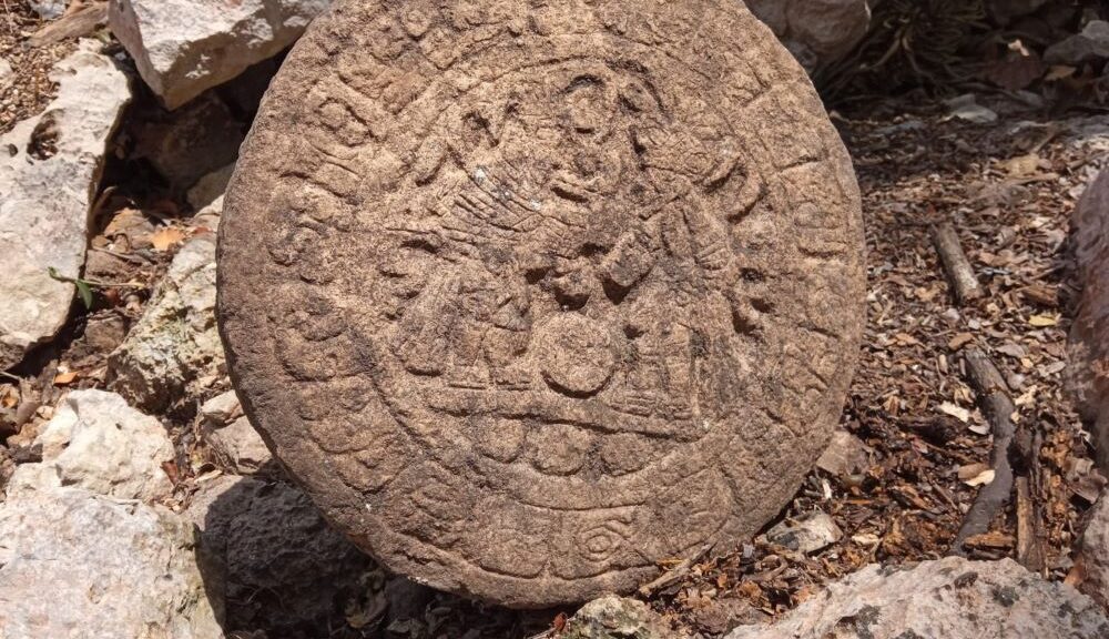
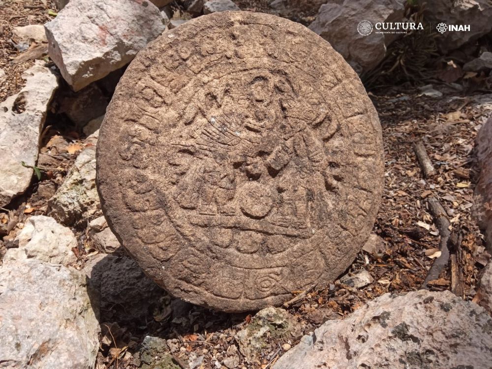
With its complete Mayan hieroglyphic text, a Ball Game marker is discovered at Chichén Itzá.

*** Presents two ball players in the center; It has a diameter of 32.5 centimeters, 9.5 centimeters thick, and 40 kilograms in weight.

*** It must have been attached to an arch that served as access to the Casa Colorada architectural complex

 In the Archaeological Zone of Chichén Itzá, archaeologists from the National Institute of Anthropology and History (INAH) discovered a stone marker of the Ball Game in a circular shape, which presents a bas-relief glyphic band surrounding two attired characters like ball players. 

The relevance of the finding lies in the fact that it is a sculptural element that preserves its complete glyphic text.

With 32.5 centimeters in diameter, 9.5 centimeters thick, and 40 kilograms in weight, the piece was found during archaeological work carried out as part of the Program for the Improvement of Archaeological Zones (Promeza), in charge of the Federal Ministry of Culture.

The piece, named Ball Players Disc, was found by archaeologist Lizbeth Beatriz Mendicuti Pérez, within the Casa Colorada architectural complex (named after the remains of red paint inside) or Chichanchob ─located between the Ossuary and the Observatory─, as part of Structure 3C27, which corresponds to an access arch to the area, informed the archaeologist Francisco Pérez Ruiz, who together with the archaeologist José Osorio León coordinates the execution of the Promise in Chichén Itzá.

“In this Mayan site it is rare to find hieroglyphic writing, let alone a complete text; It hasn’t happened for more than 11 years,” said archaeologist Pérez Ruiz, explaining that the monument found functioned as a marker of some important event related to the Casa Colorada Ball Game, a court much smaller than the Great Game of Chichen Itza ball.

The researcher estimates that this Ball Game marker must correspond to the Terminal Classic or Early Postclassic period, between the end of the 800s and the beginning of 900 AD.

In turn, the archaeologist Mendicuti Pérez explained that the monument was found in an inverted position, 58 centimeters from the surface, which suggests that it was part of the east wall of the aforementioned arch, and its final position was due to its collapse.

He explained that it is a disc composed of rock of sedimentary origin, recognized by the geographer Arlette Herver Santamaría. The glyphic band, present on the front face, measures approximately six centimeters wide, which surrounds an iconographic interior record 20 centimeters in diameter: the iconographic and epigraphic study, headed by the responsible archaeologist, Santiago Alberto Sobrino Fernández, has identified two characters dressed as ball players, standing in front of a ball.

“The character on the left wears a feathered headdress and a sash that features a flower-shaped element, probably a water lily. At the height of his face, a scroll can be distinguished, which can be interpreted as breath or voice. The opponent wears a headdress known as a ‘snake turban’, whose representation is seen on multiple occasions in Chichén Itzá.

The individual wears ballcourt protectors. The epigraphic band consists of 18 cartouches with a short count date of 12 Eb 10 Cumku, which tentatively points to AD 894.

Pérez Ruiz announced that the study of the piece will be carried out within the Promeza; At the moment, its conservation is already being attended to.

Meanwhile, the movable property restorer, Claudia Alejandra Mei Chong Bastidas, desalinated the piece with cellulose fiber compresses and physical-chemical cleaning with distilled water.

In turn, the biologist Luis Alberto Rodríguez Catana has carried out the photogrammetry process, in order to have high-resolution images of the details of the iconography and the glyphic text, to later be studied down to the smallest detail, the researcher concluded.