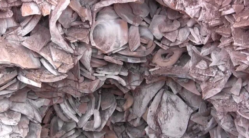
The broken Amphorae of monte testaccio in Rome
An immense mound overgrown with grass and small trees sits on the outskirts of Rome, near the Horrea Galbae, a short distance from the east bank of the River Tiber. It may seem to be just another hill, but it is actually an ancient landfill from the Roman era and one of the largest landfill of the ancient world.
It has a circumference of nearly a kilometre at its base covering an area of 20,000 square meters, and it stands 35 meters tall, though it was probably a lot higher in ancient times.
The hill is made entirely out of discarded Roman amphorae, a type of ceramic jar used to store olive oil. It has been estimated that the hill contains the remains of as many as 53 million olive oil amphorae, in which some 6 billion litres of oil were imported.
In ancient times, amphorae were the main containers used for transportation and storage of goods. They were massively produced because of their low cost and were usually recycled or destroyed once they reached their final destination.
Many amphorae were re-used to serve as drain pipes or flower pots, for instance. Broken amphorae were pounded into chips and mixed with concrete and widely used as a building material.
But the amphorae olive jars could not be recycled as they were too impregnated with oil which made them smelly and sticky. So they were dumped in landfills.

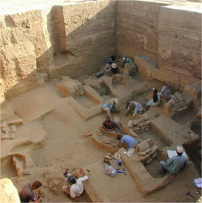
Monte Testaccio was not a haphazard waste dump, but a highly organized and carefully engineered refuse site. Excavations revealed that the mound had been raised as a series of level terraces with retaining walls made of nearly intact amphorae filled with shards to anchor them in place.

Empty amphorae were probably carried up the mound intact on the backs of donkeys or mules and then broken up on the spot, with the shards laid out in a stable pattern. Lime was then spread over the broken jars to neutralize the smell of rotting oil.
The huge numbers of broken amphorae at Monte Testaccio illustrate the enormous demand for oil of imperial Rome, which was at the time the world’s largest city with a population of at least one million people.
Many of the amphorae still have the maker’s seal and other stamped inscriptions which record information such as the weight of the oil contained in the vessel, the place where it was bottled, who weighted it and the names of the exporter.
Studies of these inscriptions and the hill’s composition suggest Rome’s imports of olive oil reached a peak towards the end of the 2nd century AD when as many as 130,000 amphorae were being deposited on the site each year. It has been estimated that Rome was importing at least 7.5 million litres of olive oil annually.