Royal Shipwreck From the 17th century Is discovered Off the Coast of England

Off the coast of England, a royal shipwreck has been unearthed. The Gloucester, one of the most renowned ships of the 17th century, sunk 340 years ago while transporting James Stuart, the future King of England.
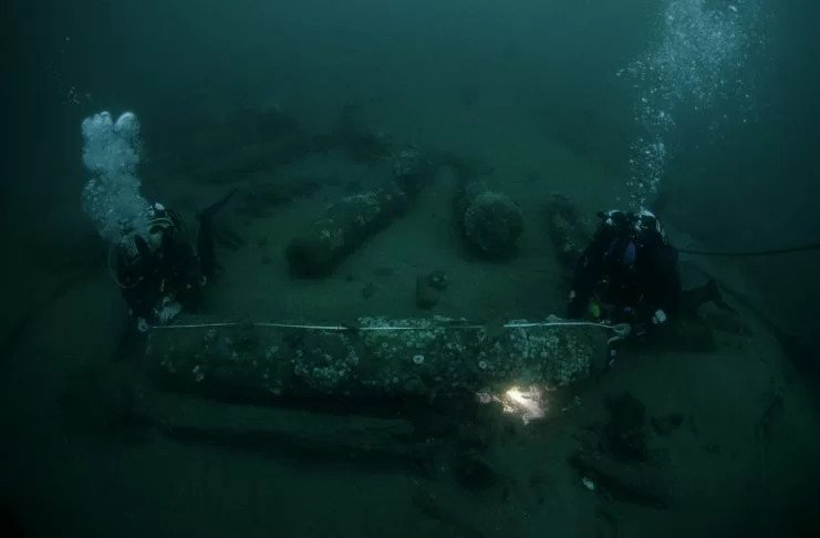
Since running aground on a sandbank on May 6, 1682, the wreck has lain half-buried on the seabed, its exact whereabouts unknown. It was found by brothers Julian and Lincoln Barnwell, with their friend James Little, after a four-year search. The discovery is described by University of East Anglia (UEA) maritime history expert Prof Claire Jowitt as the most important maritime discovery since the Mary Rose.
The wreck of one of the most famous ships of the 17thcentury – which sank 340 years ago while carrying the future King of England James Stuart – has been discovered off the coast of Norfolk in the UK, it can be revealed today. The Gloucester represents an important ‘almost’ moment in British political history: a royal shipwreck causing the very near-death of the Catholic heir to the Protestant throne – James Stuart, Duke of York and Albany – at a time of great political and religious tension. Now a major exhibition is planned for Spring 2023, the result of a partnership between the Barnwell brothers, Norfolk Museums Service, and academic partner UEA. Running from February to July at Norwich Castle Museum & Art Gallery, the exhibition will display finds from the wreck – including the bell that confirmed the ship’s identity – and share ongoing historical, scientific, and archaeological research.

Prof Jowitt, a world-leading authority on maritime cultural history, is a co-curator of the exhibition. “Because of the circumstances of its sinking, this can be claimed as the single most significant historic maritime discovery since the raising of the Mary Rose in 1982,” she said. “The discovery promises to fundamentally change the understanding of 17th-century social, maritime, and political history.
“It is an outstanding example of the underwater cultural heritage of national and international importance. A tragedy of considerable proportions in terms of loss of life, both privileged and ordinary, the full story of Gloucester’s last voyage and the impact of its aftermath needs re-telling, including its cultural and political importance, and legacy. We will also try to establish who else died and tell their stories, as the identities of a fraction of the victims are currently known.”
The Barnwell brothers are Norfolk-based printers, licensed divers and Honorary Fellows in the School of History at UEA. Lincoln said he was partly inspired to search for the wreck after watching the lifting of the Mary Rose on television as a child.
“It was our fourth dive season looking for Gloucester,” he said. “We were starting to believe that we were not going to find her, we’d dived so much and just found sand. On my descent to the seabed the first thing I spotted was large cannon laying on white sand, it was awe-inspiring and really beautiful.
“It instantly felt like a privilege to be there, it was so exciting. We were the only people in the world at that moment in time who knew where the wreck lay. That was special and I’ll never forget it. Our next job was to identify the site as the Gloucester.”

Julian added: “When we decided to search for the Gloucester we had no idea how significant she was in history. We had read that the Duke of York was onboard but that was it. We were confident it was the Gloucester, but there are other wreck sites out there with cannons, so it still needed to be confirmed.
“There is still a huge amount of knowledge to be gained from the wreck, which will benefit Norfolk and the nation. We hope this discovery and the stories that are uncovered will inform and inspire future generations.”
Lord Dannatt, Norfolk Deputy Lieutenant and longstanding resident of the county are lending his skills and support to the historic rescue project. As the former head of the British Army, he works with charities and organizations that have links to the armed services.
“This is going to be Norfolk’s Mary Rose,” said Lord Dannatt. “Julian and Lincoln have touched history, history that could have changed the course of this nation. It’s such an amazing story to tell. Our aim is to bring that story to life and to share it with as many people as possible.”

The Gloucester was commissioned in 1652, built at Limehouse in London, and launched in 1654. In 1682 it was selected to carry James Stuart – who later became King of England and King of Ireland as James II, and King of Scotland as James VII – to Edinburgh to collect his heavily pregnant wife and their households. The aim was to bring them back to King Charles II’s court in London in time, it was hoped, for the birth of a legitimate male heir.
The ship had set sail from Portsmouth with the Duke and his entourage joining it off Margate, having travelled by yacht from London. At 5.30 am on May 6, the Gloucester ran aground some 45km off Great Yarmouth following a dispute about navigating the treacherous Norfolk sandbanks. The Duke, a former Lord High Admiral, had argued with the pilot for control over the ship’s course. Within an hour the vessel sank with the loss of hundreds of the crew and passengers. The Duke barely survived, having delayed abandoning the ship until the last minute.
As well to the Duke of York, the Gloucester carried a number of prominent English and Scottish courtiers including John Churchill, later the 1st Duke of Marlborough. Diarist and naval administrator Samuel Pepys, who witnessed events from another ship in the fleet, wrote his own account – describing the harrowing experience for victims and survivors, with some picked up “half-dead” from the water.

Together with their late father Michael, and two friends including James Little, a former Royal Navy submariner, and diver, the Barnwell brothers found the wreck site in 2007, with the Gloucester, split down the keel and remains of the hull submerged in sand. The ship’s bell, manufactured in 1681, was later recovered, and in 2012 it was used by the Receiver of Wreck and Ministry of Defence to decisively identify the vessel.
Due to the time taken to confirm the identity of the ship and the need to protect an ‘at risk’ site, which lies in international waters, it is only now that its discovery can be made public. As well as the Receiver of Wreck and Ministry of Defence, the wreck has been declared to Historic England.
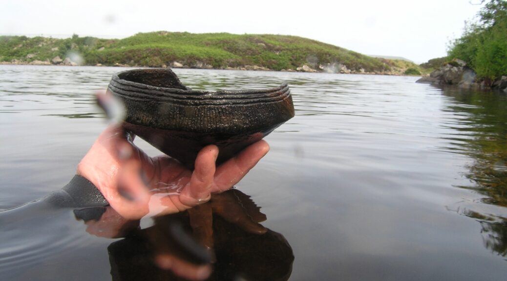
Following the discovery, the brothers completed an underwater archaeology course with the Nautical Archaeology Society. Artefacts rescued and conserved include clothes and shoes, navigational and other professional naval equipment, personal possessions, and many wine bottles.
One of the wine bottles bears a glass seal with iconography that connects it to a passenger onboard, Colonel George Legge, Master of Ordnance and Groom of the Bedchamber to the Duke of York. Legge was the son of Elizabeth Washington, and the Washington crest on the wine bottle, with its distinctive ‘stars and stripes’, links it and the ship to the most famous member of the family, George Washington, the first US President.
The accompanying historical research project, funded by the Leverhulme Trust and led by Prof Jowitt, will explore not only the failures of command at sea before the Gloucester sank but conspiracy theories about the tragedy’s causes and its political consequences. It is also hoped that UEA’s scientific expertise and facilities will be used to analyze some of the finds from the wreck.
The Ministry of Defence’s position is that all artefacts remain the property of the Ministry of Defence; however, where items are positively identified as personal property, ownership will then default to the Crown. Alongside UEA, Norfolk Museums Service, and the Barnwell brothers, foundational partners in the project are the Alan Boswell Group, Ministry of Defence, the National Museum of the Royal Navy in Portsmouth, York Archaeology, the Leverhulme Trust, and Maritime Archaeology Trust. The project is also being generously supported by Birketts LLP.
A new paper titled ‘The Last Voyage of the Gloucester (1682): The Politics of a Royal Shipwreck’ by Prof Claire Jowitt offers a comprehensive academic analysis of the disaster and its political implications and legacies. It is published in the journal English Historical Review on Friday, June 10.