A 1000-year-old silver hoard containing several beautiful torque-style neck rings, arm rings and coins has been discovered in Viggbyholm, Täby, outside Stockholm. “This is something you probably only experience once in a lifetime”, says Maria Lingström at The Archaeologists, National Historical Museums in Sweden.
A unique treasure hoard dating from the Viking Age has been uncovered in Täby, Stockholm. Consisting of arms rings, coins and eight torque-style neck rings.
The treasure was found during an archaeological excavation of a Viking Age settlement in Täby outside Stockholm, an area thought to have been inhabited for several hundred years.
The archaeologists have found more than 20 houses and buildings, the earliest dating from around 400 AD, continuing into the Viking Age (800–1050 AD) and early Middle Ages.
The treasure was buried under what was once a wooden floor in a building. The coins were deposited in a pouch made of linen, which together with the jewellery had been put into a small ceramic pot.
– When I started to carefully remove the neck rings one by one, I had this extraordinary feeling of “they just keep coming and coming”. In total there were eight high-quality torque-style neck rings, extraordinarily well preserved despite having been made and deposited almost a thousand years ago. They looked almost completely new, Maria Lingström says.
In addition to the neck rings, two arm rings, one ring, two pearls and 12 coin pendants (coins used as jewellery), were found in the ceramic pot.
Why the inhabitants chose to hide some of their most valuable objects and bury them in the ground, is at the moment unclear, but several theories exist.
– One common interpretation is that people hid and buried their treasures in difficult and tumultuous times. We have yet to see if that was the case here, archaeologist John Hamilton says.
The coins are a perfect example of the far-reaching connections and blossoming trade, which flourished in Viking Age Scandinavia. Several coins are of European origin, representing countries such as England, Bohemia and Bavaria. In addition, the treasure consisted of five Arabic coins, so-called dirhams.
One of the European coins is extremely rare and was minted in the city of Rouen, in Normandy, France. It dates to approximately the 10th Century AD.
According to Professor Jens Christian Moesgaard at Stockholm University, this type of coin has previously ever been identified from drawings in an 18th-century book.
The Archaeologists also found other objects, such as arrows, quernstones, and beautiful amulet rings, within the area. But the discovery of a silver treasure was somewhat unexpected.
– This is something you probably only experience once in a lifetime, says Maria Lingström.
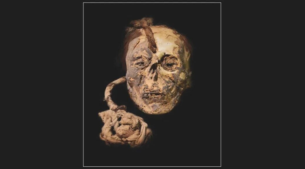
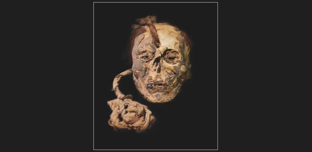
Ancient “Trophy Head” Child Was High On Psychedelic Cactus Before Ritual Sacrifice
A Nazca trophy head, once belonging to a child (who kinda looks like Elon Musk).
A child who had the honour of being made into a trophy head by the ancient Nazca culture of southern Peru was drugged up on a mescaline-containing cactus prior to being sacrificed, a new analysis has revealed.
The same study also found evidence of ayahuasca use among other mummified individuals from the Early Nazca Period – which ran from 100 BCE to 450 CE – and therefore provides the earliest archaeological evidence for the consumption of these two psychedelic plants.
Though the use of hallucinogenic substances was common throughout South America in pre-Columbian times, little is known about which concoctions were ritually consumed during the Early Nazca Period. To investigate, researchers analyzed hair samples from 22 individuals from three separate Nazca sites.
Famous for their incredible geoglyphs – known as the Nazca Lines – the Nazca were also prolific collectors of trophy heads. So far, about 150 such heads have been discovered, although scholars are unsure if these were removed from the shoulders of sacrificial victims or enemy warriors during battle.
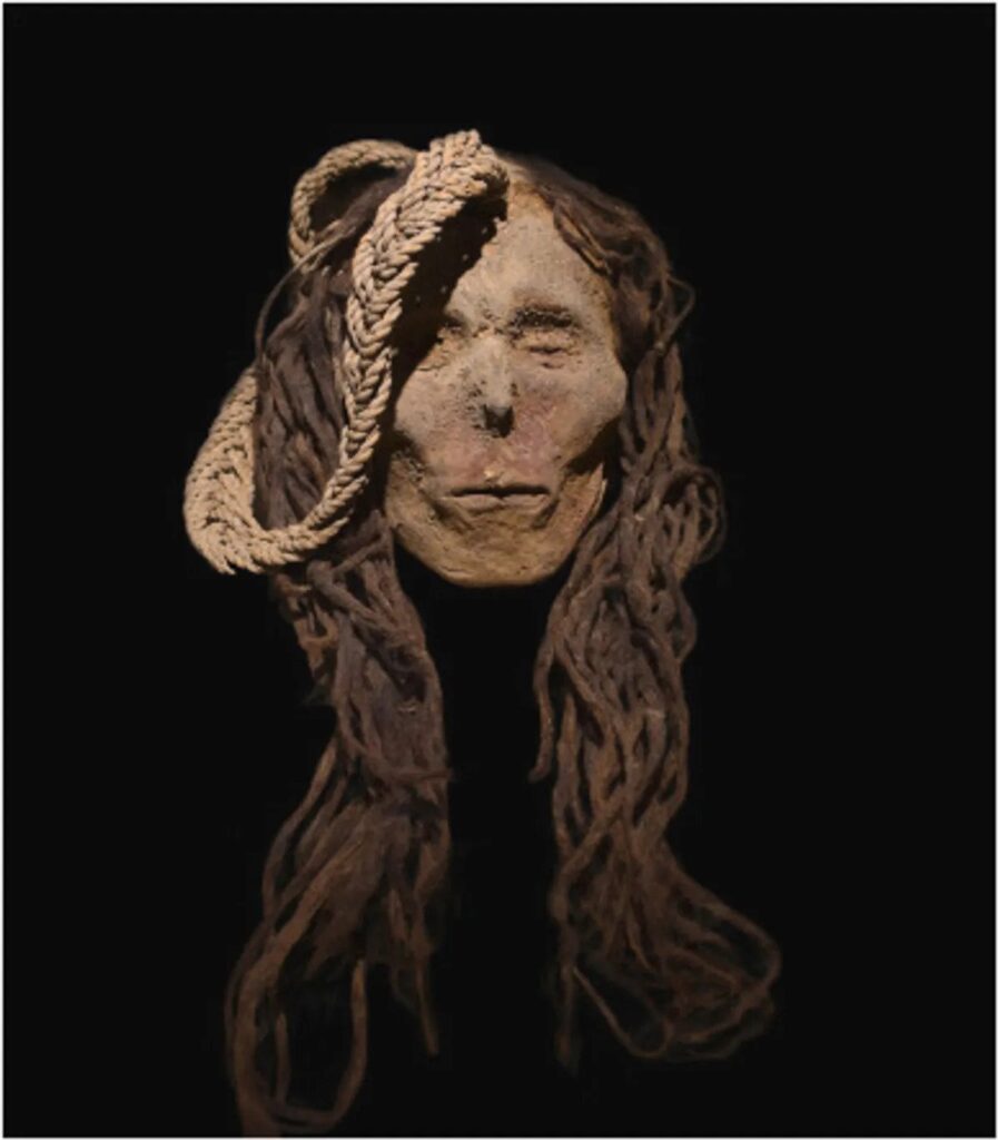
Among the 22 specimens assessed in the study were four trophy heads, including a child of unknown sex, an adult female and two adult males.
When conducting their analysis, the study authors searched for metabolites of the coca plant – such as cocaine and benzoylecgonine – as well as mescaline and other compounds found in the psychedelic Amazonian brew ayahuasca.
A Nazca trophy head belonging to a female victim.
Reporting their findings, the researchers explain that “the level of the mescaline in the child’s hair suggested a high consumption of the San Pedro cactus.” Named after Saint Peter – who holds the keys to heaven – San Pedro has been used as a sacrament by Indigenous Andean cultures for millennia. Interestingly, the psychedelic cactus is also known by its Quechua name “Huachuma”, which roughly translates as “removing the head”.
At the same time, the authors discovered that the female victim had chewed coca leaves, while neither of the adult male trophy heads showed any signs of drug use.
Based on these findings, the researchers speculate that the woman and child may have been ritually sacrificed before having their heads removed and that their consumption of coca and San Pedro might have formed part of the ceremony.
In contrast, the male heads may have been captured during warfare, thus explaining why these victims were not supplied with any substances before being dispatched.
This hypothesis is supported by evidence that the more recent Inca civilization gave ayahuasca to child sacrifice victims as an anti-depressant while they awaited their fate. However, as the study authors note, “this is the first proof that some of the victims transformed into trophy heads were given stimulants prior to their death.”
Turning their attention to the 18 remaining Nazca specimens, the researchers found ayahuasca compounds in the hair of two further individuals. Concentrations of these substances in the hair of one mummy “far exceeded any previously investigated ancient samples, suggesting a possible shamanistic occupation of this individual.”
Coca metabolites, meanwhile, were present in five samples, including a six-month infant who probably ingested the substance via its mother’s breastmilk.
Collectively, these findings represent the earliest evidence for the use of San Pedro and ayahuasca, while also confirming for the first time that coca leaves were present on the southern Peruvian coast during the Early Nazca Period.
Ancient Snail From 99 Million Years Ago Discovered With Hairs Growing on Shell
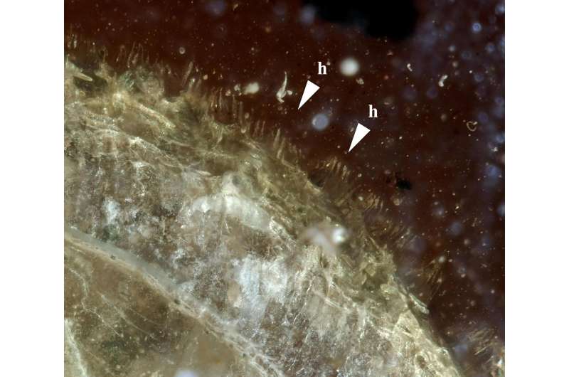
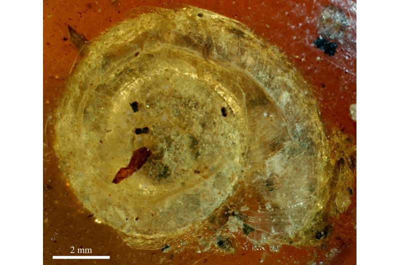
A snail preserved in amber with an intact fringe of tiny delicate bristles along its shell is helping biologists better understand why one of the world’s slimiest animals might evolve such a groovin’ hairstyle.
The 99-million-year-old amber contains the tiny snail.
This unusual mollusc fossil, found in the Hukawng Valley of Myanmar, has lines of stiff, miniscule hairs, each between 150 and 200 micrometres long, following the swirl of its 9-millimetre long, 3.1-millimetre high shell.
It’s not the first hairy snail discovered, either, joining an exclusive club of coifed gastropods.
“This is already the sixth species of hairy-shelled Cyclophoridae – a group of tropical land snails – found so far, embedded in Mesozoic amber, about 99 million years old,” explains University of Bern palaeontologist Adrienne Jochum.
They’re not just some weirdo extinct critters, either. Several land snails still living today also have fuzzy shells.
A modern-day hairy snail, Trichia hispida.
A team of researchers led by malacologist Jean-Michel Bichain from the Museum of Natural History and Ethnography in France named the newly discovered animal Archaeocyclotus brevivillosus – its species name combining the Latin words small (brevis) and shaggy (villōsus).
Out of eight species found in Myanmar amber, six have hairy shells, suggesting this may be the ancestral state of these land snails. In fact, this fuzz may have helped snails transition from a watery environment to life on land during the Mesozoic period 252 to 66 million years ago, the researchers suggest.
The hairs are formed from the outermost protein-filled layer of the snail’s shell – the shell’s skin – called the periostracum. Adding hairs to a shell would cost the tiny animals energy, so it must have given these minuscule prehistoric snails some sort of selective advantage in their tropical environment to make it worthwhile.
The edge of the snail shell is lined with tiny hairs.
Bichain and team speculate that these could have included water retention and protection against shell desiccation, allowing these animals to branch out into dryer soil niches. And just like our own mammalian hair, it’s possible the shell fuzz may have helped with thermoregulation.
“The bristles could also have served as camouflage or protected the snail against a direct attack by stalking birds or soil predators,” explains Jochum. “They may also have played a role in thermal regulation for the snail by allowing tiny water droplets to adhere to the shell, thereby serving as an ‘air conditioner’. And finally, it cannot be ruled out that the hairs provided an advantage in sexual selection.”
Archaeocyclotus brevivillosus.
As well as shaggy snails, Myanmar amber has conserved over two thousand unique species from delicate flowers to an exquisitely preserved feathered dinosaur tail, providing a stunning window into the biodiversity of the Cretaceous period.
Signs of ancient species from the tropics are hard to come by, given the warm, moist conditions are ideal for the disintegration and recycling of organic matter. So animals preserved in amber fill in some of these gaps in our fossil records, providing details on soft tissues and even the metallic colours of ancient insects, which would otherwise be lost to time.
One such specimen preserved what may be the first evidence of live births in land snails (rather than egg laying), with neonate snails still attached to their mother through mucus.
Sadly, while the amber does hold many precious exquisite specimens, trade in the fossils is currently funding devastating conflicts in Myanmar. In recognition of this awful problem, the researchers note the amber-encased snail specimen was collected legally in 2017 before the current conflicts resumed.
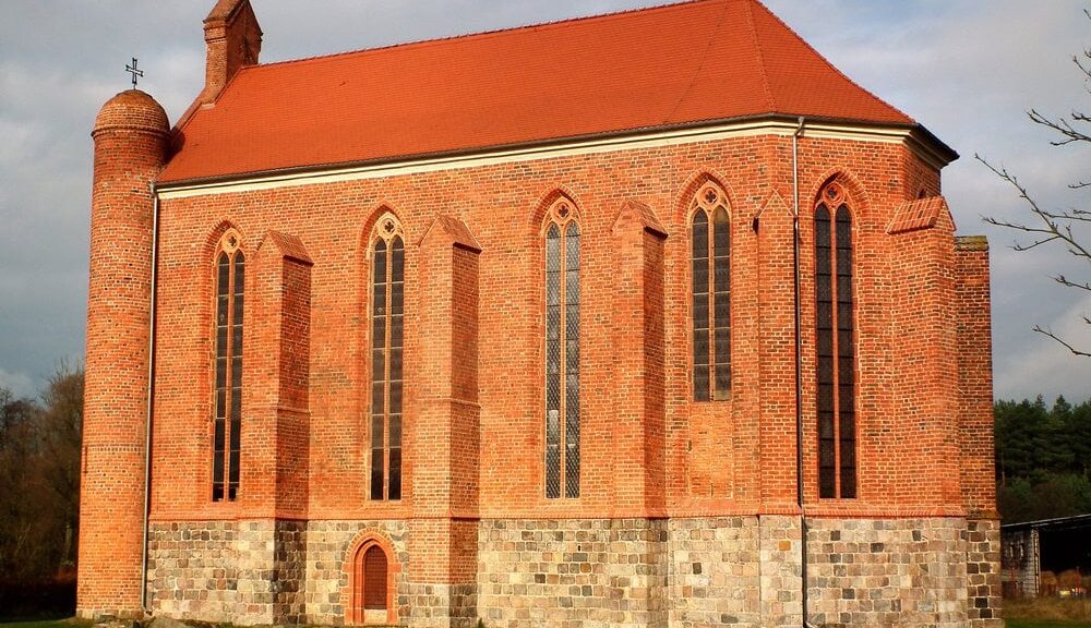
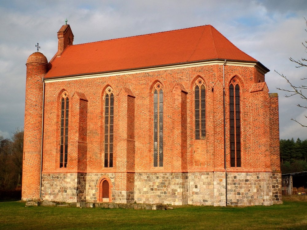
Crypts, Tunnel Discovered Beneath Knights Templar Chapel in Poland
The Knights Templar constructed the Saint Stanislaus chapel in the Polish village of Chwarszczany during the 13th century.
Around 1119, in the midst of Christian Crusades to wrest the Holy Land from Muslim control, a French knight named Hugues de Payens formed a small military order dedicated to defending pilgrims as they travelled from West to East.
Known today as the Knights Templar, the group (and various legends surrounding its history) has captured the public imagination for centuries.
As Patrick Masters, a film studies scholar at the University of Portsmouth, wrote for the Conversation in 2019, 13th-century epics and Dan Brown’s The Da Vinci Code alike link the order to the mythical Holy Grail—albeit with little supporting evidence.
Over the years, physical traces of the organization’s existence have yielded insights into its actual role in medieval society. In villages across the West Pomeranian region of Poland, for instance, 13th-century Gothic buildings created by the knights upon their return from the Holy Land testify to the order’s lasting influence.
Now, reports Małgosia Krakowska for CNN, an ongoing archaeological dig at a Knights Templar chapel in a remote Polish village of about 100 residents is offering up an array of exciting new discoveries.
Last fall, a research team using ground-penetrating radar (GPR) uncovered a number of crypts, as well as the possible remains of an underground passageway or tunnel, while conducting excavations at the chapel of Saint Stanislaus in Chwarszczany.
“According to legends and medieval documents, there was a well in the vicinity of the chapel,” Przemysław Kołosowski, the lead archaeologist working on the site, tells CNN. “Rumor has it that the well served as an entrance to a secret tunnel. This still requires an exhaustive archaeological investigation.”
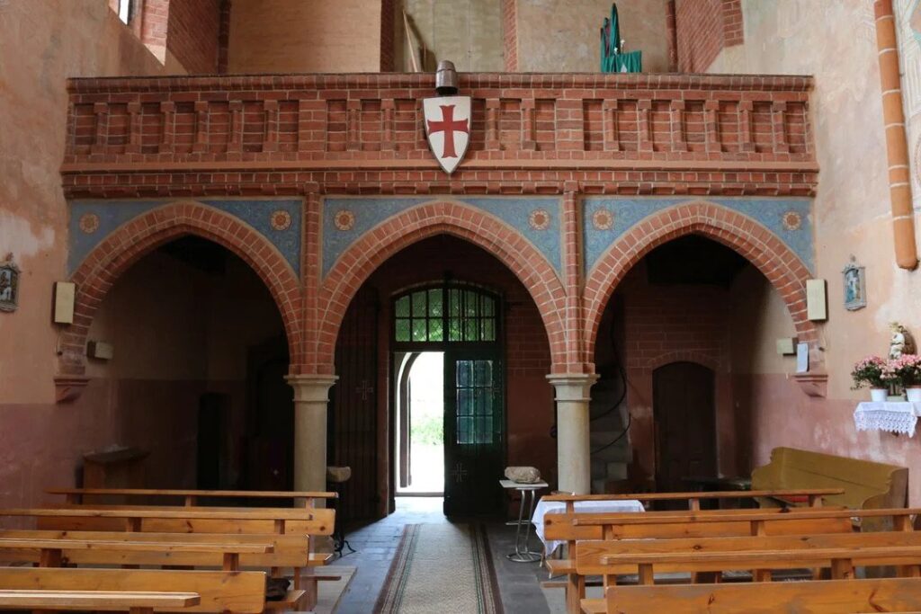
Interior of the chapel of St. Stanislaus.
As Jakub Pikulik reported for the Polish newspaper Gazeta Lubuska last year, renovations and archaeological work at the site have been ongoing since 2004. Kołosowski’s team commenced work in July 2019, scanning the chapel and surrounding fields with the help of a hundred or so volunteers.
An excavation expected to unearth a medieval fortress yielded no substantial findings from the period. But archaeologists did discover centuries-old cobblestones, the walls of an 18th-century distillery, Bronze Age pottery and iron nails, and a 1757 coin likely left behind by Russian troops stationed nearby during the Seven Years’ War.
Inside the chapel, archaeologists investigating a small depression beneath the stone floors found seven vaulted crypts.
As Per a statement from OKM, the German manufacturer of the GPR technology used by the researchers, these underground crypts “cannot be dated back to Templar times.” Instead, Gazeta Lubuska notes, the crypts were likely constructed later, only to be emptied during renovations in the second half of the 19th century.
Built on the site of an older Romanesque temple in the second half of the 13th century, the red-brick Chwarszczany chapel was “both a place of worship and a defensive fortification,” according to Sarah Cascone of artnet News.
At the time, the Knights Templar wielded significant power in western Poland, local historian Marek Karolczak tells CNN.
“Back in those days, the appearance of Knights Templar on this soil was a popular trend,” Karolczak explains. “This is the time of the Crusades. Local rulers wanted to strengthen their power by inviting military orders to settle on their land and build commanderies.”
Because the Knights Templar were protected by the pope, they “enjoy[ed] papal privileges, tax breaks and lavish donations while also accruing legendary status,” reports CNN. But the group’s luck changed in the early 14th century, when Philip IV of France ordered members’ arrest, perhaps out of a desire to seize their vast wealth or assert his political dominance over the papacy, writes Mark Cartwright for Ancient History Encyclopedia.
Those arrested were tortured into giving false confessions of homosexuality and sacrilege, and in 1312, Pope Clement V officially disbanded the religious order.
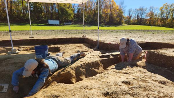
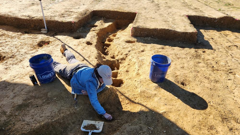
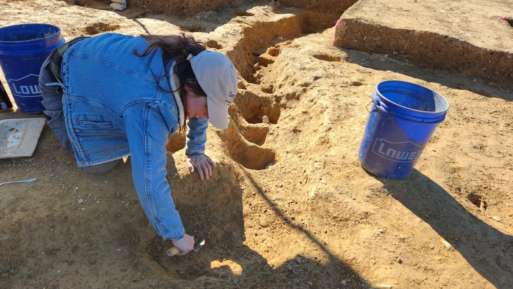
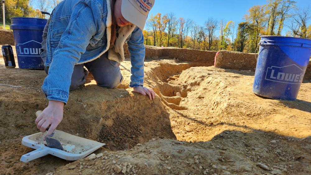
Revolutionary War Prison Camp Found in Pennsylvania
In this photo provided by John Crawmer, Jane C. Skinner and Samantha Muscella excavate post holes at the bottom of a stockade trench, Thursday, Oct. 27, 2022, in York, Pa. Researchers say they have solved a decades-old riddle by finding remnants of the stockade and therefore the site of a prison camp in York, that housed British soldiers for nearly two years during the American Revolutionary War.
Researchers say they solved a decades-old riddle this week by finding remnants of the stockade and therefore the site of a prison camp in York, Pennsylvania, that housed British soldiers for nearly two years during the American Revolutionary War.
The location of Camp Security was thought to have been on land acquired by the local government nearly a decade ago. On Monday, an archaeological team working there located what they believe to be the prison camp’s exterior security fence.
The camp housed more than 1,000 English, Scottish and Canadian privates and noncommissioned officers for 22 months during the war, starting with a group of prisoners who arrived in 1781, four years after their surrender at Saratoga, New York. By the next year, there were some 1,200 men at the camp, along with hundreds of women and children.
In this photo provided by John Crawmer, Jane C. Skinner excavates post holes at the bottom of a stockade trench, Thursday, Oct. 27, 2022, in York, Pa. Researchers say they have solved a decades-old riddle by finding remnants of the stockade and therefore the site of a prison camp in York, that housed British soldiers for nearly two years during the American Revolutionary War.
Fieldwork at the site, which also includes the lower-security Camp Indulgence, has gone on for decades, but the exact spot of Camp Security — where prisoners from the 1781 Battle of Yorktown, Virginia, were kept — had been unknown until a telltale pattern of post holes in a foot-deep trench was uncovered.
“This has been a long project, and to finally see it come to fruition, or at least know you’re not nuts, that’s wonderful,” said Carol Tanzola, who as president of Friends of Camp Security led fundraising for the project.
Lead archaeologist John Crawmer said the location site had been narrowed down after about 28 acres (11 hectares) were ploughed for metal detection and surface collection of artefacts in 2020. That further reduced the search area to about 8 acres (3 hectares), where long exploratory trenches were dug last year.
Those trenches helped the team identify post holes that in turn led to the pattern of holes and a stockade trench that matched stockades at other 18th-century military sites, Crawmer said.
Next spring, Crawmer and other researchers hope to determine the full size of the stockade and perform a focused search for artefacts within and around it.
“Was it circular or square, what’s inside, what’s outside?” Crawmer said. “As we do that, we’re going to start finding those 18th-century artefacts, the trash pits. We’ll be able to start answering questions about where people were sleeping, where they were living, where they were throwing things away, where the privies are.”
Crawmer said there is evidence the vertical posts that formed the security stockade were not in the ground for very long and that they may have been dug up and reused after the camp was closed in 1783.
A contemporaneous account of camp life by a British surgeon’s mate said there was a “camp fever” that might have killed some of the prisoners, and a list of Camp Security inmates was located in the British National Archives. No human remains have been found at the site.
Historians confirmed local lore about the general location of Camp Security and Camp Indulgence after a 1979 archaeological study of a small portion of the property produced buckles, buttons and other items associated with British soldiers of the period. That survey also found 20 coins and 605 straight pins that may have been used by prisoners to make lace.
Large-Scale Trade in Herring Dates to the Viking Age
Lane Atmore has spent weeks and months in the lab extracting DNA from tiny herring bones like this.
Historians have believed extensive herring trade started around the year 1200 AD, later controlled by the Hanseatic League. Now, a new study shows that it was already established in the Viking Age.
“We found that this trade existed already around 800 AD, 400 years earlier, which really pushes back this extensive fishing,” says Doctoral Research Fellow Lane Atmore at the University of Oslo.
She is the first author of the study, published today in PNAS, which shows that herring bones from western populations around Sweden and Denmark were found as far east in the Baltic as Truso in today´s Poland. Truso is known as an important Viking Age trade port.
“In the genetic signature from these bones, we found that the fishes were adapted to higher salinity than you find in the central Baltic. This means they were coming from around Kattegat, and then they were being shipped into the eastern Baltic,” Atmore says.
The lower salinity of The Baltic Sea means that herring from the population in Kattegat will have a hard time adapting to the waters further east.
“That high salinity adapted fish are never found that far in,” Atmore says.
More difficult to trade
Her co-author, Associate Professor Bastiaan Star, has previously studied cod trade in the same area.
“Earlier we have seen that cod from the trading place Hedeby in what is now Germany had travelled all the way from northern Norway. Our new study shows that it was not just cod. It was also herring, a fish that technologically is much more difficult to trade,” Star says.
Atlantic herring (Clupea harengus) is a much fattier fish than cod and not easy to store, let alone trade if you don’t have the right technology.
“If you don’t cure it with salt or smoke, it will go bad very quickly. You need access to salt and wood so that you can cure it and then ship it. You need to have extensive trade networks and to catch enough fish if it´s going to be worth the investment,” Atmore says.
“I think that fish was traded over greater distances than previously anticipated. We can now pin down this date because these bones are absolutely dated between 800 and 850,” Star says.
“We can´t prove that it was the Vikings who brought the herring from one place to the next, but we know that we have herring bone from a site where Vikings were trading,” Atmore says.
Biology and archaeology
Atmore and Star are both biologists. In this study, they have worked closely with archaeologists. One of them is Professor James H. Barrett at NTNU University Museum.
“The herring industry of the Baltic Sea supported one of the most important trades in medieval Europe,” Barrett says.
“By combining the genetic study of archaeological and modern samples of herring bone, one can discover the earliest known evidence for the growth of long-range trade in herring, from comparatively saline waters of the western Baltic to the Viking Age trading site of Truso in north-east Poland,” Barrett says.
The study also reveals what has happened to the herring populations in more recent times.
“The economic and political ramifications of the herring industry are well-charted, but its ecological impacts have been much debated,” Barrett says.
Spring spawners and autumn spawners
The different populations of herring have their own spawning grounds, hence their adaptation to different levels of salinity. Populations also differ in spawning season.
“There are two major populations that spread across all Atlantic herring. One spawns in the springtime, and one spawns in the autumn. These populations spawn in unique locations and in different seasons, so they don’t interbreed much. This means they are genetically different from each other,” Atmore explains.
She is now able to identify where these fish are coming from to see how populations grow and decline, and how this is impacted by the fishing industry.
“We found that earlier in the historical record, starting around 800, you get more fish in these archaeological sites that come from the autumn spawning population in the western Baltic. This is a population that was targeted by a famous fishery around 1200,” Atmore says.
Collapsed 100 years ago
In more recent times it was the opposite.
“They were then targeting the autumn spawners and this population collapsed in the 1920s. In the Baltic now commercial catches are 90% spring spawners,” Atmore says.
“It´s not that the autumn spawners entirely disappear in the Baltic. It is more that they are not commercially interesting anymore. They are still there, but not in the numbers we were used to,” Star says.
He is not in doubt that the fishing industry had a major impact on the herring populations.
“There is a consistent pattern with over exploitation that takes place over centuries,” Star says.
“Our results provide a new and persuasive way to test the archaeological hypothesis that human impacts on super-abundant European marine fish started already in the Middle Ages, and that different herring stocks were targeted sequentially through time,” Barrett says.
This also means that the ecology of the Baltic Sea has shifted. Autumn spawners spawn in a different place at a different season.
“They are also bigger than the spring spawners and they eat slightly different food. When the population of autumn spawners goes far down in size, the ecology is going to change,” Atmore says.
“The Baltic Sea is much more confined compared to the North Sea. Some of the impacts that humans or climate may have, is amplified in such a small system,” says Star.
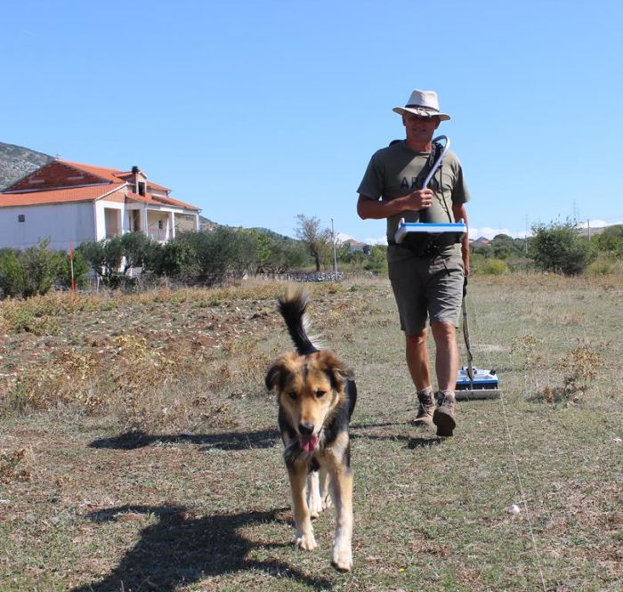
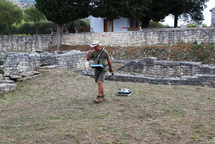
The ancient building has massive walls and a rectangular outline (approx. 20 x 10 m). Georadar images show the frame of the entrance, according to scientists most likely in the form of relics of a colonnade.
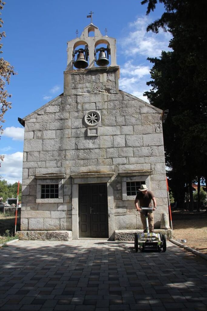
The foundations were discovered under and next to the Church of St. Daniel in the village of Danilo near Šibenik, the former Roman city of Ridit.
Although archaeologists have been finding numerous architectural elements and decorations from the monumental Roman sacral building until now its location was unknown.
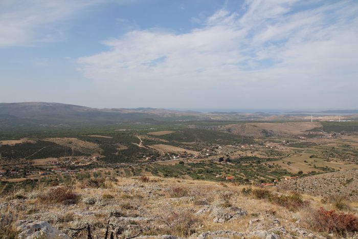
View of the valley where the village of Danilo is currently located, in ancient times it was the city of Ridit/Municipium Riditarum.
Georadar surveyed the church in Danilo, under which relics of the Roman sacral building were discovered.
Polish research leader, Professor Fabian Welc from the Institute of Archaeology of the Cardinal Stefan Wyszyński University in Warsaw, said: “The data we have collected indicate that under today’s church and the adjacent cemetery there are relics of a temple, which was part of the forum, the most important part of a Roman city.”
Georadar survey in the area around the Danilo cemetery.
He added that the forum was the centre of the social and economic life of the inhabitants of every Roman municipium (city). This forum was located at the intersection of the main communication arteries and was also the central point in the city. In addition to the temple, it was the location of the most important public buildings of cities, such as courts or municipal offices. The forum was additionally decorated with monuments or triumphal arches.
Georadar survey in Danilo.
Next year, scientists plan to conduct archaeological research near the church to verify the findings of geophysical surveys. It is known that the current 18th-century church was built on the foundations of an earlier, small Romanesque Christian temple. Under it – according to the latest research – was the oldest, Roman temple.
The LIDAR aerial scanning technology was also helpful in locating the temple. It enables a very thorough analysis of the terrain and makes it possible to detect the remains of former architecture, very weakly outlined on the surface.
According to the scientists, not only the church was built on the ruins of the former temple. The nearby cemetery, which functioned from the 9th to the 15th century, was also partly located within its original range. Next to it were other buildings surrounding the forum.
Some of the medieval graves were dug directly into the relics of the Roman baths along with the adjacent vast building with a central courtyard and a portico surrounded by numerous rooms.
Professor Welc said: “This means that the extensive medieval cemetery was founded directly on the relics of Roman buildings.”
The Croatian project coordinator, Dr. Ana Konestra added that thanks to large-scale geophysical surveying and analysis of the ALS model, a number of other Roman buildings were identified around the modern-day cemetery in Danilo. According to the archaeologists, they were mainly residential and utility buildings.
Reconstruction of a building with a courtyard made by Professor Fabian Welc.
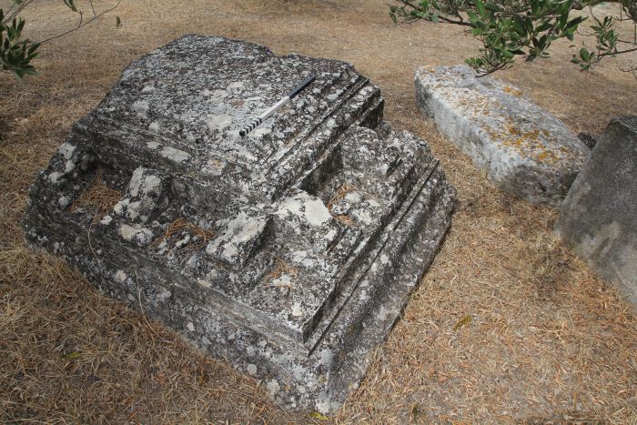
Even before the recent surveys, there were suspicions concerning the location of the forum within the area of the cemetery, because reused fragments of monumental architectural decorations and a large column were discovered in the stone walls surrounding medieval graves.
Professor Welc said: “The very size of these elements indicated that somewhere near the cemetery there had to be a large, monumental building, which had to be part of a complex of buildings surrounding the city forum. However, previous excavations did not allow us to determine its location.”
Archaeologists have been conducting research in Danilo for over 70 years.
The first extensive work was associated with the construction of the water pipeline. It brought finds in the form of hundreds of Roman inscriptions, some of which mentioned Municipium Riditarum, an enigmatic city founded somewhere in Danilo by the local community of the romanised Ridit tribe.
A fragment of an ornamented monumental beaming of the Roman temple was unearthed in the 1950s in the medieval cemetery near the church in Danilo.
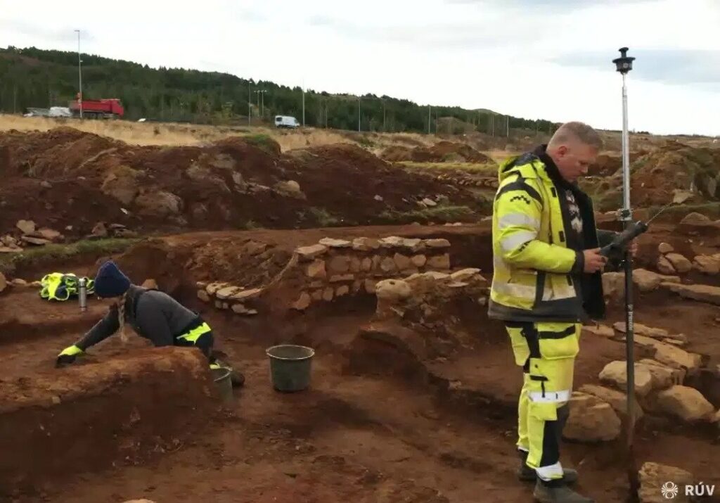
19th-Century Farmer’s Cottage Uncovered in Iceland
Archaeologists have unearthed a cottage near Úlfarsfell, a mountain and popular walking area between Reykjavík and Mosfellsbær. The discovery was made during exploratory excavations made preceding the construction of the shopping centre.
According to Icelandic law, an archaeological investigation must be conducted before construction and any finds registered with the Cultural Heritage Agency of Iceland.
The cottage in question, called Hamrahlíð, was found to have been inhabited from around 1850 to 1920.
Among the everyday objects found to include a knife, pottery, plates, cups, glass bottles, and some agricultural tools.
An archaeologist from Antikva ehf., the contractor responsible for the excavation, stated to RÚV that: “We’ve found cooking pits, so people were cooking something here or working with food.
We don’t have any mounds or any built-up fireplaces, but we do have these holes. In one, which is 35 cm deep, we have at least six layers of moss with burnt bones and charcoal. It can be seen very clearly on the floors that they busied themselves around this area.”
Hermann Jakob Hjartarson, the archaeologist at Antikva, has stated that relatively few studies of such small cottages have been carried out. He started to RÚV, “undoubtedly, I think that this is still just one part of a bigger story. Most people here at that time were just cottage farmers.”