Site of 18th-Century Steam Engine Uncovered in Slovakia
In recent day’s Nová Baňa, approximately 40 volunteers have worked under the expert supervision of archeologists to unleash a special Potter atmospheric steam engine, the first one of its kind on the continent of Europe.

In the Althandel shaft, the atmospheric steam engine was built and was used in the 18th century. Enthusiasts from the mining group Novobanský had decided a while ago to reveal this treasure to the public, hidden in the garden of one house.
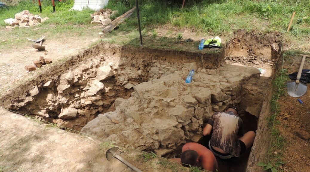
Matej Styk, an expert assistant from the Department of Archaeology of the Constantine the Philosopher University in Nitra, said that two-week research followed last year’s findings of the archaeologists. Its aim was to research the discovered construction and the discovered features, proving mining activity in the 18th century.
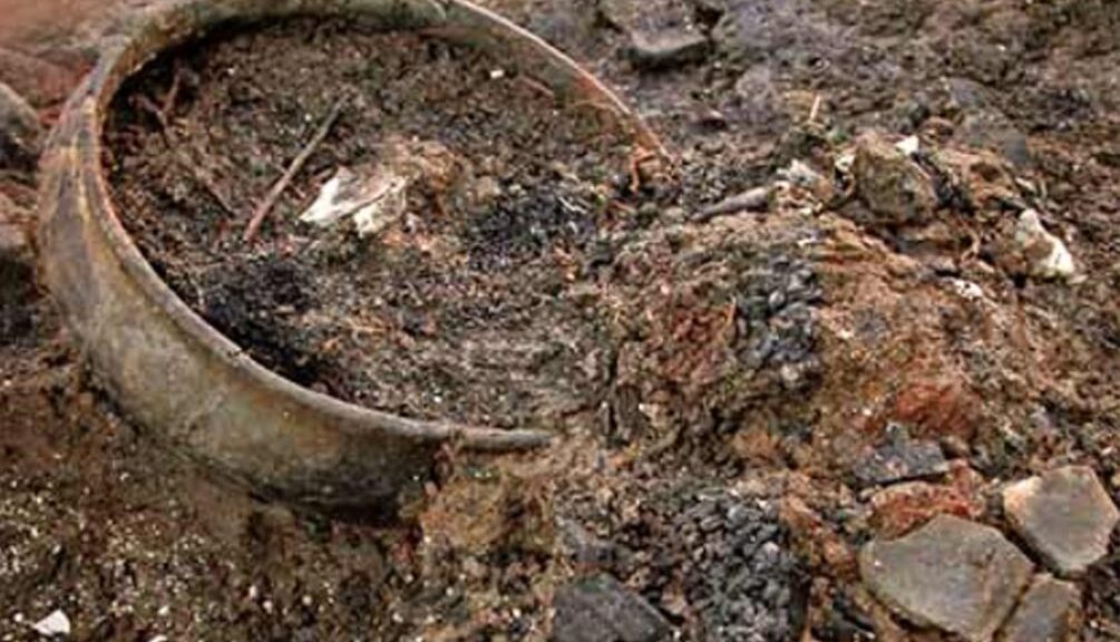
“In two weeks, we succeeded in uncovering the entire measurement of the Potter engine room, about eight and 14 meters,” he said, as quoted by the TASR newswire. He added that the masonry is compact, undamaged, located about 30 to 40 centimeters under the ground surface.
Bigger than anticipated
Thanks to research, they can prove that activities were ongoing not only in the 18th but also in the 19th century. In the interior of the engine room, the bases of another construction were found, about which there was no knowledge until now.
“There were many tiles from a stove inside,” Styk noted for TASR. “We think that the building was wooden. It has a stone foundation wall and inside another production activity was ongoing.”
Styk noted that the measures of the engine room itself were surprising. The building was bigger than they anticipated.
They succeeded in finding several interesting objects during the research, a mining button from probably the 19th century, a pipe or various iron nails, and components.
Mining failed
The steam engine served to drainage of water from mine. The head of the Slovak mining archive in Banská Štiavnica, Peter Konečný, said that it was built by Isaac Potter in the Althandel shaft in the years 1721-1722.
“Isaac Potter operated this machine alongside his colleagues within the mining industry, which received the right to mine local ores,” Konečný noted, as quoted by TASR.
However, mining was not successful, over in a few years and the machine put out of the operation, Konečný said. Potter remained for several years, but the state, which paid the construction, offered the opportunity to shift it to another private miner, to Hodruša.
“There we lost its traces because the supposed shift to Banská Štiavnica did not happen,” said Konečný for TASR, adding that this assumption is not proven.
The remains of the unique machine should be accessible to the public in the future. The association would like to build an open-air folk museum at the site. They succeeded in persuading the municipality in purchasing the house with the garden where the engine room was discovered.
Museum and replica planned
The head of the association, Zoltán Vén, said that the original owners did not have a clue as to the treasure in the ground. The association was behind the finding, which discovered it inaccessible documents.
Vén noted that they have big plans with the compound. They would like to build a replica of the machine and they have some ideas on how to use the house as well. It should be the headquarters of the mining association and a museum exhibition.
Vén said that last year, British Ambassador Andrew Garth, who is leaving Bratislava at the end of July, also visited the place.
“We would like to have contact with him to be able to go to the UK, as they have one museum piece working. We would like to see it,” Vén summed up, as quoted by TASR.