Earth has Another Continent Called Zealandia – Only 6% of it is Above Water

About 3,500 feet under the south Pacific waves sits a lost eighth continent.
In 2017, scientists reported that the underwater landmass known as Zealandia was a different continent. However, they hadn’t been able to trace it in its entirety before now. GNS Science in New Zealand revealed that they had created an unparalleled map of the continent’s shape and scale. Users could digitally navigate the continent by using their maps on an interactive website.
“We’ve made these maps to provide an accurate, complete, and up-to-date picture of the geology of the New Zealand and southwest Pacific area — better than we have had before,” Nick Mortimer, who led the work, said in a statement.
Mortimer and his colleagues mapped the bathymetry surrounding Zealandia — the shape and depth of the ocean floor — as well as its tectonic profile, showing where Zealandia falls across tectonic-plate boundaries.
The maps reveal new information about how Zealandia formed before it became submerged underwater millions of years ago.
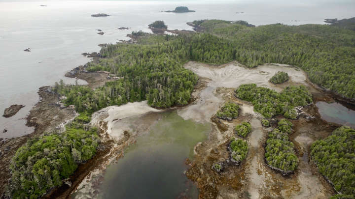
An underwater continent nearly 2 million square miles in size
Zealandia’s area is nearly 2 million square miles (5 million square kilometres) — about half the size of Australia.
But only 6% of the continent is above sea level. That part underpins New Zealand’s north and south islands and the island of New Caledonia. The rest is underwater, which makes Zealandia challenging to survey. To better understand the submerged continent, Mortimer and his team mapped both Zealandia and the ocean floor around it. The bathymetric map they created (below) shows how high the continent’s mountains and ridge rise toward the water’s surface.

It also depicts coastlines, territorial limits, and the names of major undersea features. The map is part of a global initiative to map the planet’s entire ocean floor by 2030.
The second map the GNS scientists made (below) reveals the types of crust that make up the underwater continent, how old that crust is, and major faults. The continental crust — the older, thicker kind of Earth’s crust that forms landmasses — is shown in red, orange, yellow, and brown. The oceanic crust, which is generally younger, is in blue. Red triangles show where volcanoes are.

This map also reveals where Zealandia sits across various tectonic plates, which of those plates are being pushed under the other in a process known as subduction, and how quickly that movement is happening. Studying the tectonic machinations that underpin Zealandia today can reveal clues about how the continent formed in the first place.
Zealandia’s 85 million-year-old origins
The concept of Zealandia is 25 years old. Geophysicist Bruce Luyendyk coined the term in 1995.
Luyendyk previously told Business Insider that he never intended for the term to describe a new continent. Rather, the name originally referred to New Zealand and a collection of submerged chunks of crust that broke off the ancient supercontinent Gondwana about 85 million years ago.
“The reason I came up with this term is out of convenience,” Luyendyk said. “They’re pieces of the same thing when you look at Gondwana. So I thought, ‘Why do you keep naming this collection of pieces as different things?'”
Gondwana formed when Earth’s ancient supercontinent, Pangea, split into two fragments. Laurasia in the north became Europe, Asia, and North America. Gondwana in the south dispersed to form modern-day Africa, Antarctica, South America, and Australia.

Geologic forces continued to rearrange these landmasses, and Zealandia was forced under the waves about 30 million to 50 million years after it broke off Gondwana as the largest tectonic plate — the Pacific Plate — slowly subducted beneath it.
These maps show Zealandia is a continent like the other 7
Until 2017, Zealandia was classified as a “microcontinent,” as the island of Madagascar. But according to Mortimer, Zealandia ticks all the boxes for continent status: It has clearly defined boundaries, occupies an area greater than 386,000 square miles (1 million square kilometres), is elevated above the surrounding ocean crust, and has a continental crust thicker than that oceanic crust.
These new maps, therefore, offer further evidence that the underwater landmass should be considered the eighth continent, Mortimer added.
“If we could pull the plug on the world’s oceans, it would be quite clear that Zealandia stands out,” he told Science News in 2017, adding, “If it wasn’t for the ocean level, long ago we’d have recognized Zealandia for what it was — a continent.”