Headless Skeletons Uncovered at Neolithic Site in Slovakia

Headless Skeletons Uncovered at Neolithic Site in Slovakia

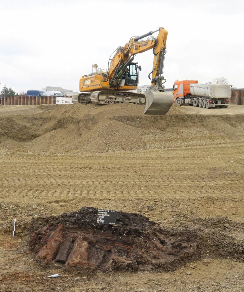
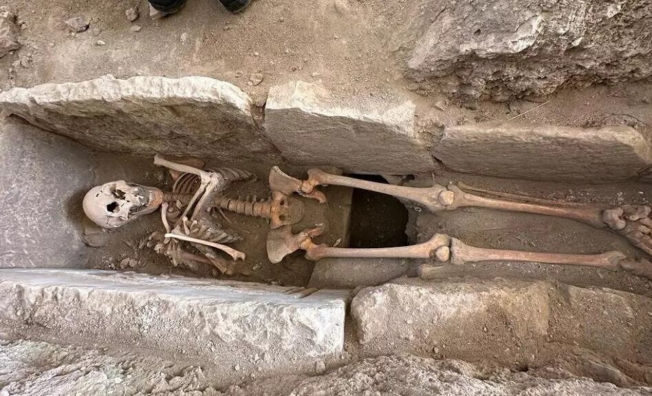
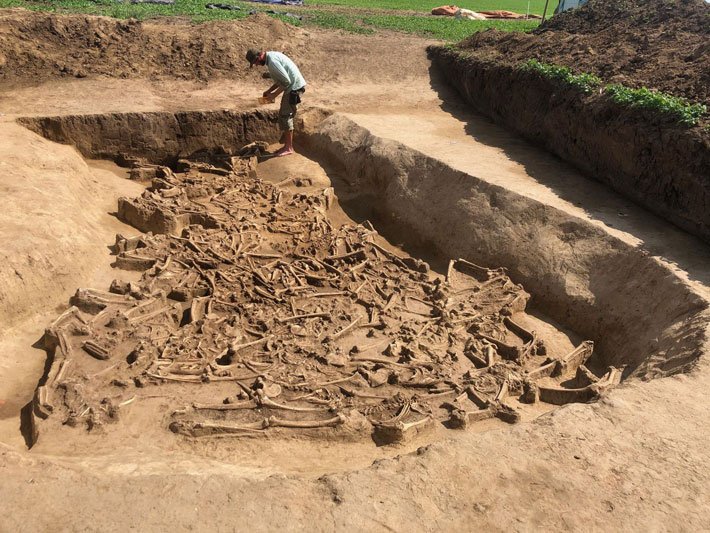
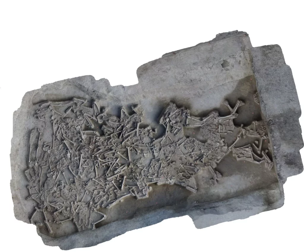
During last year’s excavation in Vráble, Slovakia, archaeologists from the Collaborative Research Centre (CRC) 1266 of Kiel University (CAU) and the Archaeological Institute of the Slovak Academy of Sciences (Nitra) came across a spectacular find: The remains of 38 individuals were found in a ditch surrounding the settlement. Their well-preserved skeletons were jumbled together and all of them were missing their heads, with the exception of a young child. How, when, and why these people’s heads were removed are central questions for future investigations. Already last year, the team had uncovered headless skeletons there.

Headless Skeletons Uncovered at Neolithic Site in Slovakia
37 skeletons without heads; here are two of them lying on their fronts. How, when, and why the heads were removed is still unclear to the scientists.
The skeletons lay jumbled and in different positions on an area of 15 square metres.
The site of Vráble-Ve`lke Lehemby comprised three neighbouring villages in the Neolithic period. The skeletons were found in the ditches surrounding the south-western settlement.

“We assumed to find more human skeletons, but this exceeded all imaginations,” reports project leader Prof. Dr Martin Furholt.

An important Neolithic settlement site

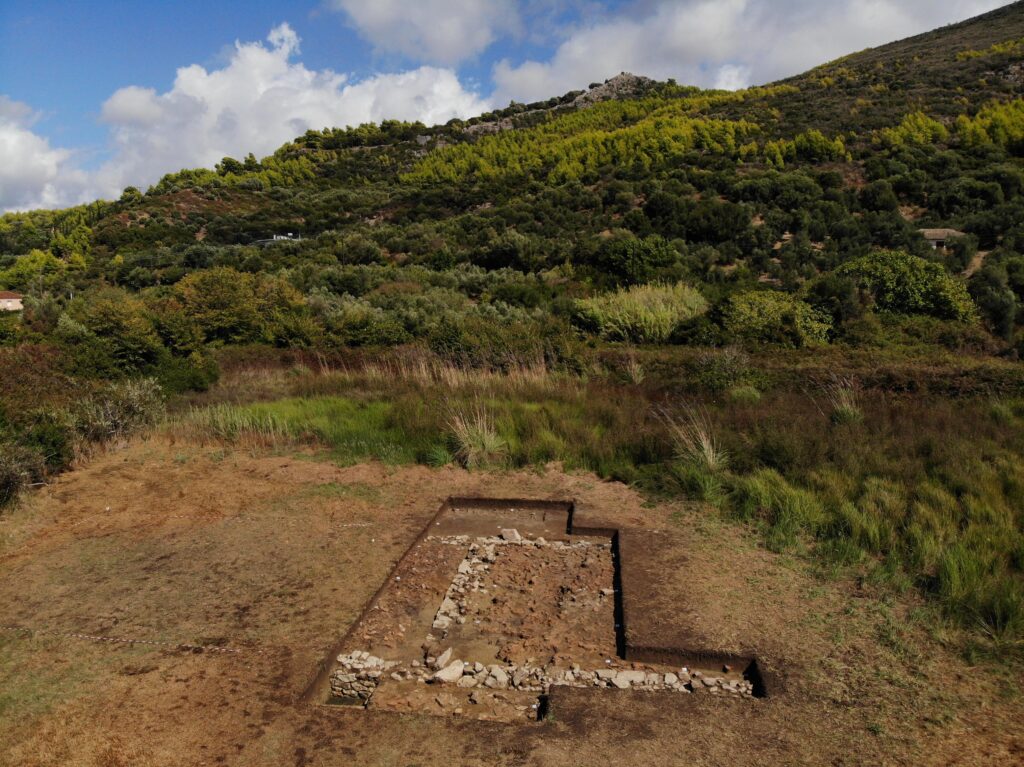
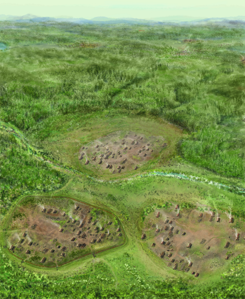
The site of Vráble-Ve`lke Lehemby (5,250-4,950 BCE) was one of the largest settlement sites of the Early Neolithic in Central Europe and has been a research focus of the CRC 1266 for several years.

The archaeological artefacts are associated with the Linear Pottery Culture (LBK). 313 houses in three neighbouring villages were identified by geomagnetic measurements. Up to 80 houses were inhabited at the same time – an exceptional population density for this period.

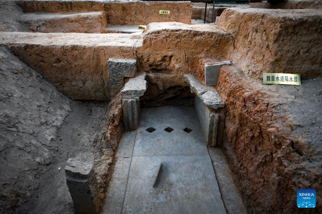
The south-western of the three settlements was surrounded by a 1.3 km-long double ditch and thus separated from the others. Some areas were reinforced with palisades, which should not be interpreted as a defensive structure, but rather as a boundary marking of the village area.

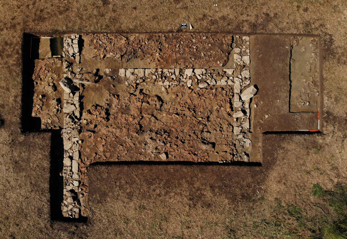
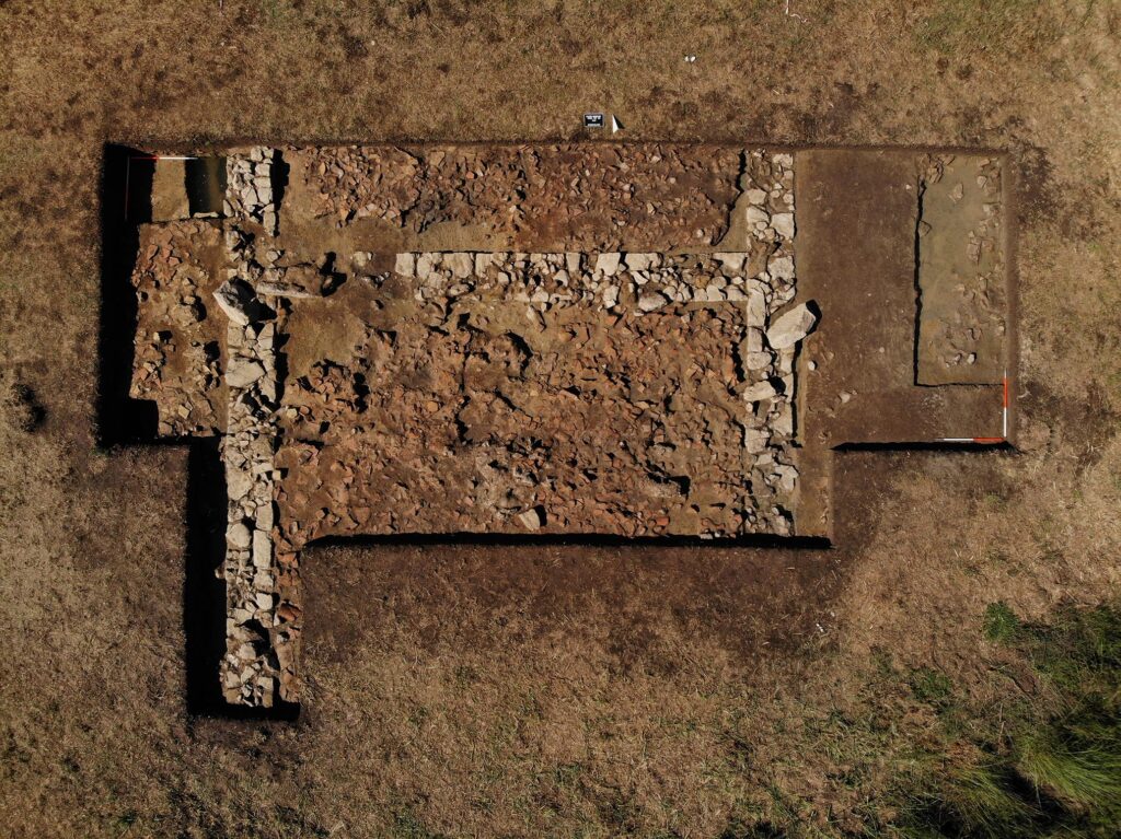
During the excavations in the summer of 2022, the Slovak-German team uncovered the remains of at least 38 individuals, spread over an area of about 15 square metres.

One on top of the other, side by side, stretched out on their stomachs, crouched on their sides, on their backs with their limbs splayed out – the position of the skeletons does not suggest that the dead were carefully buried. Rather, the positions suggest that most of them were thrown or rolled into the ditch.

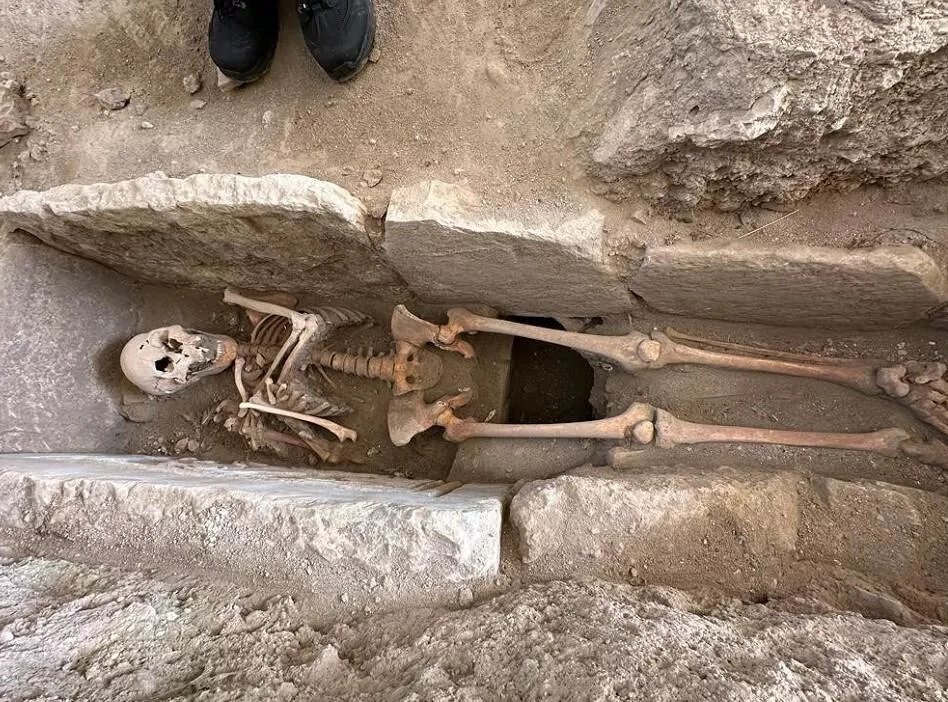
All of them, with the exception of one infant, are missing their heads, including their lower jaws. “In mass graves with an unclear positioning, the identification of an individual is usually based on the skull, so for us this year’s find represents a particularly challenging excavation situation,” says Martin Furholt.

Massacre, head-hunters, or peaceful skull cult: Many unanswered questions

While the skeletons were being recovered, the first questions began to arise: Were these people killed violently, perhaps even decapitated? How and when were the heads removed? Or did the removal of the heads take place only after the corpses had decomposed? Are there any indications of the causes of death, such as disease? In what order were they placed into the ditch, could they have died at the same time? Or is it not a single mass burial at all, but the result of several events, perhaps even over many generations? A few clues to answering these questions already exist.

“Several individual bones out of anatomical position suggest that the temporal sequence might have been more complex. It is possible that already-skeletonised bodies were pushed into the middle of the trench to make room for new ones,” elaborates Dr Katharina Fuchs, an anthropologist at Kiel University. “In some skeletons, the first cervical vertebra is preserved, indicating careful removal of the head rather than beheading in the violent, ruthless sense – but these are all very preliminary observations that remain to be confirmed with further investigation.”

Interdisciplinary examinations of the skeletons should provide answers

An important part of the further research is to find out more about the dead. Were they of a similar age or do they represent a cross-section of society? Were they related to each other or to other dead from Vráble? Were they locals, or did they come from far away? Did they share a similar diet? Can any social significance be inferred from the treatment of the dead?

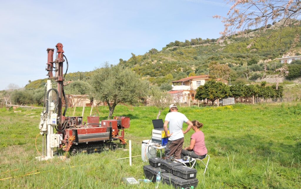
Answers can only be found in the interaction of detailed archaeological and osteological investigations, aDNA analyses, radiocarbon dating, and stable isotope analyses. The Kiel interdisciplinary research network of the Johanna Mestorf Academy, the CRC 1266, and the Cluster of Excellence ROOTS, in collaboration with the Slowakian Academy of Sciences in Nitra, offers excellent conditions for this further research.

Further considerations on meaning and interpretation are only meaningful based on such interdisciplinary research results.

 “It may seem obvious to assume a massacre with human sacrifices, perhaps even in connection with magical or religious ideas. Warlike conflicts may also play a role, for example, conflicts between village communities, or even within this large settlement. Did these people fall victim to head-hunters, or did their fellow villagers practise a special death cult that had nothing to do with interpersonal violence? There are many possibilities and it is important to remain open to new insights and ideas. But it is indisputable that this find is absolutely unique for the European Neolithic so far,” says project leader Dr Maria Wunderlich.

Possible Archaic Temple of Poseidon Discovered in Greece

Possible Archaic Temple of Poseidon Discovered in Greece

The ancient Greek historian Strabo referred to the presence of an important shrine located on the west coast of the Peloponnese some 2,000 years ago.

Remains of such an Archaic temple have now been uncovered at the Kleidi site near Samikon, which presumably once formed part of the sanctuary of Poseidon.

Researchers of the Austrian Archaeological Institute in collaboration with colleagues from Johannes Gutenberg University Mainz (JGU), Kiel University, and the Ephorate of Antiquities of Elis unearthed the remains of an early temple-like structure that was located within the Poseidon sanctuary site and was quite possibly dedicated to the deity himself.

The Mainz-based team from the JGU Institute of Geography headed by Professor Andreas Vött contributed to the investigative work with their drilling and direct push techniques.

Use of the direct push system to examine the subsoil near the ancient temple at Kleidi to obtain evidence of changes to the coast and landscape. The hill in the background shows the remains of the walls of the ancient fortress of Samikon above Kleidi.
The famous ancient sanctuary has long been suspected in the plain below the ancient fortress of Samikon, which dominates the landscape from afar on a hilltop north of the lagoon of Kaiafa on the west coast of the Peloponnese.
The excavations undertaken in the autumn of 2022 revealed parts of the foundations of a structure that was 9.4 meters wide and had carefully positioned walls with a thickness of 0.8 meters.
In connection with the uncovered fragments of a Laconic roof, the discovery of the part of a marble perirrhanterion, i.e., a ritual water basin, provides evidence for dating the large building to the Greek Archaic period.

Exceptional coastal configuration of the Kleidi/Samikon region

The form of the western coast of the Peloponnese peninsula, the region in which the site is located, is very distinctive. Along the extended curve of the Gulf of Kyparissa is a group of three hills of solid rock surrounded by coastal alluvial sediments in an area otherwise dominated by lagoons and coastal swamps. Because this location was easily accessed and secure, a settlement was established here during the Mycenaean era that continued to flourish for several centuries and was able to maintain contacts to the north and south along the coast.

Professor Andreas Vött of Mainz University has been undertaking geoarchaeological surveys of this area since 2018 with the aim of clarifying how this unique situation evolved and how the coast in the Kleidi/Samikon region has changed over time. For this purpose, he has collaborated in several campaigns with Dr. Birgitta Eder, Director of the Athens Branch of the Austrian Archaeological Institute, and Dr. Erofili-Iris Kolia of the local monuments protection authority, the Ephorate of Antiquities of Elis.

“The results of our investigations to date indicate that the waves of the open Ionian Sea actually washed up directly against the group of hills until the 5th millennium BCE. Thereafter, on the side facing the sea, an extensive beach barrier system developed in which several lagoons were isolated from the sea,” described Vött, who is Professor of Geomorphology at JGU.

However, evidence has been found that the region was repeatedly afflicted by tsunami events in both the prehistoric and historic periods, most recently in the 6th and 14th centuries CE. This tallies with surviving reports of known tsunamis that occurred in the years 551 and 1303 CE. “The elevated situation provided by the hills would have been of fundamental importance in antiquity as it would have made it possible to move on dry land along the coast to the north and to the south,” Vött pointed out.

In autumn 2021, geophysicist Dr. Dennis Wilken of Kiel University found traces of structures at a site at the eastern foot of the hill group in an area that had already been identified as of interest following previous exploration.

After initial excavation work under the supervision of Dr. Birgitta Eder in autumn 2022, these structures proved to be the foundations of an ancient temple that could well be those of the long-sought temple to Poseidon.

“The location of this uncovered sacred site matches the details provided by Strabo in his writings,” emphasized Eder, who is working for the Austrian Archaeological Institute.

An extensive archaeological, geoarchaeological and geophysical analysis of the structure is to be conducted over the next few years. The researchers hope to establish whether it has a specific relationship with a coastal landscape that is subject to extensive transformation. Hence, on the basis of the geomorphological and sedimentary evidence of the recurrent tsunami events here, the geomythological aspect is also to be investigated.

It seems possible that this location may have actually been explicitly selected for the site of the Poseidon temple because of these extreme occurrences. After all, Poseidon, with his cult title of Earthshaker, was considered by the ancients to be responsible for earthquakes and tsunamis.

Natural Hazard Research and Geoarchaeology team at JGU studies the processes of coastal change and extreme wave events

For the past 20 years, the Natural Hazard Research and Geoarchaeology group at Mainz University, headed by Professor Andreas Vött, has been examining the development of the coast of Greece over the last 11,600 years. They particularly focus on the western side of Greece from the coast of Albania opposite Corfu, the other Ionian Islands of the Ambrakian Gulf, the western coast of the Greek mainland down to the Peloponnese and Crete. Their work involves identifying relative sea level changes and the corresponding coastal changes . Another core feature of their investigations is the detection of extreme wave events of the past, which in the Mediterranean mainly take the form of tsunamis, and the analysis of their impact on coasts and the communities living there.

Innovative direct push sensing – a new technique in geoarchaeology

Based on sediment cores that document vertical and horizontal aberrations in depositional layers, the JGU team is able to posit scenarios of what changes occurred along the coasts and within the landscape.

The group now has an archive of some 2,000 core samples obtained mainly in Europe. Moreover, since 2016, they have been using an innovative direct push technique to investigate the underground. Direct push sensing involves using hydraulic pressure to force various sensors and tools into the ground to collect sedimentological, geochemical, and hydraulic information on the subsurface.

The Institute of Geography at Johannes Gutenberg University Mainz is the only institution of its kind in Germany that has the necessary equipment at its disposal.

Ancient Egyptian pharaoh Ramesses II’s ‘handsome’ face revealed in striking reconstruction

Ancient Egyptian pharaoh Ramesses II’s ‘handsome’ face revealed in striking reconstruction

Ancient Egyptian pharaoh Ramesses II's 'handsome' face revealed in striking reconstruction
“Age regression” software was used to determine what the pharaoh would have looked like in his prime, at about the age of about 45.

The face of the ancient Egyptian ruler Ramesses II — possibly the pharaoh of the biblical Book of Exodus who persecuted Moses and the Israelites — has been reconstructed from his mummified remains. And although the pharaoh died in his 90s, his visage has been “reverse aged” by several decades to show him in his prime, at about age 45. 

“We carried a three-dimensional age regression process to remove some of the signs of ageing in order to depict him in his middle-age, at the peak of his power,” Caroline Wilkinson, director of the Face Lab at Liverpool John Moores University in the United Kingdom, told Live Science in an email. 

The result is a portrait of the pharaoh Ramesses II described as “handsome” by Sahar Saleem, a professor of radiology at Cairo University in Egypt and the leader of the project.

“King Ramesses II was a great warrior who ruled Egypt for 66 years,” Saleem told the radiology magazine AuntMinnieEurope.com. (An “Aunt Minnie” is a radiological term for an unquestionable diagnosis “Bringing Ramesses’ face to life in his old age and as a young man reminds the world of his legendary status,” she said.

Mummy scan

The mummy of Ramesses II is now in the National Museum of Egyptian Civilization in Cairo. It was discovered in 1881 near Luxor in southern Egypt, and at some point after that, it was partially unwrapped to show the pharaoh’s mummified features.

For the latest facial reconstruction, Saleem made a three-dimensional virtual model of the pharaoh’s head and skull from new CT scan data — effectively, thousands of X-rays assembled into a 3D image — which Wilkinson then used to reconstruct his face with computer software used in criminal investigations. 

The new facial reconstruction was made from computed tomography data of the 3,000-year-old mummy of Ramesses II.

Next, Wilkinson used computer-generated imagery (CGI) techniques to add skin, eye and hair textures, based on what Saleem reported would have been common among Egyptians at the time — which showed what the pharaoh may have looked like when he died — and finally used the age regression software to show how he had likely appeared decades earlier. “The age regression was challenging, as this was in 3D,” she said.

Wilkinson explained that the field of estimating the face of someone from their skull is dominated by two approaches: “facial approximation,” which uses average data, templates and biological profiles to produce an “average” face, which might result from several different skulls; and “facial reconstruction,” a more detailed attempt to determine what a particular person looked like, based on anatomical standards, measurements and morphological analysis. A related term is “facial depiction,” which adds colors and textures, she said. 

In this case, the team used the more detailed approach. “The face of Rameses II was produced using 3D facial reconstruction and then a 3D facial depiction process,” Wilkinson said.

Hair and skin coloring based on what’s thought to have been common in ancient Egypt were then added to the facial reconstruction.
The first stage of the facial reconstruction was to use anatomical measurements and other techniques to determine how the pharaoh looked when he died at the age of 90

Famous pharaoh

The pharaoh who is said to have persecuted Moses and the Israelites in the story of Exodus is never named in the Bible, but several historians think his depiction most closely resembles Ramesses II, who was a celebrated ruler at a height of Egyptian power in the 13th century B.C.

As a result, Ramesses II — also called Ramses II or Ramesses the Great — has often been depicted in literary and film adaptations of Exodus, including in the 1956 movie “The Ten Commandments.”

The mummy of Ramesses II was found in 1881 in southern Egypt; at some point it was partially unwrapped to show its mummified head.

However, American historians Megan Bishop Moore and Brad Kelle wrote in “Biblical History and Israel’s Past: The Changing Study of the Bible and History” (Eerdmans, 2011) that no archaeological evidence has been found to support the idea that the Israelites were enslaved in Egypt, nor for any of the other events described in Exodus, including the destruction of the pharaoh’s army as it pursued the Israelites across the Red Sea.

Historical records attest that Ramesses II was born in about 1303 B.C. into the family of the pharaoh Seti I and that he became pharaoh when his father died in about 1279 B.C.

During his reign, Ramesses II expanded the Egyptian empire as far north as modern-day Syria and built many monumental structures, including the expansion of the Karnak Temple. He died in about 1213 B.C. 

Ramesses II also influenced later culture: he was the inspiration for the 1818 poem “Ozymandias” by the English poet Percy Bysshe Shelley, who had seen a huge broken statue of Ramesses II — known as Ozymandias in Greek — in the British Museum in London, leading him to pen the words “Look on my Works, ye Mighty, and despair!”

Roman-Era Sarcophagus Uncovered in Istanbul

Roman-Era Sarcophagus Uncovered in Istanbul

Roman-Era Sarcophagus Uncovered in Istanbul

A sarcophagus determined to belong to the Roman era has been unearthed during the excavation works of an apartment demolished within the scope of the urban transformation project in Istanbul.

The sarcophagus came to light during the foundation excavation of the demolished building in the Büyükçekmece district.

It was determined that there were bones belonging to the human body, and the tomb was made of carved stone.

Two archaeologists and an anthropologist from the Istanbul Archaeological Museums Directorate conducted an examination of the construction site where the sarcophagus was uncovered.

As a result of the three-hour examination, the human bones found in the tomb were taken out.

The expert team also determined that the tomb is nearly 2,000 years old, dating to the Roman period.

After the completion of the examinations, the sarcophagus was lifted with a crane and taken to the Istanbul Archaeological Museums Directorate.

Since Istanbul’s foundation, the city has developed under the domination of several civilizations and has been the center of various cultures.

Three of the most powerful empires in history, Rome, Byzantine and Ottoman, declared the city as their capital.

As a result, numerous temples, buildings, churches, palaces and baths from several cultures have been located in the city.

After the conquest of the city by Ottoman Sultan Mehmet II, the city became the new capital of the empire. On the other hand, freedom of religion and social rights were granted to the former residents.

With the religious buildings of former residents, Turkish Art left its marks on the city, and domes and minarets dominated the city skyline.

3,000-year-old wishing well uncovered in Germany. Take a look at the items left inside

3,000-year-old wishing well uncovered in Germany. Take a look at the items left inside

3,000-year-old wishing well uncovered in Germany. Take a look at the items left inside
Archaeologists in Germering uncovered a wooden well with over 100 items carefully placed inside as offerings during a drought, photos show.

Whether it’s Rome’s iconic Trevi Fountain or a water feature at the nearby mall, wish-filled waterworks are common — but perhaps not a new phenomenon.

Archaeologists in Germering unearthed a 3,000-year-old wooden wishing well, the Bavarian State Office for Monument Protection said in a Dec. 20 news release. Unlike today’s coin-filled fountains, this well was filled with over 100 well-preserved artifacts.

At the bottom of the 16-foot well, archaeologists found a variety of items that appeared intentionally placed.

Considering the depth of the well, the artifacts may have been ritual offerings or religious sacrifices made during a long drought, archaeologist Marcus Guckenbiehl said in the release.

Over 70 finely crafted clay vessels were unearthed from the well, with photos showing the decorated cups, pots and bowls. Experts noted these ceramics were not everyday items.

Pottery vessels found at the bottom of the well.

The excavation also revealed 26 bronze robe pins at the bottom of the well.

Bronze needles or robe pins were found at the bottom of the well.

A bracelet, two metal spirals, and four amber beads were all recovered from the well, too. 

Amber beads found in the well.

Additionally, archaeologists found a mounted animal tooth and a wooden scoop inside the well. The number and quality of items indicated the artifacts did not fall into the well accidentally, experts said.

A mounted animal tooth found in the well.
A partially-intact wooden scoop found in the well.

The wishing well is one of over 70 found at the excavation area – but the only well found with relics inside. The findings are extremely rare, archaeologist Jochen Haberstroh said in the release.

Archaeologists are excavating the site before the construction of a letter distribution center.

The wishing well and its trove of artifacts will be studied further to gain more insight into the daily life of settlers 3,000 years ago.

A view of the well as construction takes place nearby.

Germering is about 10 miles west of Munich in the southern region of Bavaria.

Ancient Water System Unearthed in Central China

Ancient Water System Unearthed in Central China

Ancient Water System Unearthed in Central China
This photo taken on Jan. 6, 2023 shows the ruins of water channels dating back to the Wei and Jin dynasties (220-420) in Luoyang city site in Luoyang, central China’s Henan Province. The ancient capital Luoyang site in today’s Henan Province has recently discovered over 80 meters of water channels dating back to the Wei and Jin dynasties (220-420). It indicates the mature techniques of building water conservancy facilities and the dynasties’ capability of water resource utilization and environmental upgrade back then.

The ancient capital Luoyang site in today’s Henan Province has recently discovered over 80 meters of water channels dating back to the Wei and Jin dynasties (220-420). It indicates the mature techniques of building water conservancy facilities and the dynasties’ capability of water resource utilization and environmental upgrade back then.

The excavation on the Qianqiu Gate site of the ancient palace started in 2021, and the researchers later found the large-scale underground water channels beneath the gate site’s square.

So far, four water channels have been discovered, all stone culverts running side by side from southwest to northeast. The channels were confirmed to be built together and follow a unified construction planning, said Guo Xiaotao with the Institute of Archaeology under the Chinese Academy of Social Sciences.

Such water conservancy facilities with large-scale layouts and delicate designs are the first to be spotted during the excavation work on the Luoyang ancient city.

The manhole covers above the channels also have square holes to facilitate rainwater collection. The water channel ruins are believed to have introduced water sources outside into the palace city and then allowed the water to flow into lakes of the Xiyou Garden in the north of the imperial palace.

The facilities were likely part of the garden’s water diversion project inside the ancient capital city’s palace and later reused by Emperor Xiaowen of the Northern Wei Dynasty (386-534), said Liu Tao with the institute.

The discovery further explores the royal garden layout of Luoyang at that time and serves as a historical reference for modern urban water resource utilization, Liu added.

Luoyang city site, located in today’s Luoyang in Henan, has a history of over 1,500 years, while for about 600 years in its vast history, it served as the capital city for many dynasties in ancient China. 

This photo taken on Jan. 6, 2023 shows the ruins of water channels dating back to the Wei and Jin dynasties (220-420) in Luoyang city site in Luoyang, central China’s Henan Province. The ancient capital Luoyang site in today’s Henan Province has recently discovered over 80 meters of water channels dating back to the Wei and Jin dynasties (220-420). It indicates the mature techniques of building water conservancy facilities and the dynasties’ capability of water resource utilization and environmental upgrade back then.

Byzantine Woman’s Remains Found at a Castle in Turkey

Byzantine Woman’s Remains Found at a Castle in Turkey

Archaeological excavations in the historical Kadıkalesi Castle in the western province of Aydın have unearthed the skeleton of a woman, which is believed to date back to the 13th century.

The excavation team said that the female skeleton found in a tomb in the church section is believed to belong to the wife of a bureaucrat or someone who donated to the church.

The female skeleton was found under the water channel stones that were removed during the excavations in the monumental church in the ancient city of Kadıkalesi (Anaia), which was used as a settlement from the prehistoric period to the Ottoman Empire in the Kuşadası district.

Anthropologists think that the woman was buried in the 13th century and she was buried in the church because she made a large amount of donation to the church or because she was the wife of a bureaucrat.

In the examinations, it was determined that the woman was 34-38 years old and 1.63 meters tall.

Provincial Culture and Tourism Director Umut Tuncer, who made examinations in the area, said, “The things that turn a cultural structure into a tourist attraction are the findings there. Kadıkalesi is a very rich destination in this sense. It is full of findings that reveal new mysteries that excite us.

During the studies carried out last month, a tomb dating back to 1,300 A.D. was discovered.

The female skeleton, which we estimate to be approximately 1.63 meters tall, was found in the tomb.”

Art historian Umut Kardaşlar from the excavation team said, “We thought it might actually be a water channel. When we opened it, we realized that it was a burial of a woman.

In fact, it is not very common to put a woman’s burial inside churches. Probably, this woman must have been a woman who donated a significant amount to the church, or she must have been the wife of a bureaucrat.”

Londoner solves 20,000-year Ice Age drawings mystery

Londoner solves 20,000-year Ice Age drawings mystery

Londoner solves 20,000-year Ice Age drawings mystery
Researchers concluded 20,000-year-old markings on drawings could refer to a lunar calendar.

Ancient cave paintings, like animal figures and handprints, are generally thought to have meanings, however, the specifics of these drawings have long eluded experts. But now, British scientists have claimed to have decoded why Ice Age hunter-gatherers drew cave paintings. 

Independent researcher Ben Bacon took an interest in cave art drawings. “The meaning of the markings within these drawings has always intrigued me so I set about trying to decode them,” he told the BBC.

Mr Bacon spent hours at the British library searching for photos of cave art online and collected “as much data as possible and began looking for patterns”.

He analysed 20,000-year-old markings on the drawings and concluded that they could refer to a lunar calendar. 

As his research and idea progressed, Mr Bacon reached out to academics to collaborate with them. He published a study in the  Cambridge Archaeological Journal along with senior academics from Durham University and University College London (UCL), which revealed that Ice Age hunter-gatherers were using markings combined with drawings of their animal prey to store and communicate “sophisticated” information about the behaviour of species crucial to their survival at least 20,000 years ago. 

In the study, the researchers explained that as the marks, found in more than 600 images on cave walls and objects across Europe, record information numerically and reference a calendar rather than recording speech, they cannot be called “writing” in the sense of the pictographic and cuneiform systems of early writing that emerged in Sumer from 3,400 BC onwards.

Instead, the team refers to them as a “proto-writing system” – pre-dating other token-based systems that are thought to have emerged during the Neolithic period by at least 10,000 years.

The researchers in particular examined a ‘Y’ sign on some paintings, which they felt might be a symbol for “giving birth” as it showed one line growing out from another.

Their study showed that the sequences record mating and birthing seasons and found a “statistically significant” correlation between the number of marks the position of the ‘Y’ sign and the months in which modern animals mate and birth respectively. 

Professors Paul Pettitt of Durham University said, “This is a fascinating study that has brought together independent and professional researchers with expertise in archaeology and visual psychology, to decode information first recorded thousands of years ago.” 

“The result show that Ice Age hunter-gatherers were the first to use a systematic calendar and marks to record information about major ecological events within that calendar. In turn, we’re able to show that these people – who left a legacy of spectacular art in the caves of Lascaux and Altamira – also left a record of early timekeeping that would eventually become commonplace among our species,” Mr Pettitt added. 

Post a commentIn the study, the researchers showed that despite the difficulties, researchers can crack the meaning of at least some of the symbols. For Bacon, the findings had even more significance. “As we probe deeper into their world, what we are discovering is that these ancient ancestors are a lot more like us than we had previously thought,” he said. “These people, separated from us by many millennia, are suddenly a lot closer,” Mr Bacon added. 

All In One Magazine