Gates of Biblical City Unearthed- Site of Jesus Miracle of feeding 5,000
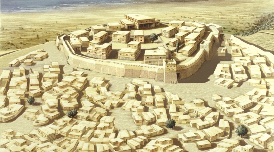
In the last few weeks, local officials in northern Golan Heights in Israel announced a significant discovery by archaeologists. The entrance gate to the great fortified city, just north of the Sea of Galilee has been excavated, leading some to claim it is additional evidence supporting the site being Bethsaida, the city of three of Jesus’ disciples and associated with his famous miracle of the loaves and fishes. The early phase of the city may also have an intriguing connexion to the Bible’s King David, who reigned around 1000 BC.

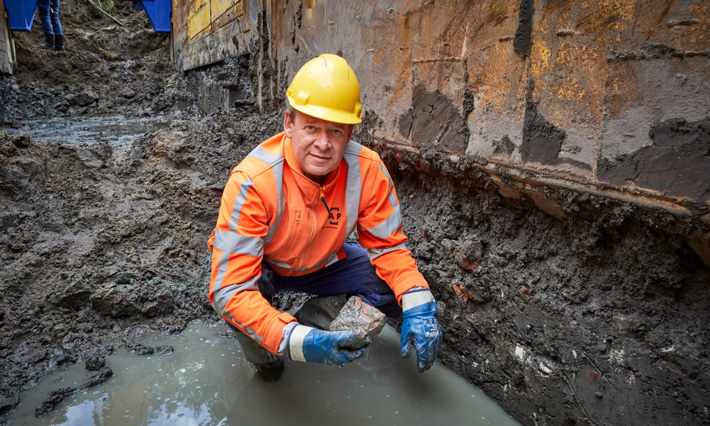
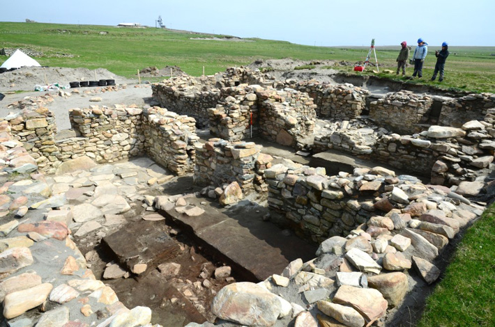
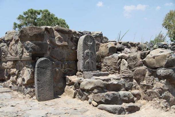
The remains of the entrance gate, standing about 10 feet high, were unearthed at a place called et-Tell by the Bethsaida Excavations Project, which just wrapped up its 2018 season. The director is Professor Rami Arav from the University of Nebraska at Omaha, who has excavated the site for nearly 30 years.
“It is the largest and the best preserved city gate [in Israel],” Arav told the Times of Israel. “Likewise, this year’s excavation provides evidence that Bethsaida, an Aramean settlement, houses one of the earliest towers incorporated in city walls in Israel,” he said.
“In the entire archaeology of the Land of Israel from 10-8th century BCE, there are no towers on city walls. Israelites did not have this feature. This is the first example of towers surrounding a city in Israel,” Arav added. This “unusual feature” of guard towers were placed every 20 meters around the city wall.
The gate is believed by archaeologists to have been used from the 11th century BC down to about 920 BC. As reported in the Jerusalem Post, Professor Arav stated, “There are not many gates in this country from this period. Bethsaida was the name of the city during the Second Temple period [during the time of Jesus], but during the First Temple period it was the city of Zer.” Pointing to Joshua 19:35, he continued, “The fortified towns were Ziddim, Zer, Hammath, Rakkath, Kinnereth.”
These were the fortified cities in land allotted to the tribe of Naphtali after the conquest of Canaan. If this was the site of Zer, there should be even older remains, under the current dig levels, from the period of Israel’s conquest of Canaan.

The city of Zer (or “Tzer”) was also possibly the historical capital of Geshur, which at the time of King David was an independent Aramean kingdom just northeast of Israel.
The area may have been referenced in the famous Tel Amarna letters between Pharaoh Akhenaten and city leaders in Canaan. The Bible says one of David’s wives was Maacah the daughter of the king of Geshur, apparently a politically-driven marriage to unify the two kingdoms.
The third [son of David], Absalom, whose mother was Maacah, the daughter of Talmai, king of Geshur…
– 1 Chronicles 3:2 (ESV)
The Times of Israel points out that Maacah (or “Maachah”) was the mother of Absalom, who fled to his mother’s homeland of Geshur after murdering his half-brother (2 Samuel 13:37-38). The close ties between the two kingdoms were renewed when Absalom’s daughter, also named Maacah, married Solomon’s son Rehoboam, king of Judah (1 Kings 14:31-15:2). These facts cause Arav to speculate that King David may have walked through this very gate to claim his bride. He amusingly recounted his impression of the royal courtship in the Time articles:
‘King David entered the gate to meet the king of Geshur to ask for the hand of his daughter. Maachah looked at him like a “hillbilly” mountain guy, but for the sake of inclusion into the Bible, went through with it. “So we’re digging the gate where David entered,” said Arav, laughing.’

In past seasons, evidence from many different periods was found, evidence that this site had significance for millennia. Among the finds was a decorated pottery shard from 300 BC showing the birth of the Greek goddess Athena from the head of her father Zeus. Also found was a rare Roman coin issued in AD 85 by Agrippa II with the phrase “Judea Capta” (or “Judea is captive”), commemorating the crushing of the Jewish rebels and their temple in AD 70.
This year, archaeologists from 20 international institutions joined Arav in the dig sponsored by the Hebrew Union College in Jerusalem. The size of the site confirms the Bible’s account of the significance of Geshur at the time of David.
The Connection to Jesus
The recent finds also join other archaeological evidence in the debate over whether this really was the site of Bethsaida at the time of Jesus. For nearly thirty years, et-Tell has been designated by Israel as Bethsaida, one of the holiest sites to Christians, but for that entire time, this has long been a disputed issue.
Now Philip was from Bethsaida, the city of Andrew and Peter.
– John 1:44 (ESV)
Bethsaida’s importance in the Gospels can be seen in that it is the third most referenced city after Jerusalem and Capernaum. The Book of John mentions that Bethsaida had been home to the apostles Peter, Andrew and Philip. Other passages make it clear that after his marriage, Peter had moved his family into the house of his mother-in-law in nearby Capernaum.
The majority of Jesus’ Galilean ministry took place in the area around Bethsaida, Capernaum and Chorazin – three cities within three miles of each other near the northeast coast of the Sea of Galilee. Because of confusing descriptions in the Gospel accounts, some scholars have proposed that there were two cities named Bethsaida on the shores of Galilee.

The miracle of Jesus feeding 5,000 men plus women and children from five loaves and two fish is said by the Gospel of Luke to have taken place in a wilderness area near the town of Bethsaida.

On their return, the apostles told him all that they had done. And he took them and withdrew apart to a town called Bethsaida. When the crowds learned it, they followed him, and he welcomed them and spoke to them of the kingdom of God and cured those who had need of healing… And taking the five loaves and the two fish, he looked up to heaven and said a blessing over them. Then he broke the loaves and gave them to the disciples to set before the crowd. And they all ate and were satisfied. And what was left over was picked up, twelve baskets of broken pieces.
– Luke 9:10-11, 16-17 (ESV)
This miracle, along with many others done in the area (including the healing of a blind man in Mark 8:22), is the reason behind Jesus’ stern rebuke for the unbelief of the local population in the chapter following the account of the miraculous feeding.
“Woe to you, Chorazin! Woe to you, Bethsaida! For if the mighty works done in you had been done in Tyre and Sidon, they would have repented long ago, sitting in sackcloth and ashes.
– Luke 10:13 (ESV)
The important place these events have in the Gospels draws throngs of Christians to sites in this area every year. Avi Liberman, director of the Jordan Park in which Bethsaida is located, said, “The staff at the Jordan Park and the Golan Tourism are happy for the tens of thousands of visitors who visit the park every day. The wonderful park is also an impressive archaeological site. I [am] amazed each time by the arrival of thousands of evangelical visitors to Bethsaida. I am confident that the latest discoveries will bring more visitors to the park from around the world and from Israel” reported the Jerusalem Post.