Large-Scale Trade in Herring Dates to the Viking Age
Historians have believed extensive herring trade started around the year 1200 AD, later controlled by the Hanseatic League. Now, a new study shows that it was already established in the Viking Age.
“We found that this trade existed already around 800 AD, 400 years earlier, which really pushes back this extensive fishing,” says Doctoral Research Fellow Lane Atmore at the University of Oslo.
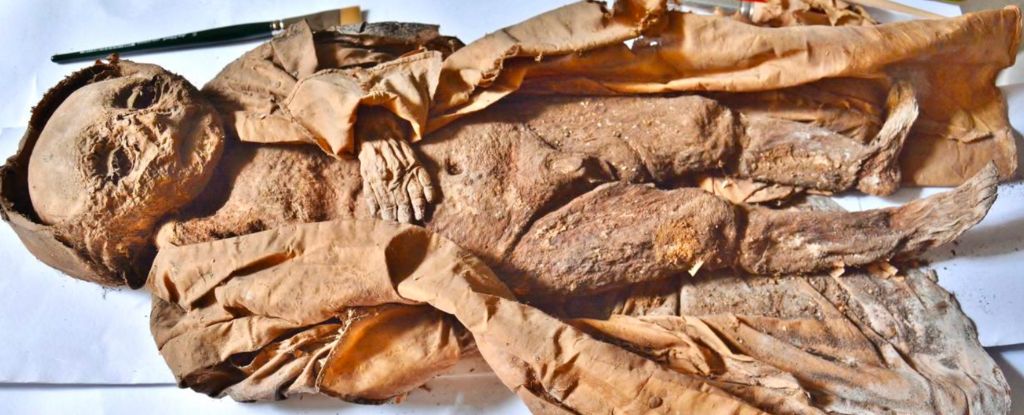
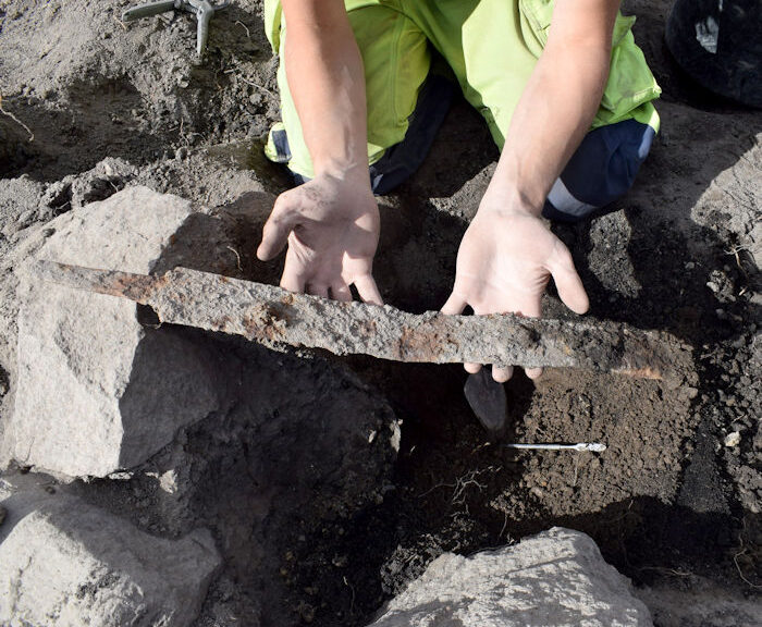
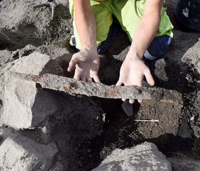
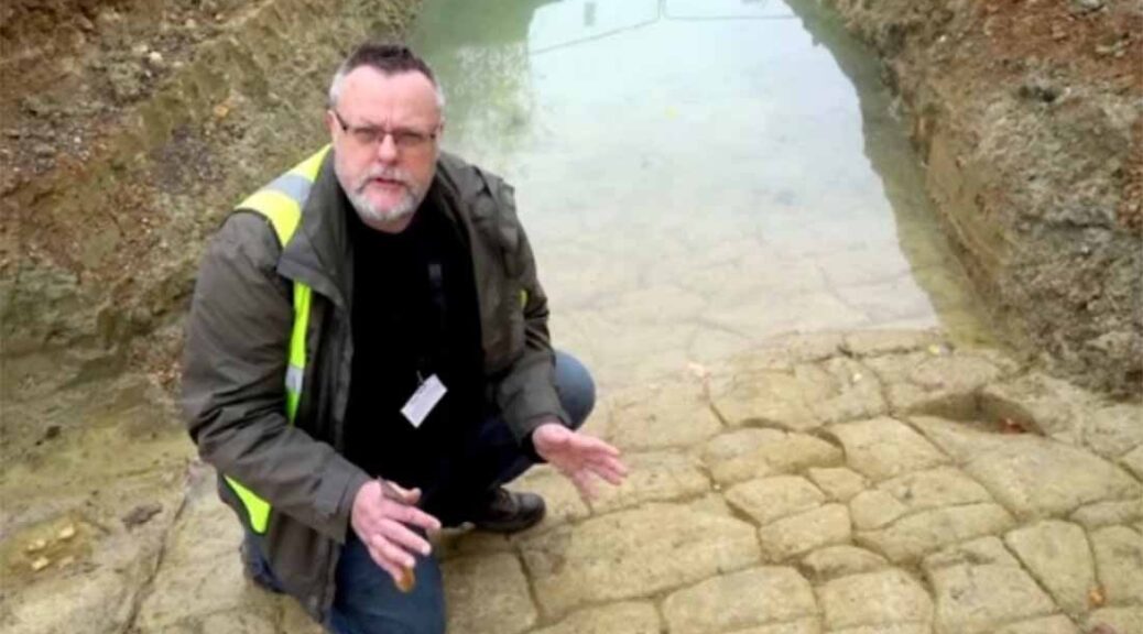
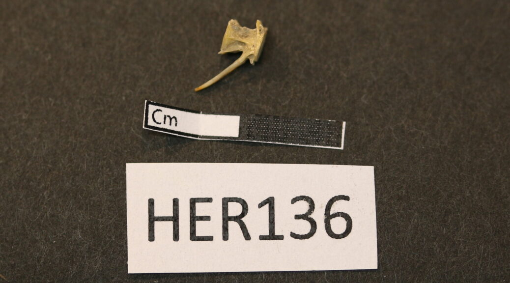
She is the first author of the study, published today in PNAS, which shows that herring bones from western populations around Sweden and Denmark were found as far east in the Baltic as Truso in today´s Poland. Truso is known as an important Viking Age trade port.
“In the genetic signature from these bones, we found that the fishes were adapted to higher salinity than you find in the central Baltic. This means they were coming from around Kattegat, and then they were being shipped into the eastern Baltic,” Atmore says.
The lower salinity of The Baltic Sea means that herring from the population in Kattegat will have a hard time adapting to the waters further east.
“That high salinity adapted fish are never found that far in,” Atmore says.
More difficult to trade
Her co-author, Associate Professor Bastiaan Star, has previously studied cod trade in the same area.
“Earlier we have seen that cod from the trading place Hedeby in what is now Germany had travelled all the way from northern Norway. Our new study shows that it was not just cod. It was also herring, a fish that technologically is much more difficult to trade,” Star says.
Atlantic herring (Clupea harengus) is a much fattier fish than cod and not easy to store, let alone trade if you don’t have the right technology.
“If you don’t cure it with salt or smoke, it will go bad very quickly. You need access to salt and wood so that you can cure it and then ship it. You need to have extensive trade networks and to catch enough fish if it´s going to be worth the investment,” Atmore says.
“I think that fish was traded over greater distances than previously anticipated. We can now pin down this date because these bones are absolutely dated between 800 and 850,” Star says.
“We can´t prove that it was the Vikings who brought the herring from one place to the next, but we know that we have herring bone from a site where Vikings were trading,” Atmore says.
Biology and archaeology
Atmore and Star are both biologists. In this study, they have worked closely with archaeologists. One of them is Professor James H. Barrett at NTNU University Museum.
“The herring industry of the Baltic Sea supported one of the most important trades in medieval Europe,” Barrett says.
“By combining the genetic study of archaeological and modern samples of herring bone, one can discover the earliest known evidence for the growth of long-range trade in herring, from comparatively saline waters of the western Baltic to the Viking Age trading site of Truso in north-east Poland,” Barrett says.
The study also reveals what has happened to the herring populations in more recent times.
“The economic and political ramifications of the herring industry are well-charted, but its ecological impacts have been much debated,” Barrett says.
Spring spawners and autumn spawners
The different populations of herring have their own spawning grounds, hence their adaptation to different levels of salinity. Populations also differ in spawning season.
“There are two major populations that spread across all Atlantic herring. One spawns in the springtime, and one spawns in the autumn. These populations spawn in unique locations and in different seasons, so they don’t interbreed much. This means they are genetically different from each other,” Atmore explains.
She is now able to identify where these fish are coming from to see how populations grow and decline, and how this is impacted by the fishing industry.
“We found that earlier in the historical record, starting around 800, you get more fish in these archaeological sites that come from the autumn spawning population in the western Baltic. This is a population that was targeted by a famous fishery around 1200,” Atmore says.
Collapsed 100 years ago
In more recent times it was the opposite.
“They were then targeting the autumn spawners and this population collapsed in the 1920s. In the Baltic now commercial catches are 90% spring spawners,” Atmore says.
“It´s not that the autumn spawners entirely disappear in the Baltic. It is more that they are not commercially interesting anymore. They are still there, but not in the numbers we were used to,” Star says.
He is not in doubt that the fishing industry had a major impact on the herring populations.
“There is a consistent pattern with over exploitation that takes place over centuries,” Star says.
“Our results provide a new and persuasive way to test the archaeological hypothesis that human impacts on super-abundant European marine fish started already in the Middle Ages, and that different herring stocks were targeted sequentially through time,” Barrett says.
This also means that the ecology of the Baltic Sea has shifted. Autumn spawners spawn in a different place at a different season.
“They are also bigger than the spring spawners and they eat slightly different food. When the population of autumn spawners goes far down in size, the ecology is going to change,” Atmore says.
“The Baltic Sea is much more confined compared to the North Sea. Some of the impacts that humans or climate may have, is amplified in such a small system,” says Star.